


Summary
Lake Tarawera is the largest of a series of lakes which surround the volcano Mount Tarawera in the North Island of New Zealand. Like the mountain, it lies within the Ōkataina Caldera. It is located 18 kilometres (11 mi) to the east of Rotorua, and beneath the peaks of the Tarawera massif i.e. Wahanga, Ruawahia, Tarawera and Koa. Tarawera means "Burnt Spear", named by a visiting hunter who left his bird spears in a hut and on returning the following season found both the spears and hut had been burned down completely.[4]
| Lake Tarawera | |
|---|---|
 Lake Tarawera | |
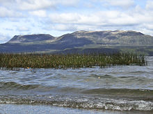
 Lake Tarawera  Lake Tarawera | |
 Bathymetric map of Lake Tarawera[1] | |
| Location | Rotorua Lakes, Bay of Plenty Region, North Island |
| Coordinates | 38°12′S 176°27′E / 38.200°S 176.450°E |
| Lake type | volcanic |
| Primary inflows | Tarawera Peak Stream, Te Whekau Stream, Orchard Stream, Spencer Road Ford Stream multiple springs and subsurface |
| Primary outflows | Tarawera River and subsurface |
| Catchment area | 143.8 km2 (55.5 sq mi)[2]: 56 |
| Basin countries | New Zealand |
| Max. length | 11.4 km (7.1 mi)[3] |
| Max. width | 9.0 km (5.6 mi)[3] |
| Surface area | 41.0 km2 (15.8 sq mi)[3] |
| Average depth | 57.0 m (187.0 ft)[3] |
| Max. depth | 87.5 m (287 ft)[3] |
| Surface elevation | 298 m (978 ft)[3][2]: 55 |
| References | [2][3] |
Geography edit
Lake Tarawera is 298 m (978 ft) above sea level,[3][2]: 24 and has a surface area of 41 km2 (16 sq mi). To the north-west is Lake Ōkataina, to the west as you go south, lakes Ōkāreka, Tikitapu and Rotokākahi and to the south-east Lake Rotomahana. Lake Tarawera township is on the western shore, between Lake Tarawera and Lake Ōkāreka. The main road access is from Rotorua to the west.
The lake was substantially affected by the eruption of Mount Tarawera on 10 June 1886 to the lake's east.[5][6][7][8]: 291–2 There were changes in lake level and sediment carriage.[8]: 491–2, 4
The lake has a large catchment. This includes Lake Tarawera's immediate catchment, being 143.8 km2 (55.5 sq mi) in area, and the catchment of the nearby higher lakes, being a total of 380.9 km2 (147.1 sq mi), with an estimated mean annual precipitation of 20,001 L/s (706.3 cu ft/s).[2]: 56
Water Flow edit


Lake Tarawera is filled primarily by water flowing through the volcanic rocks and ashes, only about 42% being from water flowing in streams, etc.[2]: 10 The mean surface inflows are estimated to be:[2]: 43
| Source | Mean Water Flow | Coordinates |
|---|---|---|
| Te Puroku No. 2 (Twin Creeks) | 384 L/s (13.6 cu ft/s) | 38°13′23″S 176°24′13″E / 38.22306°S 176.40361°E[2]: 43 [9] |
| Wairoa Stream | 347 L/s (12.3 cu ft/s) | 38°12′29″S 176°22′31″E / 38.20806°S 176.37528°E[2]: 43 [9] |
| Wairua Stream | 208 L/s (7.3 cu ft/s) | 38°14′24″S 176°25′28″E / 38.24000°S 176.42444°E[2]: 43 [9] |
| Waterfall | 174 L/s (6.1 cu ft/s) | 38°14′21″S 176°27′17″E / 38.23917°S 176.45472°E[2]: 43 [9] |
| Waitangi Stream | 164 L/s (5.8 cu ft/s) | 38°10′37″S 176°23′5″E / 38.17694°S 176.38472°E[2]: 43 [9] |
| Te Puroku No. 1 (Twin Creeks) | 123 L/s (4.3 cu ft/s) | 38°13′23″S 176°24′13″E / 38.22306°S 176.40361°E[2]: 43 [9] |
| Te Toroa | 91 L/s (3.2 cu ft/s) | 38°12′15″S 176°23′4″E / 38.20417°S 176.38444°E[2]: 43 |
| Camp Site | 65 L/s (2.3 cu ft/s) | 38°14′3″S 176°27′17″E / 38.23417°S 176.45472°E[2]: 43 |
| The Landing drain 1 | 32 L/s (1.1 cu ft/s) | 38°12′24″S 176°22′38″E / 38.20667°S 176.37722°E[2]: 43 |
| Te Whekau Stream | 20 L/s (0.71 cu ft/s) | 38°10′1″S 176°23′36″E / 38.16694°S 176.39333°E[2]: 43 [9] |
| Orchard Stream | 16 L/s (0.57 cu ft/s) | 38°12′18″S 176°22′38″E / 38.20500°S 176.37722°E[2]: 43 |
| Ungauged sites in Kotukutuku Bay | 10 L/s (0.35 cu ft/s) | - [2]: 43 |
| Ungauged sites in SE of lake | 10 L/s (0.35 cu ft/s) | - [2]: 43 |
| Waitangui Spring | 4 L/s (0.14 cu ft/s) | 38°10′28″S 176°23′24″E / 38.17444°S 176.39000°E[2]: 43 [9] |
| Spencer Rd Ford Stream | 1.5 L/s (0.053 cu ft/s) | 38°9′52″S 176°23′35″E / 38.16444°S 176.39306°E[2]: 43 [9] |
Thus surface water inflows contribute 1,649.5 L/s (58.25 cu ft/s) which is less than the 2,358 L/s (83.3 cu ft/s) rainfall on the lake surface itself and much less than either the estimated total outflow from the lake approaching 10,000 L/s (350 cu ft/s).[2]: 15, 47, 68–69 Therefore there is a fair subsurface inflow into the lake.
|
An estimate has been made of total inflows both surface and subsurface from the surrounding lake catchments[2]: 68–69
The main hot water sources are in the southern section of the lake at the Wairua Stream, Hot Water Beach and Te Puha and Tarawera fumaroles. There is also a small geothermal area at Humphrey's Bay, to the south of Lake Ōkataina.[2]: 69 Water varies between 37 °C (99 °F) and 90 °C (194 °F).[9] Lake Tarawera's outflow at its north east end, has been heavily influenced by the local geology, with a mean 7 m3/s (250 cu ft/s) discharged on the surface into the Tarawera River, which flows north-east into the Bay of Plenty.[8]: 491 An estimate of subsurface outflow has been made by measuring flow below Tarawera Falls where total river flow has increased to 9.9 m3/s (350 cu ft/s).[2]: 47
Geology edit
Lake Tarawera has been modified by eruptions within the Ōkataina Caldera, most recently the 1314 ± 12 CE Kaharoa eruption and the 10 June 1886 eruption.[8]: 491–2 Its current outlet control is where Tapahoro lava flows created by the 5526 ± 145 BP[10] Whakatane eruption[8]: 492 run into a 14,009 ± 155 BP[10] Pokohu lava flow which the Tarawera River flows across in a 10 m (33 ft) wide channel.[8]: 492 Before the Whakatane eruption it is thought the lake had a lower level than at present.[8]: 494 Immediately after the Whakatane eruption its level increased by at least 100 m (330 ft) with gradual cutting down and Taupō Rift subsidence to a level just before the 1314 Kaharoa eruption of 17 m (56 ft) above present lake levels.[8]: 494 The 1314 eruption blocked the outlet in a temporary dam to a temporary lake height of 32 m (105 ft) above present lake levels, which was subsequently eroded with a great flood at one stage, to reach by the time of European settlement first surveys 8 m (26 ft) below present lake level.[8]: 494
The lake outlet was blocked for two decades after the 1886 eruption and the lake level increased to a maximum of 12.8 m (42 ft) above its present level.[8]: 491–2, 4 The eruption killed over 120 people, and buried the Māori village of Te Wairoa on the southwest shore of the lake.[11][12] The last major decrease in lake level occurred in a flood of 1904 down the Tarawera River valley after the new volcanic material dam first broke on 1 November 1904.[8]: 504 The main flood surge on 3 November 1904 was assessed at a peak flow of 700 m3/s (25,000 cu ft/s).[8]: 504 After 1906 it is now known that the main change in lake level relative to reference sea level would have been due to the slow subsidence of this area of the Taupō Rift. This rate can be estimated to have been about 1.5 m (4 ft 11 in) in 100 years from the nearest NZ Geonet station RGTA data which has been operative since November 2007 and shows a linear trend in height decrease since then.[13][14]
Also assumed destroyed were the nearly famed Pink and White Terraces which were located to the south of the lake and accessed via boat across the lake and the old Lake Rotomahana.[15]: 26 However, in February 2011 a team mapping the lake floor discovered what appeared to be part of the Pink Terraces. The lowest two tiers of the terraces were reportedly found in their original place at 60 metres (200 ft) deep (too deep for scuba diving without special gas gear). Subsequently, a portion of the White Terraces was reportedly rediscovered in June 2011. The announcement of the rediscovery of the White Terraces coincided with the 125th anniversary of the eruption of Mt. Tarawera in 1886. It was thought that the rest of the terraces may be buried in sediment rather than having been destroyed. More recent research question these earlier findings and reports the Pink and White terrace spring sites instead lie on land (along with a lesser-known Black Terrace spring).[16][17][18][19] As of 2023 no sample of any terrace has been recovered, so any claim of survival of any of the terrace formations is unproven.[20]: 34
Ecology edit
Lake Tarawera is classified as mesotrophic, with a trophic level index of 3.0 in 2014 which was a decline.[2]: 5
The native bush has regenerated since the 1886 eruption.[21]
Recreational edit
Lake Tarawera is home to eels and rainbow trout. During the summer it is popular for both fishing and water sports, and also camping as there a number of hot water beaches. Much of the more inaccessible lake shore is part of the Lake Tarawera Scenic Reserve with hunting permits possible.[22] There are multiple popular walking trails with access to thermal features and rock paintings, often without a permit.[21]
Lake Tarawera township edit
The township on the shores of Lake Tarawera is described by Statistics New Zealand as a rural settlement, and covers 4.50 km2 (1.74 sq mi).[23] It had an estimated population of 280 as of June 2023,[24] with a population density of 62 people per km2. Lake Tarawere township is part of the larger Kaingaroa-Whakarewarewa statistical area.[25]
| Year | Pop. | ±% p.a. |
|---|---|---|
| 2006 | 270 | — |
| 2013 | 207 | −3.72% |
| 2018 | 267 | +5.22% |
| Source: [26] | ||
The township had a population of 267 at the 2018 New Zealand census, an increase of 60 people (29.0%) since the 2013 census, and a decrease of 3 people (−1.1%) since the 2006 census. There were 132 households, comprising 132 males and 135 females, giving a sex ratio of 0.98 males per female, with 30 people (11.2%) aged under 15 years, 33 (12.4%) aged 15 to 29, 126 (47.2%) aged 30 to 64, and 78 (29.2%) aged 65 or older.
Ethnicities were 91.0% European/Pākehā, 11.2% Māori, 2.2% Pacific peoples, 4.5% Asian, and 2.2% other ethnicities. People may identify with more than one ethnicity.
Although some people chose not to answer the census's question about religious affiliation, 59.6% had no religion, 32.6% were Christian and 1.1% had other religions.
Of those at least 15 years old, 69 (29.1%) people had a bachelor's or higher degree, and 27 (11.4%) people had no formal qualifications. 66 people (27.8%) earned over $70,000 compared to 17.2% nationally. The employment status of those at least 15 was that 114 (48.1%) people were employed full-time, 42 (17.7%) were part-time, and 3 (1.3%) were unemployed.[26]
References edit
- ^ de Ronde, Cornel E.J.; Caratori-Tontini, Fabio; Black, Jenny A. (2022). "Bathymetric Map of Lake Tarawera, New Zealand". GNS Science Rotorua Lakes Map Series. doi:10.21420/3C7C-VY17. Retrieved 31 August 2023.
- ^ a b c d e f g h i j k l m n o p q r s t u v w x y z aa White, P; Toews, M; Tschritter, C; Lovett, A (2016). "Nitrogen discharge from the groundwater system to lakes and streams in the greater Lake Tarawera catchment GNS Science Consultancy Report 20151108" (PDF). Retrieved 28 August 2023.
- ^ a b c d e f g h Lowe, D.J.; Green, J.D. (1987). Viner, A.B. (ed.). Inland waters of New Zealand. Wellington: DSIR Science Information Publishing Centre. pp. 471–474. ISBN 0-477-06799-9.
- ^ Smitz, Paul; Bao, Sandra; Cruttenden, Pete (2005). Australia & New Zealand on a shoestring (1st ed.). Lonely Planet Publications. p. 603. ISBN 1-74059-646-3.
- ^ Royal Society of New Zealand (1984), Journal of the Royal Society of New Zealand, Vol. 14–15 p. 121. ISSN 0303-6758
- ^ Keam, Ron (1988). Tarawera: The Volcanic Eruption of 10 June 1886. Auckland: R. F. Keam.
- ^ Nairn, I. and Houghton, B. F. (1986) "Tarawera- the 1886 eruption" in Perry, J. F. (Ed.) Tarawera Eruption Centennial Exhibition 1886–1986, Rotorua District Council, Rotorua, 204
- ^ a b c d e f g h i j k l Hodgson, K. A.; Nairn, I. A. (2005). "The c. AD 1315 syn‐eruption and AD 1904 post‐eruption breakout floods from Lake Tarawera, Haroharo caldera, North Island, New Zealand". New Zealand Journal of Geology and Geophysics. 48 (3): 491–506. doi:10.1080/00288306.2005.9515128. S2CID 129163031.
- ^ a b c d e f g h i j Gillon, Nicolas; White, Paul; Hamilton, David; Warwick, Silvester (2009). "Groundwater in the Okataina caldera: Model of future nitrogen loads to Lake Tarawera" (PDF). University of Waikato.
- ^ a b Villamor, Pilar; Litchfield, Nicola J.; Gómez-Ortiz, David; Martin-González, Fidel; Alloway, Brent V.; Berryman, Kelvin R.; Clark, Kate J.; Ries, William F.; Howell, Andrew; Ansell, India A. (2022). "Fault ruptures triggered by large rhyolitic eruptions at the boundary between tectonic and magmatic rift segments: The Manawahe Fault, Taupō Rift, New Zealand". Journal of Volcanology and Geothermal Research. 427: 107478. Bibcode:2022JVGR..42707478V. doi:10.1016/j.jvolgeores.2022.107478. hdl:2292/59828. ISSN 0377-0273. S2CID 246258923.
- ^ Flagler, Bette (2005). Adventure Guide New Zealand, Hunter Publishing (NJ), Illustrated ed. p. 205. ISBN 1-58843-405-2
- ^ Keam, Ron (2004). Dissolving Dreams. Auckland: RE. F. Keam. pp. 33–34.
- ^ "Geonet Sensor Search:RGTA". Retrieved 22 August 2023.
- ^ "Geonet Sensor Plot:RGTA". Retrieved 22 August 2023.
- ^ Thomas, A. P. W. (1888). Report on the Eruption of Tarawera and Rotomahana, N.Z. Wellington, New Zealand: Government Printer. Retrieved 17 August 2023.
- ^ Bunn, Rex; Nolden, Sascha (7 June 2017). "Forensic cartography with Hochstetter's 1859 Pink and White Terraces survey: Te Otukapuarangi and Te Tarata". Journal of the Royal Society of New Zealand. 48: 39–56. Bibcode:2018JRSNZ..48...39B. doi:10.1080/03036758.2017.1329748. ISSN 0303-6758. S2CID 134907436.
- ^ Bunn, Rex; Nolden, Sascha (December 2016). "Te Tarata and Te Otukapuarangi: Reverse engineering Hochstetter's Lake Rotomahana Survey to map the Pink and White Terrace locations". Journal of New Zealand Studies. NS23: 37–53.
- ^ Bunn, A. R., Davies, N. and Stewart, D. (2018) "Dr Hochstetter’s Lost Survey” Surveying+Spatial, 94, 5–13.
- ^ Bunn, A. R. (2019) "Hochstetter’s Survey of the Pink and White Terraces: The Final Iteration” Surveying+Spatial, 99, 30–35
- ^ Bunn, Alfred Rex; Nolden, Sascha (17 March 2023). "Ferdinand von Hochstetter's November 1860 Folio of New Zealand survey data and the location of the Pink and White Terraces". EarthArXiv. Preprint version 1. doi:10.31223/X5T365. Retrieved 25 August 2023 – via Academia.edu.
- ^ a b "Lake Tarawera Scenic Reserve". NZ Department of Conservation. Retrieved 28 August 2023.
- ^ "Hunting Lake Tarawera Scenic Reserve". NZ Department of Conservation. Retrieved 28 August 2023.
- ^ "ArcGIS Web Application". statsnz.maps.arcgis.com. Retrieved 10 January 2023.
- ^ "Subnational population estimates (RC, SA2), by age and sex, at 30 June 1996-2023 (2023 boundaries)". Statistics New Zealand. Retrieved 25 October 2023. (regional councils); "Subnational population estimates (TA, SA2), by age and sex, at 30 June 1996-2023 (2023 boundaries)". Statistics New Zealand. Retrieved 25 October 2023. (territorial authorities); "Subnational population estimates (urban rural), by age and sex, at 30 June 1996-2023 (2023 boundaries)". Statistics New Zealand. Retrieved 25 October 2023. (urban areas)
- ^ 2018 Census place summary: Kaingaroa-Whakarewarewa
- ^ a b "Statistical area 1 dataset for 2018 Census". Statistics New Zealand. March 2020. 7015098 and 7015100.
External links edit
 Media related to Lake Tarawera at Wikimedia Commons