
KNOWPIA
WELCOME TO KNOWPIA

Lalleu 
Summary
Lalleu (French pronunciation: [lalø]; Gallo: Laloe, Breton: An Alloz) is a commune in the Ille-et-Vilaine department in Brittany in northwestern France.
Lalleu
| |
|---|---|
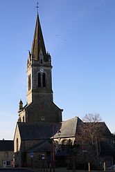 The church of Saint-Jean-Baptiste | |
Location of Lalleu .mw-parser-output .locmap .od{position:absolute}.mw-parser-output .locmap .id{position:absolute;line-height:0}.mw-parser-output .locmap .l0{font-size:0;position:absolute}.mw-parser-output .locmap .pv{line-height:110%;position:absolute;text-align:center}.mw-parser-output .locmap .pl{line-height:110%;position:absolute;top:-0.75em;text-align:right}.mw-parser-output .locmap .pr{line-height:110%;position:absolute;top:-0.75em;text-align:left}.mw-parser-output .locmap .pv>div{display:inline;padding:1px}.mw-parser-output .locmap .pl>div{display:inline;padding:1px;float:right}.mw-parser-output .locmap .pr>div{display:inline;padding:1px;float:left}html.skin-theme-clientpref-night .mw-parser-output .od,html.skin-theme-clientpref-night .mw-parser-output .od .pv>div,html.skin-theme-clientpref-night .mw-parser-output .od .pl>div,html.skin-theme-clientpref-night .mw-parser-output .od .pr>div{background:#000;color:#fff}html.skin-theme-clientpref-night .mw-parser-output .locmap{filter:grayscale(0.6)}@media(prefers-color-scheme:dark){html.skin-theme-clientpref-os .mw-parser-output .locmap{filter:grayscale(0.6)}html.skin-theme-clientpref-os .mw-parser-output .od,html.skin-theme-clientpref-os .mw-parser-output .od .pv>div,html.skin-theme-clientpref-os .mw-parser-output .od .pl>div,html.skin-theme-clientpref-os .mw-parser-output .od .pr>div{background:#000;color:#fff}}  Lalleu  Lalleu | |
| Coordinates: 47°51′22″N 1°30′32″W / 47.8561°N 1.5089°W | |
| Country | France |
| Region | Brittany |
| Department | Ille-et-Vilaine |
| Arrondissement | Redon |
| Canton | Bain-de-Bretagne |
| Intercommunality | Bretagne Porte de Loire |
| Government | |
| • Mayor (2020–2026) | Thierry Lassalle[1] |
| Area 1 | 15.47 km2 (5.97 sq mi) |
| Population (2021)[2] | 570 |
| • Density | 37/km2 (95/sq mi) |
| Time zone | UTC+01:00 (CET) |
| • Summer (DST) | UTC+02:00 (CEST) |
| INSEE/Postal code | 35140 /35320 |
| Elevation | 31–104 m (102–341 ft) |
| 1 French Land Register data, which excludes lakes, ponds, glaciers > 1 km2 (0.386 sq mi or 247 acres) and river estuaries. | |
Geography edit
The stream de la Couyère forms all of the commune's eastern border, then flows into the Semnon, which forms all of its southern border.
Population edit
Inhabitants of Lalleu are called Allodiens in French.
| Year | Pop. | ±% |
|---|---|---|
| 1962 | 497 | — |
| 1968 | 588 | +18.3% |
| 1975 | 506 | −13.9% |
| 1982 | 460 | −9.1% |
| 1990 | 445 | −3.3% |
| 1999 | 469 | +5.4% |
| 2008 | 565 | +20.5% |
See also edit
References edit
- ^ "Répertoire national des élus: les maires" (in French). data.gouv.fr, Plateforme ouverte des données publiques françaises. 13 September 2022.
- ^ "Populations légales 2021". The National Institute of Statistics and Economic Studies. 28 December 2023.
External links edit
Wikimedia Commons has media related to Lalleu.
- Base Mérimée: Search for heritage in the commune, Ministère français de la Culture. (in French)
- Mayors of Ille-et-Vilaine Association (in French)