


Summary
Lambton Quay (once known as The Beach) is the heart of the central business district of Wellington, the capital city of New Zealand.[1][2]
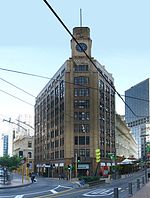 The MLC Building near the south end of Lambton Quay, at Hunter St | |
| Maintained by | Wellington City Council |
|---|---|
| Location | Wellington, New Zealand |
| Postal code | 6011 |
| North end | Featherston Street/Mulgrave Street/Thorndon Quay |
| South end | Customhouse Quay/Willeston Street/Willis Street |
Originally, as the name implies, it was the high-water line of the foreshore, and sometimes the sea would roll across the road and enter the shops on the opposite side.[3] It was the site of the original European settlement in 1840 (following initial settlement on flood-prone land at Petone), which grew into Wellington.[4] In the 19th century Pipitea Pa was situated at the extreme northern end of Lambton Quay – the section of road in this area is now known as Thorndon Quay.[5] Land uplift caused by the 1855 Wairarapa earthquake and further reclamation have left Lambton Quay some 250 metres from the current shoreline.[1][6] Kumototo Stream used to flow from the Terrace, down what is now Woodward Street and across Lambton Quay to the waterfront. This stream was culverted in the late 19th century.[7]
Lambton Quay is named after John Lambton, 1st Earl of Durham, the first chairman of directors of the New Zealand Company.[1]
Lambton Quay, Willis Street, Manners Street and Courtenay Place form what is known locally as the Golden Mile.[8] The city's retail trade has spread further south to also include Cuba Street, but Lambton Quay remains a major commercial thoroughfare. In 2020 it was estimated that about 70,000 people travel on Lambton Quay and Willis Street each day, mostly on foot or by bus.[9] It is also of administrative significance, with the New Zealand Parliament Buildings towards the northern end.[10] The Wellington Cenotaph is also located at this end, next to Parliament.[11]
The Wellington Cable Car runs from Lambton Quay to the top of the Botanic Garden. James Henry Marriott, who arrived from London in 1843, had a bookshop here.[12]
The length of Lambton Quay is punctuated by several notable sculptures.[13]
History edit

Dense bush, down to the harbour's edge, covered much of the area until 1840 and, at the site of the Old Bank Arcade, it could be hard to get round the rocks at high tide at what was then Windy Point, or Clay Point.[15][16] The Point was dug away between 1857 and 1863[17] to reclaim 7 acres 3 roods 34 perches (almost 8 acres (3.2 ha)).[18]
The name Lambton Quay was in use by the end of 1840.[19] On 22 October 1840[20] Barrett's Hotel, a 2-storey pub, opened at the north end of the Quay.[21] The Wellington Hotel opened by 1843. Its owner, Baron Alzdorf, was the only Wellington person killed in the 1855 earthquake, when a chimney of the hotel fell on him, after which it became the Criterion Hotel,[22] a name it kept until at least 1887.[23] By 1900 buildings on the Quay included the Royal Hotel,[24] government printer, Old Government Buildings,[25] Central Police Station,[26][27] Club Hotel, Occidental Hotel, Commercial Union and New Zealand Insurance companies, Trust & Loan Co, Star Hotel, Baker Bros, Union Bank of Australia, Bank of New South Wales, South British Insurance, Colonial Bank,[28] Exchange Building, Barrett's Hotel and Equitable Building Investment Co.[29]
References edit
- ^ a b c Thomson, Rebecca (28 August 2013). "Streetwise History: Lambton Quay". Stuff. Retrieved 19 January 2021.
- ^ Holmes, William Howard; Taonga, New Zealand Ministry for Culture and Heritage Te Manatu. "Lambton Quay, 1856". teara.govt.nz. Retrieved 21 July 2021.
- ^ Holmes, William Howard; Taonga, New Zealand Ministry for Culture and Heritage Te Manatu. "Lambton Quay, 1856". teara.govt.nz. Retrieved 19 January 2021.
- ^ "History of Wellington". www.lonelyplanet.com. 2018. Retrieved 19 January 2021.
- ^ "Story Map Journal". wcc.maps.arcgis.com. Retrieved 21 July 2021.
- ^ "Waterfront reclamation". Wellington City Council. 19 February 2015. Retrieved 19 January 2021.
- ^ "[untitled]". The Dominion. 14 November 1907. Retrieved 21 July 2021 – via Paperspast.
- ^ "Golden Mile Improvements". lgwm.nz. 2021. Retrieved 19 January 2021.
- ^ Stantec (June 2020). "Golden Mile Short List Options Report" (PDF). Let's Get Wellington Moving. p. 1. Retrieved 21 July 2021.
- ^ Harris, Catherine (18 September 2015). "Government precinct's makeover begins with Masons Lane revamp". Stuff. Retrieved 19 January 2021.
- ^ "Wellington Cenotaph". wellingtoncityheritage.org.nz. 25 September 2017. Retrieved 19 January 2021.
- ^ Downes, Peter. "James Henry Marriott". Dictionary of New Zealand Biography. Ministry for Culture and Heritage. Retrieved 1 March 2019.
- ^ "Wellington sculpture tours – Wellington sculpture tours". www.sculptures.org.nz. Retrieved 15 September 2019.
- ^ "NEW ZEALAND TIMES". paperspast.natlib.govt.nz. 6 May 1887. Retrieved 23 March 2022.
- ^ "EARLY WELLINGTON. NEW ZEALAND MAIL". paperspast.natlib.govt.nz. 18 January 1905. Retrieved 23 March 2022.
- ^ "Building banks in Wellington". BNZ.
- ^ "South Lambton Quay Historic Area". www.heritage.org.nz. Retrieved 23 March 2022.
- ^ "EVENING POST". paperspast.natlib.govt.nz. 27 August 1927. Retrieved 18 March 2022.
- ^ "NEW ZEALAND GAZETTE AND WELLINGTON SPECTATOR". paperspast.natlib.govt.nz. 28 November 1840. Retrieved 23 March 2022.
- ^ "PUBLIC DINNER. NEW ZEALAND GAZETTE AND WELLINGTON SPECTATOR". paperspast.natlib.govt.nz. 24 October 1840. Retrieved 23 March 2022.
- ^ "Barrett's Hotel". National Library of New Zealand. Retrieved 23 March 2022.
- ^ "The history and archaeology of 76-84 Lambton Quay, Wellington site R27-157". NZ Archaeological Association. Retrieved 23 March 2022.
- ^ "Lambton Licensing Committee. EVENING POST". paperspast.natlib.govt.nz. 5 December 1887. Retrieved 23 March 2022.
- ^ "Thomas Ward survey map of Wellington City, sheet 16". Archives Online. Retrieved 23 March 2022.
- ^ "Thomas Ward survey map of Wellington City, sheet 23". Archives Online. Retrieved 23 March 2022.
- ^ "Former Central Police Station". www.wellingtoncityheritage.org.nz. Retrieved 23 March 2022.
- ^ "Thomas Ward survey map of Wellington City, sheet 22". Archives Online. Retrieved 23 March 2022.
- ^ "Thomas Ward survey map of Wellington City, sheet 26". Archives Online. Retrieved 23 March 2022.
- ^ "Thomas Ward survey map of Wellington City, sheet 29". Archives Online. Retrieved 23 March 2022.
External links edit
- Lambton Quay online
41°16′54″S 174°46′34″E / 41.281615°S 174.776043°E