


Summary
Lancaster is a city in Atchison County, Kansas, United States.[1] As of the 2020 census, the population of the city was 246.[3]
Lancaster, Kansas | |
|---|---|
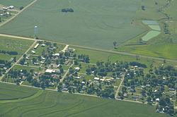 Aerial view of Lancaster (2013) | |
 Location within Atchison County and Kansas | |
 KDOT map of Atchison County (legend) | |
| Coordinates: 39°34′16″N 95°18′13″W / 39.57111°N 95.30361°W[1] | |
| Country | United States |
| State | Kansas |
| County | Atchison |
| Township | Lancaster |
| Founded | 1850s |
| Platted | 1857 |
| Named for | Lancaster, Pennsylvania |
| Area | |
| • Total | 0.20 sq mi (0.52 km2) |
| • Land | 0.20 sq mi (0.52 km2) |
| • Water | 0.00 sq mi (0.00 km2) |
| Elevation | 1,161 ft (354 m) |
| Population | |
| • Total | 246 |
| • Density | 1,200/sq mi (470/km2) |
| Time zone | UTC−6 (CST) |
| • Summer (DST) | UTC−5 (CDT) |
| ZIP Code | 66041 |
| Area code | 913 |
| FIPS code | 20-38325 |
| GNIS ID | 2395625[1] |
History edit
Lancaster was platted in 1857.[4] It may have been named after Lancaster, Pennsylvania.[5] Lancaster was an early contender for county seat.[6] Lancaster was a station on the Missouri Pacific Railroad.[7]
In 1915, Lancaster contained seven stores, a school, three churches, a grain elevator, a lumber yard, and a hotel.[8]
Geography edit
According to the United States Census Bureau, the city has a total area of 0.22 square miles (0.57 km2), all of it land.[9]
Demographics edit
| Census | Pop. | Note | %± |
|---|---|---|---|
| 1900 | 292 | — | |
| 1910 | 220 | −24.7% | |
| 1920 | 184 | −16.4% | |
| 1930 | 188 | 2.2% | |
| 1940 | 163 | −13.3% | |
| 1950 | 200 | 22.7% | |
| 1960 | 196 | −2.0% | |
| 1970 | 279 | 42.3% | |
| 1980 | 274 | −1.8% | |
| 1990 | 299 | 9.1% | |
| 2000 | 291 | −2.7% | |
| 2010 | 298 | 2.4% | |
| 2020 | 246 | −17.4% | |
| U.S. Decennial Census | |||
2020 census edit
The 2020 United States census counted 246 people, 109 households, and 73 families in Lancaster.[10][11] The population density was 1,236.2 per square mile (477.3/km2). There were 109 housing units at an average density of 547.7 per square mile (211.5/km2).[11][12] The racial makeup was 96.34% (237) white or European American (95.12% non-Hispanic white), 0.0% (0) black or African-American, 0.0% (0) Native American or Alaska Native, 0.0% (0) Asian, 0.0% (0) Pacific Islander or Native Hawaiian, 0.0% (0) from other races, and 3.66% (9) from two or more races.[13] Hispanic or Latino of any race was 1.63% (4) of the population.[14]
Of the 109 households, 39.4% had children under the age of 18; 46.8% were married couples living together; 24.8% had a female householder with no spouse or partner present. 29.4% of households consisted of individuals and 10.1% had someone living alone who was 65 years of age or older.[11] The average household size was 2.8 and the average family size was 3.8.[15] The percent of those with a bachelor’s degree or higher was estimated to be 4.9% of the population.[16]
21.1% of the population was under the age of 18, 10.2% from 18 to 24, 21.1% from 25 to 44, 31.3% from 45 to 64, and 16.3% who were 65 years of age or older. The median age was 43.6 years. For every 100 females, there were 95.2 males.[11] For every 100 females ages 18 and older, there were 90.2 males.[11]
The 2016-2020 5-year American Community Survey estimates show that the median household income was $35,000 (with a margin of error of +/- $15,966) and the median family income was $60,000 (+/- $27,460).[17] Males had a median income of $40,078 (+/- $14,878) versus $22,833 (+/- $8,285) for females. The median income for those above 16 years old was $24,938 (+/- $3,612).[18] Approximately, 10.3% of families and 17.0% of the population were below the poverty line, including 25.9% of those under the age of 18 and 6.2% of those ages 65 or over.[19][20]
2010 census edit
As of the census[21] of 2010, there were 298 people, 108 households, and 87 families residing in the city. The population density was 1,354.5 inhabitants per square mile (523.0/km2). There were 117 housing units at an average density of 531.8 per square mile (205.3/km2). The racial makeup of the city was 98.0% White, 0.3% African American, 1.0% Native American, and 0.7% Asian.
There were 108 households, of which 38.9% had children under the age of 18 living with them, 65.7% were married couples living together, 10.2% had a female householder with no husband present, 4.6% had a male householder with no wife present, and 19.4% were non-families. 16.7% of all households were made up of individuals, and 10.2% had someone living alone who was 65 years of age or older. The average household size was 2.76 and the average family size was 3.08.
The median age in the city was 40 years. 27.9% of residents were under the age of 18; 6.4% were between the ages of 18 and 24; 23.8% were from 25 to 44; 29.6% were from 45 to 64; and 12.4% were 65 years of age or older. The gender makeup of the city was 50.7% male and 49.3% female.
2000 census edit
As of the census[22] of 2000, there were 291 people, 107 households, and 81 families residing in the city. The population density was 1,307.5 inhabitants per square mile (504.8/km2). There were 117 housing units at an average density of 525.7 per square mile (203.0/km2). The racial makeup of the city was 98.28% White, 0.34% African American, 0.34% Native American, and 1.03% from two or more races.
There were 107 households, out of which 42.1% had children under the age of 18 living with them, 63.6% were married couples living together, 8.4% had a female householder with no husband present, and 23.4% were non-families. 21.5% of all households were made up of individuals, and 12.1% had someone living alone who was 65 years of age or older. The average household size was 2.72 and the average family size was 3.12.
In the city, the population was spread out, with 29.9% under the age of 18, 7.9% from 18 to 24, 30.9% from 25 to 44, 17.9% from 45 to 64, and 13.4% who were 65 years of age or older. The median age was 35 years. For every 100 females, there were 96.6 males. For every 100 females age 18 and over, there were 92.5 males.
The median income for a household in the city was $32,500, and the median income for a family was $37,188. Males had a median income of $29,000 versus $21,250 for females. The per capita income for the city was $12,921. About 10.4% of families and 11.6% of the population were below the poverty line, including 14.4% of those under the age of eighteen and 4.7% of those 65 or over.
References edit
- ^ a b c d U.S. Geological Survey Geographic Names Information System: Lancaster, Kansas
- ^ "2019 U.S. Gazetteer Files". United States Census Bureau. Retrieved July 24, 2020.
- ^ a b "Profile of Lancaster, Kansas in 2020". United States Census Bureau. Archived from the original on November 11, 2022. Retrieved November 11, 2022.
- ^ Blackmar, Frank Wilson (1912). Kansas: A Cyclopedia of State History, Volume 2. Standard Publishing Company. p. 94.
- ^ "Profile for Lancaster, Kansas". ePodunk. Retrieved June 4, 2014.
- ^ History of the State of Kansas: Containing a Full Account of Its Growth from an Uninhabited Territory to a Wealthy and Important State. A. T. Andreas. 1883. p. 409.
- ^ Gannett, Henry (1898). A Gazetteer of Kansas. Govt. Print. Off. p. 128.
- ^ Ingalls, Sheffield (1916). History of Atchison County, Kansas. Standard Publishing Company. p. 96.
- ^ "US Gazetteer files 2010". United States Census Bureau. Archived from the original on July 2, 2012. Retrieved July 6, 2012.
- ^ "US Census Bureau, Table P16: HOUSEHOLD TYPE". data.census.gov. Retrieved January 3, 2024.
- ^ a b c d e "US Census Bureau, Table DP1: PROFILE OF GENERAL POPULATION AND HOUSING CHARACTERISTICS". data.census.gov. Retrieved January 3, 2024.
- ^ Bureau, US Census. "Gazetteer Files". Census.gov. Retrieved December 30, 2023.
- ^ "US Census Bureau, Table P1: RACE". data.census.gov. Retrieved January 3, 2024.
- ^ "US Census Bureau, Table P2: HISPANIC OR LATINO, AND NOT HISPANIC OR LATINO BY RACE". data.census.gov. Retrieved January 3, 2024.
- ^ "US Census Bureau, Table S1101: HOUSEHOLDS AND FAMILIES". data.census.gov. Retrieved January 3, 2024.
- ^ "US Census Bureau, Table S1501: EDUCATIONAL ATTAINMENT". data.census.gov. Retrieved January 3, 2024.
- ^ "US Census Bureau, Table S1903: MEDIAN INCOME IN THE PAST 12 MONTHS (IN 2020 INFLATION-ADJUSTED DOLLARS)". data.census.gov. Retrieved January 3, 2024.
- ^ "US Census Bureau, Table S2001: EARNINGS IN THE PAST 12 MONTHS (IN 2020 INFLATION-ADJUSTED DOLLARS)". data.census.gov. Retrieved January 3, 2024.
- ^ "US Census Bureau, Table S1701: POVERTY STATUS IN THE PAST 12 MONTHS". data.census.gov. Retrieved January 3, 2024.
- ^ "US Census Bureau, Table S1702: POVERTY STATUS IN THE PAST 12 MONTHS OF FAMILIES". data.census.gov. Retrieved January 3, 2024.
- ^ "U.S. Census website". United States Census Bureau. Retrieved July 6, 2012.
- ^ "U.S. Census website". United States Census Bureau. Retrieved January 31, 2008.
Further reading edit
External links edit
- Lancaster - Directory of Public Officials
- USD 377, local school district
- Lancaster city map, KDOT