
KNOWPIA
WELCOME TO KNOWPIA

Landifay-et-Bertaignemont 
Summary
Landifay-et-Bertaignemont is a commune in the Aisne department in Hauts-de-France in northern France.
Landifay-et-Bertaignemont | |
|---|---|
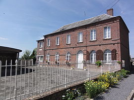 The town hall of Landifay-et-Bertaignemont | |
Location of Landifay-et-Bertaignemont .mw-parser-output .locmap .od{position:absolute}.mw-parser-output .locmap .id{position:absolute;line-height:0}.mw-parser-output .locmap .l0{font-size:0;position:absolute}.mw-parser-output .locmap .pv{line-height:110%;position:absolute;text-align:center}.mw-parser-output .locmap .pl{line-height:110%;position:absolute;top:-0.75em;text-align:right}.mw-parser-output .locmap .pr{line-height:110%;position:absolute;top:-0.75em;text-align:left}.mw-parser-output .locmap .pv>div{display:inline;padding:1px}.mw-parser-output .locmap .pl>div{display:inline;padding:1px;float:right}.mw-parser-output .locmap .pr>div{display:inline;padding:1px;float:left}html.skin-theme-clientpref-night .mw-parser-output .od,html.skin-theme-clientpref-night .mw-parser-output .od .pv>div,html.skin-theme-clientpref-night .mw-parser-output .od .pl>div,html.skin-theme-clientpref-night .mw-parser-output .od .pr>div{background:#000;color:#fff}html.skin-theme-clientpref-night .mw-parser-output .locmap{filter:grayscale(0.6)}@media(prefers-color-scheme:dark){html.skin-theme-clientpref-os .mw-parser-output .locmap{filter:grayscale(0.6)}html.skin-theme-clientpref-os .mw-parser-output .od,html.skin-theme-clientpref-os .mw-parser-output .od .pv>div,html.skin-theme-clientpref-os .mw-parser-output .od .pl>div,html.skin-theme-clientpref-os .mw-parser-output .od .pr>div{background:#000;color:#fff}}  Landifay-et-Bertaignemont  Landifay-et-Bertaignemont | |
| Coordinates: 49°49′04″N 3°36′25″E / 49.8178°N 3.6069°E | |
| Country | France |
| Region | Hauts-de-France |
| Department | Aisne |
| Arrondissement | Vervins |
| Canton | Marle |
| Intercommunality | Thiérache du Centre |
| Government | |
| • Mayor (2020–2026) | Sandrine Beaud'Huin[1] |
| Area 1 | 19.6 km2 (7.6 sq mi) |
| Population (2021)[2] | 255 |
| • Density | 13/km2 (34/sq mi) |
| Time zone | UTC+01:00 (CET) |
| • Summer (DST) | UTC+02:00 (CEST) |
| INSEE/Postal code | 02403 /02120 |
| Elevation | 77–153 m (253–502 ft) (avg. 113 m or 371 ft) |
| 1 French Land Register data, which excludes lakes, ponds, glaciers > 1 km2 (0.386 sq mi or 247 acres) and river estuaries. | |
Population edit
| Year | Pop. | ±% |
|---|---|---|
| 1962 | 512 | — |
| 1968 | 482 | −5.9% |
| 1975 | 389 | −19.3% |
| 1982 | 339 | −12.9% |
| 1990 | 312 | −8.0% |
| 1999 | 277 | −11.2% |
| 2008 | 299 | +7.9% |
See also edit
References edit
- ^ "Répertoire national des élus: les maires". data.gouv.fr, Plateforme ouverte des données publiques françaises (in French). 9 August 2021.
- ^ "Populations légales 2021". The National Institute of Statistics and Economic Studies. 28 December 2023.
Wikimedia Commons has media related to Landifay-et-Bertaignemont.