
-
 Las Cruces Hotel advertised its proximity to Las Cruces Hot Springs and Nojoqui Falls (The Lompoc Record, Dec. 18, 1880)
 -
 Las Cruces, California location map submitted to the U.S. Post Office Department in 1885

KNOWPIA
WELCOME TO KNOWPIA
Las Cruces, California 
Summary
Las Cruces (sometimes rendered Las Cruses, meaning the crosses in Spanish)[2] is a former settlement and an archaic placename in Santa Barbara County, California.[1] It lies at the split between California State Route 1, which travels north to Lompoc, and U.S. Route 101, which travels north to Buellton. The two routes coincide on the highway to the south through the Gaviota Gorge to the Gaviota Coast. The community lies within area code 805.
Las Cruces, California | |
|---|---|
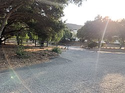 Las Cruces, August 2021 | |
 Las Cruces, California | |
| Coordinates: 34°30′29″N 120°13′45″W / 34.50806°N 120.22917°W | |
| Country | United States |
| State | California |
| County | Santa Barbara |
| Elevation | 341 ft (104 m) |
| Time zone | UTC-8 (Pacific (PST)) |
| • Summer (DST) | UTC-7 (PDT) |
| Area code(s) | 805 & 820 |
| GNIS feature ID | 1660894[1] |
History edit
There was a post office at Las Cruces as early as 1876.[3] The spot has long been a crossroads for travellers along the Central Coast.[4] In the 19th century, Las Cruces "was an overnight stop-over for farmers delivering grain and other crops from the Santa Ynez Valley to the Gaviota Wharf."[5]
Gaviota Hot Springs were originally known as Las Cruces Hot Springs because of its proximity to the village.[6] Locals used the springs for bathing.[7]
According to the 1941 American Guide to Santa Barbara, the settlement, "shaded by immense old sycamores, [was] a cluster of homes about an inn, a wayside store, and a garage. The spot was once a gathering place for early-California cattlemen who took their cattle through the pass and down to the old Gaviota Landing for shipment. In still earlier times, the region was a battleground during the tenacious wars between the coastal tribes and the Tulare Indians from the San Joaquín Valley."[8] The population of Las Cruces in 1941 was 64 people.[9][8] Las Cruces was fairly busy during World War II, when it attracted visitors from Camp Cooke, now Vandenberg Space Force Base.[10] It was said to have been a "small community" as of the 1950s.[9] The village is said to have been "obliterated" by highway construction.[7] The Las Cruces village store was demolished in December 1967 to make way for the interchange.[10]
Additional images edit
History of Las Cruces, California


References edit
- ^ a b U.S. Geological Survey Geographic Names Information System: Las Cruces, California
- ^ Gannett, Henry (1905). The Origin of Certain Place Names in the United States. U.S. Government Printing Office. p. 182.
- ^ U.S. Post Office Department, "California: San Mateo – Santa Clara Counties (Roll 65)", M1126: Post Office Department Reports of Site Locations, 1837–1950, Washington, D.C.: U.S. National Archives and Records Administration, film images 353–356 of 789, NAID 68237020 – via archives.gov
- ^ McMahon, Marilyn (February 13, 2021). "Special school: Vista de Las Cruces project among architect's favorites". Santa Barbara News-Press. Retrieved February 20, 2021.
- ^ "Crumbling Las Cruces Adobe Patiently Waits Future Course". Santa Ynez Valley News. April 13, 1972. p. 6. Retrieved January 21, 2024. & "Adobe [part 2 of 2]". Santa Ynez Valley News. April 13, 1972. p. 7. Retrieved January 21, 2024.
- ^ "Wilson, Leila Weekes. Santa Barbara, California. Santa Barbara, Calif.: Pacific Coast Publ. Co., 1913". HathiTrust. pp. 91–92. Retrieved January 21, 2024.
- ^ a b Cappon, Sally (April 15, 2008). "'Warm Springs' Once a Hot Spot". Best of Roadside Attractions. Santa Maria Times. pp. A3. Retrieved January 21, 2024.
- ^ a b Writers' Program (U.S.) (1941). Santa Barbara; a guide to the Channel city and its environs. Prelinger Library. New York: Hastings house. p. 170.
- ^ a b Dale, Judith (May 12, 2020). "Las Cruses: The forgotten crossroad". Santa Ynez Valley News. pp. B1. Retrieved January 21, 2024. & "Dale [part 2 of 2]". Santa Ynez Valley News. May 12, 2020. pp. B3. Retrieved January 21, 2024.
- ^ a b "Old Las Cruces Store Gives Way to New Interchange". Santa Ynez Valley News. January 11, 1968. p. 9. Retrieved January 21, 2024.
Further reading edit
- Chestnut, Merlyn (1993). The Gaviota Land: A Glimpse into California History from a Bend on El Camino Real. Santa Barbara: Fithian Press. ISBN 9781564740519.