


Summary
Lāwaʻi is a census-designated place (CDP) in Kauaʻi County in the U.S. state of Hawaiʻi. The population was 2,578 at the 2020 census,[2] up from 1,984 at the 2000 census.
Lawai, Hawaii
Lāwaʻi | |
|---|---|
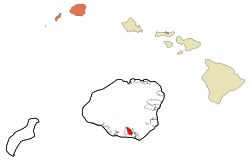 Location in Kauai County and the state of Hawaii | |
| Coordinates: 21°55′31″N 159°30′27″W / 21.92528°N 159.50750°W | |
| Country | United States |
| State | Hawaii |
| County | Kauai |
| Area | |
| • Total | 4.15 sq mi (10.75 km2) |
| • Land | 4.06 sq mi (10.50 km2) |
| • Water | 0.10 sq mi (0.25 km2) |
| Elevation | 554 ft (169 m) |
| Population (2020) | |
| • Total | 2,578 |
| • Density | 635.60/sq mi (245.42/km2) |
| Time zone | UTC-10 (Hawaii-Aleutian) |
| ZIP code | 96765 |
| Area code | 808 |
| FIPS code | 15-44450 |
| GNIS feature ID | 0361798 |
Geography edit
Lāwaʻi is located on the southern side of the island of Kauai at 21°55′31″N 159°30′27″W / 21.92528°N 159.50750°W (21.925343, -159.507385).[3] It is bordered to the west by Kalaheo and to the east by Omao. Hawaii Route 50 passes through Lawai, leading northeast 11 miles (18 km) to Lihue and west 6 miles (10 km) to Hanapepe.
According to the United States Census Bureau, the Lawai CDP has a total area of 4.2 square miles (10.8 km2), of which 4.1 square miles (10.5 km2) are land and 0.1 square miles (0.3 km2), or 2.33%, are water.[2]
Demographics edit
| Census | Pop. | Note | %± |
|---|---|---|---|
| 2020 | 2,578 | — | |
| U.S. Decennial Census[4] | |||
As of the census[5] of 2000, there were 1,984 people, 711 households, and 531 families residing in the CDP. The population density was 521.7 inhabitants per square mile (201.4/km2). There were 747 housing units at an average density of 196.4 per square mile (75.8/km2). The racial makeup of the CDP was 35.4% White, 0.3% African American, 0.3% Native American, 30.8% Asian, 5.5% Pacific Islander, 1.4% from other races, and 26.4% from two or more races. Hispanic or Latino of any race were 11.8% of the population.
There were 711 households, out of which 32.2% had children under the age of 18 living with them, 60.6% were married couples living together, 9.1% had a female householder with no husband present, and 25.3% were non-families. 18.8% of all households were made up of individuals, and 6.2% had someone living alone who was 65 years of age or older. The average household size was 2.79 and the average family size was 3.18.
In the CDP the population was spread out, with 24.8% under the age of 18, 7.1% from 18 to 24, 27.7% from 25 to 44, 27.0% from 45 to 64, and 13.4% who were 65 years of age or older. The median age was 39 years. For every 100 females, there were 105.8 males. For every 100 females age 18 and over, there were 104.2 males.
The median income for a household in the CDP was $55,662, and the median income for a family was $60,750. Males had a median income of $34,479 versus $30,761 for females. The per capita income for the CDP was $22,884. About 2.7% of families and 4.9% of the population were below the poverty line, including 4.0% of those under age 18 and 0.8% of those age 65 or over.
Points of interest edit
Notable people edit
- Kaliko Kauahi, actress
References edit
- ^ "2020 U.S. Gazetteer Files". United States Census Bureau. Retrieved December 18, 2021.
- ^ a b "Geographic Identifiers: 2010 Demographic Profile Data (G001): Lawai CDP, Hawaii". American Factfinder. U.S. Census Bureau. Retrieved February 4, 2019.[dead link]
- ^ "US Gazetteer files: 2010, 2000, and 1990". United States Census Bureau. 2011-02-12. Retrieved 2011-04-23.
- ^ "Census of Population and Housing". Census.gov. Retrieved June 4, 2016.
- ^ "U.S. Census website". United States Census Bureau. Retrieved 2008-01-31.
- Save Our Seas -LawaiBay.Com