
KNOWPIA
WELCOME TO KNOWPIA

Lazy Acres, Colorado 
Summary
Lazy Acres is an unincorporated community and a census-designated place (CDP) located in and governed by Boulder County, Colorado, United States. The CDP is a part of the Boulder, CO Metropolitan Statistical Area. The population of the Lazy Acres CDP was 957 at the United States Census 2020.[3] The Boulder post office (Zip Code 80302) serves the area.[4]
Lazy Acres, Colorado | |
|---|---|
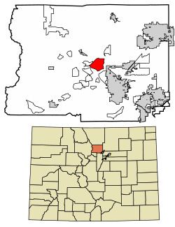 Location of the Lazy Acres CDP in Boulder County, Colorado. | |
 Lazy Acres Location of the Lazy Acres CDP in the United States. | |
| Coordinates: 40°05′01″N 105°19′53″W / 40.0836969°N 105.3312676°W[1] | |
| Country | |
| State | |
| County | Boulder County |
| Government | |
| • Type | unincorporated community |
| Area | |
| • Total | 5.291 sq mi (13.704 km2) |
| • Land | 5.290 sq mi (13.700 km2) |
| • Water | 0.002 sq mi (0.004 km2) |
| Elevation | 6,781 ft (2,067 m) |
| Population | |
| • Total | 957 |
| • Density | 180/sq mi (70/km2) |
| Time zone | UTC-7 (MST) |
| • Summer (DST) | UTC-6 (MDT) |
| ZIP Code[4] | Boulder 80302 |
| Area codes | 303 & 720 |
| GNIS feature[2] | Lazy Acres CDP |
Geography edit
Lazy Acres is located in central Boulder County in the Front Range of the Southern Rocky Mountains. It is situated on a ridge northwest of the city of Boulder.
The Lazy Acres CDP has an area of 3,386 acres (13.704 km2), including 1.0 acre (0.004 km2) of water.[1]
Demographics edit
The United States Census Bureau initially defined the Lazy Acres CDP for the United States Census 2010.
| Year | Pop. | ±% |
|---|---|---|
| 2010 | 920 | — |
| 2020 | 957 | +4.0% |
| Source: United States Census Bureau | ||
See also edit
References edit
- ^ a b c "State of Colorado Census Designated Places - BAS20 - Data as of January 1, 2020". United States Census Bureau. Retrieved December 8, 2020.
- ^ a b c "U.S. Board on Geographic Names: Domestic Names". United States Geological Survey. Retrieved December 8, 2020.
- ^ a b United States Census Bureau. "Lazy Acres CDP, Colorado". Retrieved April 18, 2023.
- ^ a b "Zip Code 80302 Map and Profile". zipdatamaps.com. 2020. Retrieved December 20, 2020.
External links edit
Lazy Acres, Colorado at Wikipedia's sister projects
 Definitions from Wiktionary
 Media from Commons
 News from Wikinews
 Quotations from Wikiquote
 Texts from Wikisource
 Textbooks from Wikibooks
 Resources from Wikiversity
- Boulder County website