
KNOWPIA
WELCOME TO KNOWPIA

Le Gault-du-Perche 
Summary
Le Gault-du-Perche (French pronunciation: [lə ɡo dy pɛʁʃ], literally Le Gault of the Perche; before 2017: Le Gault-Perche)[3] is a commune in the Loir-et-Cher department of central France, close to the border with Eure-et-Loir.[4]
Le Gault-du-Perche | |
|---|---|
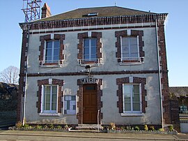 Town hall | |
 Coat of arms | |
Location of Le Gault-du-Perche .mw-parser-output .locmap .od{position:absolute}.mw-parser-output .locmap .id{position:absolute;line-height:0}.mw-parser-output .locmap .l0{font-size:0;position:absolute}.mw-parser-output .locmap .pv{line-height:110%;position:absolute;text-align:center}.mw-parser-output .locmap .pl{line-height:110%;position:absolute;top:-0.75em;text-align:right}.mw-parser-output .locmap .pr{line-height:110%;position:absolute;top:-0.75em;text-align:left}.mw-parser-output .locmap .pv>div{display:inline;padding:1px}.mw-parser-output .locmap .pl>div{display:inline;padding:1px;float:right}.mw-parser-output .locmap .pr>div{display:inline;padding:1px;float:left}html.skin-theme-clientpref-night .mw-parser-output .od,html.skin-theme-clientpref-night .mw-parser-output .od .pv>div,html.skin-theme-clientpref-night .mw-parser-output .od .pl>div,html.skin-theme-clientpref-night .mw-parser-output .od .pr>div{background:#000;color:#fff}html.skin-theme-clientpref-night .mw-parser-output .locmap{filter:grayscale(0.6)}@media(prefers-color-scheme:dark){html.skin-theme-clientpref-os .mw-parser-output .locmap{filter:grayscale(0.6)}html.skin-theme-clientpref-os .mw-parser-output .od,html.skin-theme-clientpref-os .mw-parser-output .od .pv>div,html.skin-theme-clientpref-os .mw-parser-output .od .pl>div,html.skin-theme-clientpref-os .mw-parser-output .od .pr>div{background:#000;color:#fff}}  Le Gault-du-Perche  Le Gault-du-Perche | |
| Coordinates: 48°05′45″N 0°58′49″E / 48.0958°N 0.9803°E | |
| Country | France |
| Region | Centre-Val de Loire |
| Department | Loir-et-Cher |
| Arrondissement | Vendôme |
| Canton | Le Perche |
| Intercommunality | Collines du Perche |
| Government | |
| • Mayor (2020–2026) | Christelle Richette[1] |
| Area 1 | 28.2 km2 (10.9 sq mi) |
| Population (2021)[2] | 327 |
| • Density | 12/km2 (30/sq mi) |
| Time zone | UTC+01:00 (CET) |
| • Summer (DST) | UTC+02:00 (CEST) |
| INSEE/Postal code | 41096 /41270 |
| Elevation | 165–228 m (541–748 ft) (avg. 228 m or 748 ft) |
| 1 French Land Register data, which excludes lakes, ponds, glaciers > 1 km2 (0.386 sq mi or 247 acres) and river estuaries. | |
Population edit
| Year | Pop. | ±% p.a. |
|---|---|---|
| 1968 | 636 | — |
| 1975 | 575 | −1.43% |
| 1982 | 490 | −2.26% |
| 1990 | 360 | −3.78% |
| 1999 | 301 | −1.97% |
| 2007 | 266 | −1.53% |
| 2012 | 308 | +2.98% |
| 2017 | 341 | +2.06% |
| Source: INSEE[5] | ||
See also edit
References edit
- ^ "Répertoire national des élus: les maires" (in French). data.gouv.fr, Plateforme ouverte des données publiques françaises. 13 September 2022.
- ^ "Populations légales 2021". The National Institute of Statistics and Economic Studies. 28 December 2023.
- ^ Décret n° 2017-149 7 February 2017 (in French)
- ^ INSEE commune file
- ^ Population en historique depuis 1968, INSEE
Wikimedia Commons has media related to Le Gault-du-Perche.