


Summary
Le Grand-Lemps (French pronunciation: [lə grɑ̃ lɛ̃s]) is a commune in the Isère department in southeastern France.
Le Grand-Lemps | |
|---|---|
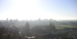 A general view of Le Grand-Lemps | |
 Coat of arms | |
Location of Le Grand-Lemps .mw-parser-output .locmap .od{position:absolute}.mw-parser-output .locmap .id{position:absolute;line-height:0}.mw-parser-output .locmap .l0{font-size:0;position:absolute}.mw-parser-output .locmap .pv{line-height:110%;position:absolute;text-align:center}.mw-parser-output .locmap .pl{line-height:110%;position:absolute;top:-0.75em;text-align:right}.mw-parser-output .locmap .pr{line-height:110%;position:absolute;top:-0.75em;text-align:left}.mw-parser-output .locmap .pv>div{display:inline;padding:1px}.mw-parser-output .locmap .pl>div{display:inline;padding:1px;float:right}.mw-parser-output .locmap .pr>div{display:inline;padding:1px;float:left}html.skin-theme-clientpref-night .mw-parser-output .od,html.skin-theme-clientpref-night .mw-parser-output .od .pv>div,html.skin-theme-clientpref-night .mw-parser-output .od .pl>div,html.skin-theme-clientpref-night .mw-parser-output .od .pr>div{background:#000;color:#fff}html.skin-theme-clientpref-night .mw-parser-output .locmap{filter:grayscale(0.6)}@media(prefers-color-scheme:dark){html.skin-theme-clientpref-os .mw-parser-output .locmap{filter:grayscale(0.6)}html.skin-theme-clientpref-os .mw-parser-output .od,html.skin-theme-clientpref-os .mw-parser-output .od .pv>div,html.skin-theme-clientpref-os .mw-parser-output .od .pl>div,html.skin-theme-clientpref-os .mw-parser-output .od .pr>div{background:#000;color:#fff}}  Le Grand-Lemps  Le Grand-Lemps | |
| Coordinates: 45°23′57″N 5°25′14″E / 45.3992°N 5.4206°E | |
| Country | France |
| Region | Auvergne-Rhône-Alpes |
| Department | Isère |
| Arrondissement | La Tour-du-Pin |
| Canton | Le Grand-Lemps |
| Intercommunality | Bièvre Est |
| Government | |
| • Mayor (2020–2026) | Geraldine Bardin-Rabatel[1] |
| Area 1 | 12.9 km2 (5.0 sq mi) |
| Population (2021)[2] | 3,089 |
| • Density | 240/km2 (620/sq mi) |
| Time zone | UTC+01:00 (CET) |
| • Summer (DST) | UTC+02:00 (CEST) |
| INSEE/Postal code | 38182 /38690 |
| Elevation | 434–724 m (1,424–2,375 ft) (avg. 480 m or 1,570 ft) |
| 1 French Land Register data, which excludes lakes, ponds, glaciers > 1 km2 (0.386 sq mi or 247 acres) and river estuaries. | |
Geography edit
The area of the municipality is 1290 hectares (about 5 square miles). It is located at the edge of the plain of Bièvre (Beaver) river, halfway between Voiron and Saint-André-la-Côte.
The town is located on the axis between Rives, Isère and La Frette, Isère (RD73). The natural reserve of the pond Le Grand-Lemps is classified as européenne2 reserves.[3] It is a natural area of ecological interest, flora and fauna which is (ZNIEFF) Type I/Zone No. 3800-7000.
Early history edit
It is likely that the first tribes there, the Ligures, would have arrived and settled in the sixth century BC. Celtic Allobroges later came to mingle with the people. Around 120 BC began the Roman invasion of Gaul. A barbarian tribe the Burgundians later migrated to the area. In 486, Clovis I founded the kingdom of the Franks. After the victory in the Battle of Vézeronce in 524, the Franks claimed the region. In the later part of the sixth century there was the fragmentation of the land between the invaders and the beginning of feudalism. There was then a time of settlement of some Saracen hordes. This was followed by a less hectic period during the reign of Charlemagne, whose empire at his death in 843 was divided into three, leaving the geographic area under the domination of his grandson Lothair I.
Population edit
Its residents are called Lempsiquois in French.
|
| ||||||||||||||||||||||||||||||||||||||||||||||||||||||||||||||||||||||||||||||||||||||||||||||||||||||||||||||||||
| Source: EHESS[4] and INSEE (1968-2017)[5] | |||||||||||||||||||||||||||||||||||||||||||||||||||||||||||||||||||||||||||||||||||||||||||||||||||||||||||||||||||
Art edit
A beautiful mural is painted on the facade of the old blind "Castro house" at the western entrance of the city. It tells the story representing a local tavern whose sign is the "Green Fairy" because it produced absinthe. Painted characters are dressed in silk and woven locally in the foreground is represented as a rosebush growing roses is common in the plain of the Le Grand-Lemps.
Many artists have visited and spent significant lengths of time in Le Grand-Lemps over the years. The painter Pierre Bonnard and his family lived in Le Grand-Lemps, where he took inspiration and created artworks based on the area. The writer, poet and politician Alphonse de Lamartine, the writer Alfred Jarry, the composer Claude Terrasse, and the painter Édouard Vuillard have stayed for periods of time as well.
Sights edit
- City Hall and City Hall Park
- Castle Square: it hosts a market every Tuesday and Friday mornings, as well as numerous events.
- Municipal halls: the multipurpose room "La Grange" (capacity 1000 people for a meal, a show for 400, 500 for sport), Foyer Municipal (capacity 200 people), Space "Pierre Bonnard" (capacity 100 persons ), the room "old Town Hall" (capacity 20 people).
- Sports facilities: Gymnasium multipurpose room for handball and basketball, the Municipal Stadium with two pitches for football and rugby, and two tennis courts.
- Its railway station, on the main line from Lyon to Grenoble, is the site of a "free library"
Twin towns edit
Le Grand-Lemps is twinned with:
 Dogern, Germany, since 1988
See also edit
References edit
- ^ "Répertoire national des élus: les maires". data.gouv.fr, Plateforme ouverte des données publiques françaises (in French). 9 August 2021.
- ^ "Populations légales 2021". The National Institute of Statistics and Economic Studies. 28 December 2023.
- ^ (in French) Réserve Européenne Archived 2010-12-18 at the Wayback Machine : Fiche sur l'étang et la tourbière du Grand-Lemps-Chabons.
- ^ Des villages de Cassini aux communes d'aujourd'hui: Commune data sheet Le Grand-Lemps, EHESS (in French).
- ^ Population en historique depuis 1968, INSEE
External links edit
- Official Site for Le Grand-Lemps (French)
- Official Site of Bièvre Est (French)
- Bird species observed on the town (French)