
KNOWPIA
WELCOME TO KNOWPIA

Ledinghem 
Summary
Ledinghem (French pronunciation: [lədɛ̃ɡɑ̃]; Picard: Ledinghin; West Flemish: Ledingem) is a commune in the Pas-de-Calais department in the Hauts-de-France region of France.[3]
Ledinghem
Ledingem | |
|---|---|
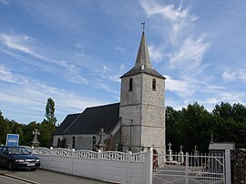 The church of Ledinghem | |
 Coat of arms | |
Location of Ledinghem .mw-parser-output .locmap .od{position:absolute}.mw-parser-output .locmap .id{position:absolute;line-height:0}.mw-parser-output .locmap .l0{font-size:0;position:absolute}.mw-parser-output .locmap .pv{line-height:110%;position:absolute;text-align:center}.mw-parser-output .locmap .pl{line-height:110%;position:absolute;top:-0.75em;text-align:right}.mw-parser-output .locmap .pr{line-height:110%;position:absolute;top:-0.75em;text-align:left}.mw-parser-output .locmap .pv>div{display:inline;padding:1px}.mw-parser-output .locmap .pl>div{display:inline;padding:1px;float:right}.mw-parser-output .locmap .pr>div{display:inline;padding:1px;float:left}html.skin-theme-clientpref-night .mw-parser-output .od,html.skin-theme-clientpref-night .mw-parser-output .od .pv>div,html.skin-theme-clientpref-night .mw-parser-output .od .pl>div,html.skin-theme-clientpref-night .mw-parser-output .od .pr>div{background:#000;color:#fff}html.skin-theme-clientpref-night .mw-parser-output .locmap{filter:grayscale(0.6)}@media(prefers-color-scheme:dark){html.skin-theme-clientpref-os .mw-parser-output .locmap{filter:grayscale(0.6)}html.skin-theme-clientpref-os .mw-parser-output .od,html.skin-theme-clientpref-os .mw-parser-output .od .pv>div,html.skin-theme-clientpref-os .mw-parser-output .od .pl>div,html.skin-theme-clientpref-os .mw-parser-output .od .pr>div{background:#000;color:#fff}}  Ledinghem  Ledinghem | |
| Coordinates: 50°39′15″N 1°59′35″E / 50.6542°N 1.9931°E | |
| Country | France |
| Region | Hauts-de-France |
| Department | Pas-de-Calais |
| Arrondissement | Saint-Omer |
| Canton | Lumbres |
| Intercommunality | Pays de Lumbres |
| Government | |
| • Mayor (2020–2026) | Olivier Dufour[1] |
| Area 1 | 8.68 km2 (3.35 sq mi) |
| Population (2021)[2] | 323 |
| • Density | 37/km2 (96/sq mi) |
| Time zone | UTC+01:00 (CET) |
| • Summer (DST) | UTC+02:00 (CEST) |
| INSEE/Postal code | 62495 /62380 |
| Elevation | 100–202 m (328–663 ft) (avg. 122 m or 400 ft) |
| 1 French Land Register data, which excludes lakes, ponds, glaciers > 1 km2 (0.386 sq mi or 247 acres) and river estuaries. | |
Geography edit
Ledinghem is situated 12 miles (19 km) southwest of Saint-Omer, on the D128 road.
Population edit
| Year | Pop. | ±% p.a. |
|---|---|---|
| 1968 | 230 | — |
| 1975 | 227 | −0.19% |
| 1982 | 202 | −1.65% |
| 1990 | 208 | +0.37% |
| 1999 | 207 | −0.05% |
| 2007 | 250 | +2.39% |
| 2012 | 327 | +5.52% |
| 2017 | 338 | +0.66% |
| Source: INSEE[4] | ||
Places of interest edit
- The church of St. Folquin, dating from the seventeenth century.
- The remains (motte and moat) of an old chateau.
See also edit
References edit
- ^ "Répertoire national des élus: les maires" (in French). data.gouv.fr, Plateforme ouverte des données publiques françaises. 13 September 2022.
- ^ "Populations légales 2021". The National Institute of Statistics and Economic Studies. 28 December 2023.
- ^ INSEE commune file
- ^ Population en historique depuis 1968, INSEE
Wikimedia Commons has media related to Ledinghem.