
KNOWPIA
WELCOME TO KNOWPIA

Leopoldschlag 
Summary
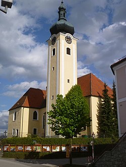
Leopoldschlag is a municipality in the district of Freistadt in the Austrian state of Upper Austria. It is located on the European continental divide between the watershed of the Elbe and the Danube, on the border with the Czech Republic.
Leopoldschlag | |
|---|---|
 | |
 Coat of arms | |
 Leopoldschlag Location within Austria | |
| Coordinates: 48°37′0″N 14°30′0″E / 48.61667°N 14.50000°E | |
| Country | Austria |
| State | Upper Austria |
| District | Freistadt |
| Government | |
| • Mayor | Alois Böhm (ÖVP) |
| Area | |
| • Total | 25.68 km2 (9.92 sq mi) |
| Elevation | 630 m (2,070 ft) |
| Population (2018-01-01)[2] | |
| • Total | 1,023 |
| • Density | 40/km2 (100/sq mi) |
| Time zone | UTC+1 (CET) |
| • Summer (DST) | UTC+2 (CEST) |
| Postal code | 4262 |
| Area code | 07949 |
| Vehicle registration | FR |
| Website | www.leopoldschlag.at |
Population edit
| Year | Pop. | ±% |
|---|---|---|
| 1869 | 1,380 | — |
| 1880 | 1,317 | −4.6% |
| 1890 | 1,299 | −1.4% |
| 1900 | 1,309 | +0.8% |
| 1910 | 1,267 | −3.2% |
| 1923 | 1,298 | +2.4% |
| 1934 | 1,212 | −6.6% |
| 1939 | 1,135 | −6.4% |
| 1951 | 1,248 | +10.0% |
| 1961 | 1,175 | −5.8% |
| 1971 | 1,189 | +1.2% |
| 1981 | 1,110 | −6.6% |
| 1991 | 1,115 | +0.5% |
| 2001 | 1,086 | −2.6% |
| 2013 | 1,038 | −4.4% |


References edit
Wikimedia Commons has media related to Leopoldschlag.