
KNOWPIA
WELCOME TO KNOWPIA

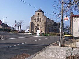
Les Bizots 
Summary
Les Bizots (French pronunciation: [le bizo]) is a commune in the Saône-et-Loire department in the region of Bourgogne-Franche-Comté in eastern France.
Les Bizots | |
|---|---|
Commune | |
 | |
Location of Les Bizots .mw-parser-output .locmap .od{position:absolute}.mw-parser-output .locmap .id{position:absolute;line-height:0}.mw-parser-output .locmap .l0{font-size:0;position:absolute}.mw-parser-output .locmap .pv{line-height:110%;position:absolute;text-align:center}.mw-parser-output .locmap .pl{line-height:110%;position:absolute;top:-0.75em;text-align:right}.mw-parser-output .locmap .pr{line-height:110%;position:absolute;top:-0.75em;text-align:left}.mw-parser-output .locmap .pv>div{display:inline;padding:1px}.mw-parser-output .locmap .pl>div{display:inline;padding:1px;float:right}.mw-parser-output .locmap .pr>div{display:inline;padding:1px;float:left}html.skin-theme-clientpref-night .mw-parser-output .od,html.skin-theme-clientpref-night .mw-parser-output .od .pv>div,html.skin-theme-clientpref-night .mw-parser-output .od .pl>div,html.skin-theme-clientpref-night .mw-parser-output .od .pr>div{background:#000;color:#fff}html.skin-theme-clientpref-night .mw-parser-output .locmap{filter:grayscale(0.6)}@media(prefers-color-scheme:dark){html.skin-theme-clientpref-os .mw-parser-output .locmap{filter:grayscale(0.6)}html.skin-theme-clientpref-os .mw-parser-output .od,html.skin-theme-clientpref-os .mw-parser-output .od .pv>div,html.skin-theme-clientpref-os .mw-parser-output .od .pl>div,html.skin-theme-clientpref-os .mw-parser-output .od .pr>div{background:#000;color:#fff}}  Les Bizots  Les Bizots | |
| Coordinates: 46°45′08″N 4°23′28″E / 46.7522°N 4.3911°E | |
| Country | France |
| Region | Bourgogne-Franche-Comté |
| Department | Saône-et-Loire |
| Arrondissement | Autun |
| Canton | Blanzy |
| Intercommunality | CU Creusot Montceau |
| Area 1 | 21.69 km2 (8.37 sq mi) |
| Population (2021)[1] | 472 |
| • Density | 22/km2 (56/sq mi) |
| Time zone | UTC+01:00 (CET) |
| • Summer (DST) | UTC+02:00 (CEST) |
| INSEE/Postal code | 71038 /71710 |
| Elevation | 289–421 m (948–1,381 ft) (avg. 337 m or 1,106 ft) |
| 1 French Land Register data, which excludes lakes, ponds, glaciers > 1 km2 (0.386 sq mi or 247 acres) and river estuaries. | |
Geography edit
The Bourbince forms part of the commune's southeastern border.
Population edit
| Year | Pop. | ±% p.a. |
|---|---|---|
| 1968 | 286 | — |
| 1975 | 233 | −2.89% |
| 1982 | 369 | +6.79% |
| 1990 | 472 | +3.13% |
| 1999 | 435 | −0.90% |
| 2009 | 437 | +0.05% |
| 2014 | 466 | +1.29% |
| 2020 | 469 | +0.11% |
| Source: INSEE[2] | ||

See also edit
References edit
- ^ "Populations légales 2021". The National Institute of Statistics and Economic Studies. 28 December 2023.
- ^ Population en historique depuis 1968, INSEE
Wikimedia Commons has media related to Les Bizots.