
KNOWPIA
WELCOME TO KNOWPIA

Les Nouillers 
Summary
Les Nouillers (French pronunciation: [le nuje]) is a commune in the Charente-Maritime department in the Nouvelle-Aquitaine region in southwestern France.
Les Nouillers | |
|---|---|
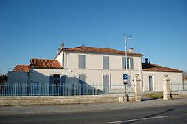 Town hall | |
Location of Les Nouillers .mw-parser-output .locmap .od{position:absolute}.mw-parser-output .locmap .id{position:absolute;line-height:0}.mw-parser-output .locmap .l0{font-size:0;position:absolute}.mw-parser-output .locmap .pv{line-height:110%;position:absolute;text-align:center}.mw-parser-output .locmap .pl{line-height:110%;position:absolute;top:-0.75em;text-align:right}.mw-parser-output .locmap .pr{line-height:110%;position:absolute;top:-0.75em;text-align:left}.mw-parser-output .locmap .pv>div{display:inline;padding:1px}.mw-parser-output .locmap .pl>div{display:inline;padding:1px;float:right}.mw-parser-output .locmap .pr>div{display:inline;padding:1px;float:left}html.skin-theme-clientpref-night .mw-parser-output .od,html.skin-theme-clientpref-night .mw-parser-output .od .pv>div,html.skin-theme-clientpref-night .mw-parser-output .od .pl>div,html.skin-theme-clientpref-night .mw-parser-output .od .pr>div{background:#000;color:#fff}html.skin-theme-clientpref-night .mw-parser-output .locmap{filter:grayscale(0.6)}@media(prefers-color-scheme:dark){html.skin-theme-clientpref-os .mw-parser-output .locmap{filter:grayscale(0.6)}html.skin-theme-clientpref-os .mw-parser-output .od,html.skin-theme-clientpref-os .mw-parser-output .od .pv>div,html.skin-theme-clientpref-os .mw-parser-output .od .pl>div,html.skin-theme-clientpref-os .mw-parser-output .od .pr>div{background:#000;color:#fff}}  Les Nouillers  Les Nouillers | |
| Coordinates: 45°55′56″N 0°39′45″W / 45.9322°N 0.6625°W | |
| Country | France |
| Region | Nouvelle-Aquitaine |
| Department | Charente-Maritime |
| Arrondissement | Saint-Jean-d'Angély |
| Canton | Saint-Jean-d'Angély |
| Government | |
| • Mayor (2020–2026) | Stéphane Ardoin[1] |
| Area 1 | 24.15 km2 (9.32 sq mi) |
| Population (2021)[2] | 727 |
| • Density | 30/km2 (78/sq mi) |
| Time zone | UTC+01:00 (CET) |
| • Summer (DST) | UTC+02:00 (CEST) |
| INSEE/Postal code | 17266 /17380 |
| Elevation | 2–64 m (6.6–210.0 ft) (avg. 48 m or 157 ft) |
| 1 French Land Register data, which excludes lakes, ponds, glaciers > 1 km2 (0.386 sq mi or 247 acres) and river estuaries. | |
Geography edit
The river Boutonne forms all of the commune's northern border.
Population edit
| Year | Pop. | ±% |
|---|---|---|
| 1962 | 544 | — |
| 1968 | 593 | +9.0% |
| 1975 | 534 | −9.9% |
| 1982 | 618 | +15.7% |
| 1990 | 607 | −1.8% |
| 1999 | 611 | +0.7% |
| 2008 | 626 | +2.5% |
Sights edit
- The Chateau of Nouillers built in the 16th century
See also edit
References edit
- ^ "Répertoire national des élus: les maires". data.gouv.fr, Plateforme ouverte des données publiques françaises (in French). 2 December 2020.
- ^ "Populations légales 2021". The National Institute of Statistics and Economic Studies. 28 December 2023.
External links edit
Wikimedia Commons has media related to Les Nouillers.
- Nouillers Les Nouillers on the Quid site