


Summary
Linga is a locality situated on the section of the Mallee Highway and Pinnaroo railway line between Ouyen and the South Australian border in the Sunraysia region. It is situated about 8 kilometres east from Boinka and 11 kilometres west from Underbool.
| Linga Victoria | |||||||||||||||
|---|---|---|---|---|---|---|---|---|---|---|---|---|---|---|---|
 Entering Linga | |||||||||||||||
 Linga | |||||||||||||||
| Coordinates | 35°10′24″S 141°41′33″E / 35.17333°S 141.69250°E | ||||||||||||||
| Population | 10 (2016 census)[1] | ||||||||||||||
| Postcode(s) | 3509 | ||||||||||||||
| Elevation | 98 m (322 ft) | ||||||||||||||
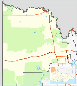
| Location | |||||||||||||||
| LGA(s) | Rural City of Mildura | ||||||||||||||
| State electorate(s) | Mildura | ||||||||||||||
| Federal division(s) | Mallee | ||||||||||||||
| |||||||||||||||
The name Linga is believed to be an invented derivative from the traditional Aboriginal name Lar-gni which meant camp of ... because as a place to camp it was a place to linger.[3]
The Post Office (as a receiving office) opened on 15 July 1912 when a regular mail service was provided by the opening of the railway from Ouyen to Murrayville a month earlier. It was called Manpy until 1913 and closed in 1975.[4]
Linga State School (No. 3798) opened on 31 March 1913 in the local hall, with a permanent building erected in 1916. The school closed on 17 December 1970. The building was subsequently sold and relocated to Ouyen.[5]
Linga South State School (No. 4460) opened on 30 January 1930 and closed in 1949.[6]
References edit
- ^ Australian Bureau of Statistics (25 October 2007). "Linga (State Suburb)". 2006 Census QuickStats. Retrieved 1 October 2007.
- ^ Travelmate Archived 24 March 2007 at the Wayback Machine
- ^ Dictionary of Aboriginal Placenames Archived 19 February 2007 at the Wayback Machine
- ^ Phoenix Auctions History, Post Office List, retrieved 10 February 2021
- ^ What Happened To All The Schools?. Local History Resource Centre. 1989. p. 30.
- ^ What Happened To All The Schools?. Local History Resource Centre. 1989. p. 31.