
KNOWPIA
WELCOME TO KNOWPIA

Lingig 
Summary
Lingig, officially the Municipality of Lingig, is a 2nd class municipality in the province of Surigao del Sur, Philippines. According to the 2020 census, it had a population of 35,142 people.[3]
Lingig | |
|---|---|
| Municipality of Lingig | |
 Tagpupuran Blue Waters Resort | |
 Flag | |
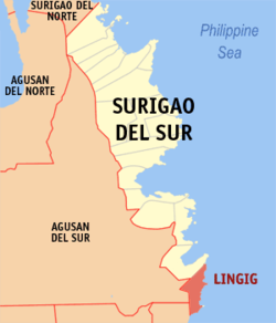 Map of Surigao del Sur with Lingig highlighted | |
OpenStreetMap .mw-parser-output .locmap .od{position:absolute}.mw-parser-output .locmap .id{position:absolute;line-height:0}.mw-parser-output .locmap .l0{font-size:0;position:absolute}.mw-parser-output .locmap .pv{line-height:110%;position:absolute;text-align:center}.mw-parser-output .locmap .pl{line-height:110%;position:absolute;top:-0.75em;text-align:right}.mw-parser-output .locmap .pr{line-height:110%;position:absolute;top:-0.75em;text-align:left}.mw-parser-output .locmap .pv>div{display:inline;padding:1px}.mw-parser-output .locmap .pl>div{display:inline;padding:1px;float:right}.mw-parser-output .locmap .pr>div{display:inline;padding:1px;float:left}html.skin-theme-clientpref-night .mw-parser-output .od,html.skin-theme-clientpref-night .mw-parser-output .od .pv>div,html.skin-theme-clientpref-night .mw-parser-output .od .pl>div,html.skin-theme-clientpref-night .mw-parser-output .od .pr>div{background:#000;color:#fff}html.skin-theme-clientpref-night .mw-parser-output .locmap{filter:grayscale(0.6)}@media(prefers-color-scheme:dark){html.skin-theme-clientpref-os .mw-parser-output .locmap{filter:grayscale(0.6)}html.skin-theme-clientpref-os .mw-parser-output .od,html.skin-theme-clientpref-os .mw-parser-output .od .pv>div,html.skin-theme-clientpref-os .mw-parser-output .od .pl>div,html.skin-theme-clientpref-os .mw-parser-output .od .pr>div{background:#000;color:#fff}}  Lingig Location within the Philippines | |
| Coordinates: 8°02′17″N 126°24′46″E / 8.038053°N 126.412664°E | |
| Country | Philippines |
| Region | Caraga |
| Province | Surigao del Sur |
| District | 2nd district |
| Barangays | 18 (see Barangays) |
| Government | |
| • Type | Sangguniang Bayan |
| • Mayor | Elmer "Boyet" P. Evangelio |
| • Vice Mayor | Edgar L. Acdog |
| • Representative | Johnny T. Pimentel |
| • Electorate | 23,980 voters (2022) |
| Area | |
| • Total | 305.17 km2 (117.83 sq mi) |
| Elevation | 101 m (331 ft) |
| Highest elevation | 1,625 m (5,331 ft) |
| Lowest elevation | 0 m (0 ft) |
| Population (2020 census)[3] | |
| • Total | 35,142 |
| • Density | 120/km2 (300/sq mi) |
| • Households | 8,593 |
| Economy | |
| • Income class | 2nd municipal income class |
| • Poverty incidence | 36.32 |
| • Revenue | ₱ 171.1 million (2020) |
| • Assets | ₱ 261.1 million (2020) |
| • Expenditure | ₱ 172.8 million (2020) |
| • Liabilities | ₱ 96.23 million (2020) |
| Service provider | |
| • Electricity | Surigao del Sur 1 Electric Cooperative (SURSECO 1) |
| Time zone | UTC+8 (PST) |
| ZIP code | 8312 |
| PSGC | 166812000 |
| IDD : area code | +63 (0)86 |
| Native languages | Surigaonon Agusan Cebuano Kamayo Tagalog |
| Website | www |
The municipality is around one and a half hour away from Barangay Mangagoy, Bislig by bus. It is a border town of Surigao del Sur with Davao Oriental.
Geography edit
Barangays edit
Lingig is politically subdivided into 18 barangays. Each barangay consists of puroks while some have sitios.
- Anibongan
- Barcelona
- Bogak
- Bongan
- Handamayan
- Mahayahay
- Mandus
- Mansa-ilao
- Pagtila-an
- Palo Alto
- Poblacion
- Rajah Cabungso-an
- Sabang
- Salvacion
- San Roque
- Tagpoporan (Tagpupuran)
- Union
- Valencia
Climate edit
| Climate data for Lingig | |||||||||||||
|---|---|---|---|---|---|---|---|---|---|---|---|---|---|
| Month | Jan | Feb | Mar | Apr | May | Jun | Jul | Aug | Sep | Oct | Nov | Dec | Year |
| Mean daily maximum °C (°F) | 29.5 (85.1) |
29.5 (85.1) |
30.5 (86.9) |
31.3 (88.3) |
31.7 (89.1) |
31.6 (88.9) |
31.6 (88.9) |
31.9 (89.4) |
32.0 (89.6) |
31.7 (89.1) |
31.1 (88.0) |
30.2 (86.4) |
31.1 (87.9) |
| Daily mean °C (°F) | 25.7 (78.3) |
25.6 (78.1) |
26.3 (79.3) |
26.9 (80.4) |
27.4 (81.3) |
27.2 (81.0) |
27.1 (80.8) |
27.3 (81.1) |
27.3 (81.1) |
27.1 (80.8) |
26.7 (80.1) |
26.2 (79.2) |
26.7 (80.1) |
| Mean daily minimum °C (°F) | 21.8 (71.2) |
21.8 (71.2) |
22.1 (71.8) |
22.6 (72.7) |
23.1 (73.6) |
22.8 (73.0) |
22.6 (72.7) |
22.7 (72.9) |
22.6 (72.7) |
22.6 (72.7) |
22.4 (72.3) |
22.2 (72.0) |
22.4 (72.4) |
| Average rainfall mm (inches) | 757 (29.8) |
561 (22.1) |
495 (19.5) |
347 (13.7) |
256 (10.1) |
165 (6.5) |
148 (5.8) |
132 (5.2) |
140 (5.5) |
200 (7.9) |
314 (12.4) |
644 (25.4) |
4,159 (163.9) |
| Source: Climate-Data.org[5] | |||||||||||||
Lingig has a tropical rainforest climate (Af) with heavy to very heavy rainfall year-round and with extremely heavy rainfall in January.
Demographics edit
| Year | Pop. | ±% p.a. |
|---|---|---|
| 1903 | 730 | — |
| 1939 | 5,397 | +5.71% |
| 1948 | 4,462 | −2.09% |
| 1960 | 11,225 | +7.99% |
| 1970 | 13,836 | +2.11% |
| 1975 | 19,172 | +6.76% |
| 1980 | 19,993 | +0.84% |
| 1990 | 21,015 | +0.50% |
| 1995 | 23,477 | +2.10% |
| 2000 | 26,487 | +2.62% |
| 2007 | 28,269 | +0.90% |
| 2010 | 31,544 | +4.07% |
| 2015 | 31,485 | −0.04% |
| 2020 | 35,142 | +2.18% |
| Source: Philippine Statistics Authority[6][7][8][9] | ||
Economy edit
References edit
- ^ Municipality of Lingig | (DILG)
- ^ "2015 Census of Population, Report No. 3 – Population, Land Area, and Population Density" (PDF). Philippine Statistics Authority. Quezon City, Philippines. August 2016. ISSN 0117-1453. Archived (PDF) from the original on May 25, 2021. Retrieved July 16, 2021.
- ^ a b Census of Population (2020). "Caraga". Total Population by Province, City, Municipality and Barangay. Philippine Statistics Authority. Retrieved July 8, 2021.
- ^ "PSA Releases the 2018 Municipal and City Level Poverty Estimates". Philippine Statistics Authority. December 15, 2021. Retrieved January 22, 2022.
- ^ "Climate: Lingig". Climate-Data.org. Retrieved October 25, 2020.
- ^ Census of Population (2015). "Caraga". Total Population by Province, City, Municipality and Barangay. Philippine Statistics Authority. Retrieved June 20, 2016.
- ^ Census of Population and Housing (2010). "Caraga" (PDF). Total Population by Province, City, Municipality and Barangay. National Statistics Office. Retrieved June 29, 2016.
- ^ Censuses of Population (1903–2007). "Caraga". Table 1. Population Enumerated in Various Censuses by Province/Highly Urbanized City: 1903 to 2007. National Statistics Office.
{{cite encyclopedia}}: CS1 maint: numeric names: authors list (link) - ^ "Province of Surigao del Sur". Municipality Population Data. Local Water Utilities Administration Research Division. Retrieved December 17, 2016.
- ^ "Poverty incidence (PI):". Philippine Statistics Authority. Retrieved December 28, 2020.
- ^ "Estimation of Local Poverty in the Philippines" (PDF). Philippine Statistics Authority. November 29, 2005.
- ^ "2003 City and Municipal Level Poverty Estimates" (PDF). Philippine Statistics Authority. March 23, 2009.
- ^ "City and Municipal Level Poverty Estimates; 2006 and 2009" (PDF). Philippine Statistics Authority. August 3, 2012.
- ^ "2012 Municipal and City Level Poverty Estimates" (PDF). Philippine Statistics Authority. May 31, 2016.
- ^ "Municipal and City Level Small Area Poverty Estimates; 2009, 2012 and 2015". Philippine Statistics Authority. July 10, 2019.
- ^ "PSA Releases the 2018 Municipal and City Level Poverty Estimates". Philippine Statistics Authority. December 15, 2021. Retrieved January 22, 2022.
External links edit
- Lingig Profile at PhilAtlas.com
- Lingig Profile at the DTI Cities and Municipalities Competitive Index
- Philippine Standard Geographic Code
- Philippine Census Information
- Local Governance Performance Management System