


Summary
Lisburn Road is a main arterial route linking Belfast and Lisburn, Northern Ireland.

The Lisburn Road is now an extension of the "Golden Mile" with many shops, boutiques, wine bars, restaurants and coffee houses. The road runs almost parallel to the Malone Road, the two being joined by many side roads. It is a busy traffic route without much strong architectural character. Most of the housing is made up of red-brick terraces, some with alterations. Some buildings along the road, however, are considered to be architecturally important and interesting.[1]
Lisburn Road itself begins at the nearby Bradbury Place and runs to Balmoral Avenue, beyond which it becomes Upper Lisburn Road. The Upper Lisburn Road extends south to reach Finaghy, at which point it becomes Kingsway and then in Dunmurry it becomes Queensway, before finally becoming the Belfast Road in Lisburn.
History edit
The first record of the development of the Lisburn Road was when a property developer offered land for development 'West of the Lisburn Road' on 6 April 1813. His advert was placed in The News Letter on that date.[citation needed] The track that initially existed here developed and expanded, until pressure grew for a faster turnpike road to Dublin, to avoid the Malone Road hills and valleys. During 1817–1819 this road improvement scheme was implemented. The post office and toll booth stood, conveniently, at Shaftesbury Square, and presumably served both turnpike roads. At the top of Tate's Avenue, on the Lisburn Road side of the junction a second booth was in existence in 1857.[2] One year later the toll business was abandoned, as the trains had taken over. Shopping habits have changed and the shopping population has moved from Shaftesbury Square,[3] along the Lisburn Road.
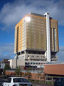
Lisburn Road attracted shops and the nearby Malone Road was left residential.[4] Queen's University is nearby, and there are a high number of expensive shops and restaurants, most of which are located at the upper end of the road. The Belfast City Hospital and the Queen's University Medical Biological Centre are also located on the road.
Racist attacks edit
In June 2009, having had their windows broken and deaths threats made against them, twenty Romanian Romani families were ejected from their homes in Lisburn Road. Up to 115 people, including women and children, were forced to seek refuge in a local church hall after being attacked. They were later moved by the authorities to a safer location.[5][6][7] As a result of petty thefts gypsies were told to leave, they spent one night at QUB Elms Village at a cost of 40 pounds per room. [citation needed] Following the arrest of three local youths in relation to the attacks, the church where the Romani people had been given shelter was badly vandalised.[8] Niall Colton and Kevin Briggs, who both attended QUB at the time of the attack, received police cautions after admitting vandalism of the Church. Police however stated that the vandalism was not racially motivated.[9]
Landmarks edit

Notable landmarks along Lisburn Road include:
- Drumglass Park
- Belfast City Hospital
- The Samaritan Hospital, Belfast
- Methodist College Belfast (which also fronts the Malone Road)
- Belfast Chinese Christian Church
- Windsor Park football ground
- King's Hall, Belfast (Former Exhibition and Concert Venue)
- Belfast Hypnotherapy Centre
Churches edit
- Malone Presbyterian Church
- Windsor Presbyterian Church[10]
- Saint Nicholas' Church of Ireland, built in 1901[11]
- St Thomas' Church of Ireland[12]
- Lisburn Road Methodist Church, designed in 1906[13]
- Ulsterville Congregation Presbyterian[14]
- St. Brigids Church, Diocese of Down and Connor, Derryvolgie Avenue[15]
Wildlife edit
A sparrowhawk (Accipiter nisus) catching a sparrow (Passer domesticus) has been recorded from the Lisburn Road.[16]
Railway stations edit
Deaf and Dumb Institute edit
The Deaf and Dumb Institute was built in 1845 and demolished in 1965, the site is now occupied by Queen's Medical Biology Centre. It was a well-designed and well built building.[17][18]
Toilets edit
There are public toilets in Drumglass Park.Belfast City Park - ''Belfast City Council'' Drumglass Park.
Library edit
Lisburn Road,440 Lisburn Road:- WWW.Librariesni.org.uk
References edit
- ^ Larmour, P. 1991. "The Architectural Heritage of Malone and Stranmillis." Ulster Architectural Heritage Society.
- ^ OS map of that date
- ^ Weatherall, N. 2002. South Belfast Terrace and Villa. ISBN 1 900935287
- ^ Weatherall. 2002. South Belfast Terrace and Villa. Cottage Publications. ISBN 1-900935-28-7
- ^ "Racist attacks on Roma are latest low in North's intolerant history". irishtimes.com. 18 June 2009. Retrieved 18 June 2009.
- ^ Morrison, Peter; Lawless; Selva, Meera; Saad, Nardine; Wolfe Murray, Alina (17 June 2009). "Romanian Gypsies attacked in NIreland". guardian.co.uk. Associated Press. Retrieved 13 August 2012.
- ^ "Protest held over racist attacks". BBC News. 20 June 2009. Retrieved 20 June 2009.
- ^ McDonald, Henry (23 June 2009). "Vandals attack Belfast church that sheltered Romanian victims of racism". London: guardian.co.uk. Retrieved 23 June 2006.
- ^ "Church vandal students cautioned". Belfast: bbc.co.uk. 23 November 2009. Retrieved 23 November 2009.
- ^ "Windsor Presbyterian – Windsor Presbyterian". www.windsorpresbyterian.com.
- ^ "Church Gazetteer: St Nicholas Church". www.stnicholascenter.org. Retrieved 13 August 2012.
- ^ "Saint Thomas' Church, Belfast | Diocese of Connor".
- ^ Lamour, P. 1987. Belfast An Illustrated Architectural Guide. Friar's Bush Press, ISBN 0-946872-10-4.
- ^ [1] Archived 9 May 2008 at the Wayback Machine
- ^ "Down and Connor Diocese - St Brigid's". Archived from the original on 12 February 2007. Retrieved 29 April 2009.
- ^ Scott, R. 2004. Wild Belfast on safari in the city. The Blackstaff Press. ISBN 0-85640-762-3
- ^ Walker, B. and Dixon, H. 1984 No Mean City Belfast 1880 - 1914.The Friar's Bush Press.ISBN 0-946872-00-7
- ^ Nesbitt, N. 1982 The Changing Face of Belfast. Ulster Museum, Belfast. Publication No. 183
External links edit
 Media related to Lisburn Road, Belfast at Wikimedia Commons
54°34′12″N 5°57′51″W / 54.57007°N 5.96412°W