The Antietam Campaign Scenic Byway begins in White's Ferry, the site of a ferry crossing where Lee crossed into Maryland from Virginia. The byway follows Whites Ferry Road to Poolesville, which is home to the John Poole House. From here, the byway continues north on MD 109, passing through Beallsville and Barnesville before reaching Comus, where Lee's army won a rearguard action. From Comus, the Antietam Campaign Scenic Byway continues west on Comus Road and Mt. Ephraim Road, crossing Sugarloaf Mountain, which served as a lookout for troops. The byway reaches Dickerson and follows MD 28 across the Monocacy Natural Resource Management Area. The route continues north onto MD 85 and passes through Buckeystown. At this point, the byway follows Michaels Mill Road and Baker Valley Road to the Monocacy National Battlefield, which was site of the Battle of Monocacy in 1864, a battle that was known as "The Battle That Saved Washington". The byway continues north on MD 355 to Frederick, which has the National Museum of Civil War Medicine and the Barbara Fritchie House. From Frederick, the Antietam Campaign Scenic Byway follows US 40 and US 40 Alternate before turning south onto MD 17. The road passes near South Mountain State Park in an area where several small battles were fought prior to the Battle of Antietam. The byway crosses South Mountain and continues north on MD 67 to Boonsboro, which has a museum with Civil War artifacts. At this point, the Antietam Campaign Scenic Byway continues west on MD 34 to Sharpsburg. Along this stretch of road, it passes through the Antietam National Battlefield, which preserves the site of the Battle of Antietam on September 17, 1862.[1]
From Thurmont, a loop of the Journey Through Hallowed Ground Byway heads west on MD 77 across Catoctin Mountain and reaches Cunningham Falls State Park, which is home to Catoctin Furnace. At this point, Catoctin Mountain Park, which contains the Camp David Presidential retreat, is to the north of the road. The byway continues to Smithsburg. From Smithsburg, the loop of the Journey Through Hallowed Ground Byway heads south to Wolfsville and follows MD 17 through a valley. The byway heads onto Highland School Road, which reaches the summit of Catoctin Mountain, before heading onto Gambrill Park Road into Gambrill State Park. The loop continues east on US 40 toward Frederick.[1]
From Uniontown, the lower loop of the Old Main Streets Scenic Byway heads south along MD 84 and west along MD 75 to Linwood, which has many Victorian buildings. The next town west is Union Bridge, which is home to the Union Bridge Station. The byway continues southwest through Johnsville to Libertytown, where it turns northeast onto MD 31. The lower loop of the byway passes through the historic town of New Windsor before continuing north of MD 84 and returning to Uniontown.[1]
At Libertytown, a branch of the Old Main Streets Scenic Byway heads east along MD 26 before following Woodville Road, Shirley Bohn Road, and Buffalo Road south through countryside that has several vineyards. The byway heads into Mount Airy and runs through town on MD 808 (Main Street), with nearby recreation. The byway continues along MD 27 to the National Road.[1]
The byway begins in Emmitsburg, which is home to the Mason and Dixon Discovery Center. From here, it follows MD 140, MD 832, and MD 140 again to Westminster, which is home to the Carroll County Farm Museum. From Westminster, the byway heads north on MD 97 to Union Mills, where the Union Mills Homestead Historic District is located. The Mason and Dixon Scenic Byway runs east along MD 496 before turning south onto MD 30 and passing through Melrose before reaching Manchester, a historic town. The byway heads east on York Street, Millers Station Road, and Alesia Road before continuing south on MD 25. The Mason and Dixon Scenic byway splits east onto Beckleysville Road and heads across the Prettyboy Reservoir. The byway turns east onto Kidds Schoolhouse Road before continuing southeast along Spooks Hill Road, passing near more of the reservoir. The route heads east along Rayville Road and Middletown Road, briefly turning south on York Road before resuming east along Wiseburg Road. The road comes to White Hall, where it crosses the Northern Central Rail Trail. From here, the Mason and Dixon Scenic Byway continues along White Hall Road, turning north onto MD 23 and passing through Drybranch and Norrisville. Here, the byway heads east on MD 136 and runs a short distance south of the Mason–Dixon line separating Maryland from Pennsylvania, reaching Harkins.[1]
In Harkins, a loop of the Mason and Dixon Scenic Byway heads south on MD 24, passing Eden Mill Nature Center and Rocks State Park. The loop continues through agricultural areas and turns north onto Grier Nursery Road and west onto Cherry Hill Road before heading back onto MD 24 and reconnecting to the mainline of the byway.[1]
From Harkins, the mainline of the Mason and Dixon Scenic Byway continues east along MD 136, passing through Whiteford, where there are many agricultural sites nearby. The byway continues east onto US 1 and crosses the Susquehanna River on the Conowingo Dam. The Mason and Dixon Scenic Byway heads east onto MD 273 and passes through Rising Sun, where the Plumpton Park Zoo is located to the east of town. The road comes to the Fair Hill Natural Resource Management Area, which occupies former land owned by the Du Pont family and has equestrian facilities, before the byway ends at the Delaware border in Appleton.[1]
The Falls Road Scenic Byway follows Falls Road (MD 25) between Baltimore and Alesia, passing through a mix of urban and rural surroundings in the Jones Falls Valley.[1]
The Horses and Hounds Scenic Byway extends 100 miles (160 km) in a loop through northern and eastern Baltimore County and western Harford County. The byway begins at I-83 Exit 20 in Cockeysville and heads west along Shawan Road, passing between Oregon Ridge Park and the equestrian facility Shawan Downs, home of the Legacy Chase, a steeplechase event. Another steeplechase, the Maryland Hunt Cup, is held in Worthington Valley, which the byway passes through along Tufton Avenue. The byway continues west along Worthington Road toward Glyndon. There, a spur of the byway heads toward Reisterstown while the mainline turns north onto MD 128.[1]
Along MD 128, the Horses and Hounds Scenic Byway passes St. John's Episcopal Church, home of an annual "Blessing of the Hounds," on its way to Butler, home of the Grand National Steeplechase. The main path of the byway leaves MD 128 at Dover Road to head toward Upperco, then veers northwest on Trenton Hill Road to rejoin a secondary path that follows MD 128 to MD 25, where the byway runs concurrently with the Falls Road Scenic Byway, to MD 88. The byway leaves MD 88 at Grace Road, then heads east on Mt. Carmel Road, which becomes MD 137. MD 137 heads east through White House to Hereford, where the byway briefly heads south on MD 45 before continuing east on MD 138 to Monkton, where the byway crosses paths with the Northern Central Railroad Trail.[1]
At Monkton, the Horses and Hounds Scenic Byway splits into a shorter branch that follows Manor Road to MD 146 and a longer branch that follows MD 138 past My Lady's Manor, site of another steeplechase course, into Harford County. The byway follows Troyer Road, Harford Creamery Road, and Madonna Road to MD 146 near Jarrettsville before returning to Baltimore County and passing the Ladew Topiary Gardens. The two byway paths merge north of Jacksonville and follow MD 146 south to the Loch Raven Reservoir, where the byway follows Dulaney Valley Road and Hydes Road east to Hydes, home of the Boordy Vineyards. The byway follows Long Green Pike past St. John the Evangelist Catholic Church to Glen Arm.[1]
From Glen Arm the Horses and Hounds Scenic Byway has a long sidetrack that heads east toward Jerusalem, which contains one of several units of Gunpowder Falls State Park. The sidetrack follows Glen Arm Road to MD 147, follows Reckord Road, Guyton Road, and Bottom Road in a brief jaunt through Harford County near Fallston, heads southeast along Fork Road, Sunshine Avenue, and Bradshaw Road through Kingsville, east along Franklinville Road to Jerusalem, north along Jericho Road to the Jerusalem Mill Village, and west along Jerusalem Road back to Kingsville. The alternate byway route follows MD 147 to Factory Road, which it follows back to Glen Arm. The main byway path heads southwest along Glen Arm Road and Cromwell Bridge Road to its end at I-695 near Towson. The final side path leaves Glen Arm Road for a path around Loch Raven Reservoir along Manor Road, Morgan Mill Road, Loch Raven Drive, and Providence Road to the side path's end at the Hampton National Historic Site in Towson.[1]
The Lower Susquehanna Scenic Byway comprises 33 miles (53 km) of highway between Havre de Grace and Perryville serving historical and recreational destinations on both sides of Susquehanna River in eastern Harford County and western Cecil County. The byway begins in downtown Havre de Grace, the site of the Concord Point Light, the Havre de Grace Maritime Museum, and the Havre de Grace Decoy Museum. The byway uses Union Avenue and Washington Street to head away from the Chesapeake Bay to the northern edge of the city, then Water Street and Erie Street to the location of the Susquehanna Museum of Havre de Grace, located at the southern end of the Susquehanna and Tidewater Canal. In the northern part of Havre de Grace, the byway also follows Otsego Street and Juniata Street. The two paths merge into one at Superior Street, which heads west under the Thomas J. Hatem Memorial Bridge and becomes part of MD 155 heading northwest out of the city.[1]
The Lower Susquehanna Scenic Byway follows MD 155 (Level Road) west past I-95 to Webster Lapidum Road, where a spur of the byway splits to the northeast. The spur continues onto Quaker Bottom Road to the Steppingstone Museum. The main route of the byway follows MD 155 to Level, where it turns north onto MD 161 (Darlington Road) and then northeast onto Rock Run Road. Rock Run Road leads to Susquehanna State Park. Within the state park, the byway turns northwest onto Stafford Road, which parallels both the canal and the west bank of the river. At Deer Creek, the byway turns inland, following the creek then heading northwest toward Darlington. A spur of the byway continues northwest to MD 161 to pass through the village; the main route turns northeast onto Shuresville Road toward Conowingo Dam. Just west of the dam, there is access to an overlook and to the Lower Susquehanna Heritage Greenway Trail, which parallels the river south from the dam. The byway turns onto US 1 (Conowingo Road) to cross the river on top of the dam; while crossing the river, the byway is concurrent with the Mason and Dixon Scenic Byway.[1]
The Lower Susquehanna Scenic Byway turns south onto MD 222 (Susquehanna River Road) to follow the east bank of the river. The byway passes through the town of Port Deposit, which contains the historic Gerry House. At the southern edge of town, MD 222 and the byway turn northeast to climb a high bluff above the town. On top of the bluff, the byway turns onto Mount Ararat Farm Road and then Frenchtown Road, which the route follows to its conclusion at MD 7 (Broad Street) in Perryville. Perryville contains Rodgers Tavern and the Perryville Railroad Museum, which are located west and east on MD 7, respectively.[1]
The Charles Street Scenic Byway runs along Charles Street (MD 139) through Baltimore and north into Baltimore County, ending in Lutherville. Charles Street serves as Baltimore's main thoroughfare and passes through many cultural, residential, and commercial areas.[1] The byway is a National Scenic Byway designated as Baltimore's Historic Charles Street.[4]
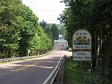
The byway begins in Washington, D.C., following Pennsylvania Avenue and Branch Avenue to the Maryland border. In Maryland, the route runs along MD 5 before continuing along Old Branch Avenue to Clinton. Here, the Surratt House Museum is located in a tavern that was a Confederate safehouse where Booth and Herold came to after the assassination to stock on supplies; the owner Mary Surratt was convicted and executed in the plot to assassinate Lincoln. From Clinton, Booth's Escape Scenic Byway continues along Brandywine Road and MD 5 to Waldorf. The byway continues east on Poplar Hill Road, reaching the Dr. Samuel A. Mudd House, where physician Samuel Mudd treated Booth's broken leg on April 15, 1865, perhaps unaware that he had assassinated Lincoln. The route turns south onto Dr. Mudd Road and Bryantown Road to Bryantown, where Dr. Mudd claimed to have first learned of the assassination. The road becomes Olivers Shop Road and comes to St. Mary's Church and Cemetery, where Dr. Mudd is buried, and also passes by Zekiah Swamp. The byway heads west on MD 6 before turning southwest onto Bel Alton Newtown Road, where it comes to the home of Samuel Cox near Bel Alton, where Booth and Herold hid for several days. The Booth's Escape Scenic Byway continues south along US 301. A detour north along US 301 and west along MD 6 provides access to Port Tobacco, a former Indian settlement that became a seaport and was the county seat of Charles County during the Civil War. The mainline of the byway continues south along US 301 and onto Popes Creek Road, coming to the Potomac River at a site where Booth and Herold accidentally rowed into the Nanjemoy Creek and spent the night before later crossing the Potomac River. The Booth's Escape Scenic Byway heads east and continues south along Edge Hill Road and US 301 to the Virginia border, where in Port Royal Booth was captured and killed at a farm outside of town.[1]
The Roots and Tides Scenic Byway runs from Plum Point to Annapolis, running through communities along the western shore of the Chesapeake Bay.[1]
The byway begins at Plum Point on the Chesapeake Bay, heading west on MD 263 before turning north onto MD 261. The road passes through Willows, with a beach a short distance to the east on the bay, before reaching Chesapeake Beach and North Beach, which have marinas, antique shops, and bed and breakfasts and were once popular resorts for residents of Baltimore and Washington, D.C. Chesapeake Beach is home to the historic Chesapeake Beach Railway Station, which serves as a museum. The byway continues north along MD 261 before following Fairhaven Road north to Fairhaven. The road continues as MD 423 and Town Point Road, passing west of Herring Bay. The route follows Leitch Road west and Franklin Gibson Road north, heading north onto MD 256. The Roots and Tides Scenic Byway continues north along MD 468 and comes to Galesville, where the Galesville Heritage Museum and the Capt. Salem Avery House are located. Past here, the road passes the Smithsonian Environmental Research Center. The byway turns northwest onto MD 214 and north onto MD 253, coming to Londontowne, where the London Town Publik House is located. The Roots and Tides Scenic Byway heads north on MD 2 before following West Street and Rowe Boulevard through Annapolis, the state capital of Maryland that is home to several 18th century buildings, the Maryland State House and the U.S. Naval Academy.[1]
The Religious Freedom Byway (formerly Religious Freedom Tour Scenic Byway) runs across Southern Maryland from Port Tobacco to Point Lookout past colonial settlements where English settlers came for religious freedom, with some of the oldest churches in the United States along the byway.[1] The byway is a National Scenic Byway.[5]
From Chaptico, the Religious Freedom Byway continues east along MD 234, with a detour along MD 243 providing access to the St. Francis Xavier Church, the oldest Catholic church in Maryland. The byway heads east onto MD 5 into Leonardtown, which is home to the Old Jail Museum and Tudor Hall. The road continues to Callaway, where a spur along MD 249 serves St. George's Episcopal Church in Valley Lee, the oldest Episcopal church in Maryland, and Piney Point Light. The mainline of the byway continues along MD 5 to St. Mary's City, which was the capital of Maryland until 1695 and has the first Catholic church in the British American colonies as well as Trinity Episcopal Church and St. Mary's College of Maryland. The Religious Freedom Byway continues to Point Lookout State Park, which was a summer resort that also served as a prison for Confederate troops during the American Civil War.[1]
State-designated signage for Chesapeake Country Scenic Byway on MD 213 near Wye Mills.
The Chesapeake Country Scenic Byway serves sites along the Chesapeake Bay in the Eastern Shore region, running from Chesapeake City south to Crisfield. The National Scenic Byway portion runs from Stevensville, near the Chesapeake Bay Bridge to the Chesapeake and Delaware Canal in Chesapeake City and has a spur to Eastern Neck Island in the Chester River. The main route runs mostly along MD 18 and MD 213, former main roads that have since been bypassed by US 50 and US 301. The spur runs along MD 20 and MD 445. A state-designated extension of the national byway continues across the Bay Bridge, into Annapolis, then back onto the Eastern Shore and heads south toward Crisfield. Both the national and state-designated sections of the byway run past many towns and buildings that remain preserved from the 18th and 19th centuries, passing through farmland and waterfront areas on the Chesapeake Bay.[1]
The Upper Eastern Shore section of the byway begins in Chesapeake City, a town located at the western end of the Chesapeake and Delaware Canal. The byway heads south on MD 213, coming to Cecilton, where MD 282 heads west to Crystal Beach on the Elk River. The road crosses the Sassafras River and passes through Georgetown, a community that was burned by the British during the War of 1812. The Chesapeake Country Scenic Byway continues along MD 213 through Galena and Kennedyville, with a detour along MD 298 and MD 292 serving the Victorian resort town of Betterton. The mainline of the byway comes to Chestertown, a port on the Chester River that has many historical buildings. At this point, a branch of the byway continues west along MD 20 to Rock Hall, a town on the Chesapeake Bay with many marinas, before following MD 445 to the Eastern Neck National Wildlife Refuge. From Chestertown, the mainline of the Chesapeake Country Scenic Byway continues along MD 213 to Church Hill, where St. Luke's Episcopal Church and Church Hill Theatre are located. The next town along the road is Centreville, which is home to the Museum of Eastern Shore Life and the Queen Anne's County Courthouse, the oldest active courthouse in Maryland. From Centreville, the byway follows MD 18 west to Queenstown, which has many Colonial buildings, and Grasonville. The road heads onto Kent Island, an island where a trading post was founded in 1631 that has many seafood restaurants. The Chesapeake Country Scenic Byway comes to Stevensville, which is home to the Cray House and the Stevensville Train Depot. At this point, a connection for the byway crosses the Chesapeake Bay Bridge to Annapolis.[1]
From Centreville, the Mid-Shore Section of the Chesapeake Country Scenic Byway continues on MD 213, with a spur along US 50 providing access to the Wye Mills Natural Resource Management Area. The byway heads into Wye Mills and heads south on MD 662, passing by the site of Wye Oak, which was the largest white oak tree in the United States until it was destroyed during a storm in 2002. The byway continues along MD 662 before picking up US 50 and coming to Easton, a historical town which is home to the Avalon Theatre and the Academy Art Museum. From Easton, a branch of the Chesapeake Country Scenic Byway heads west on MD 33 to St. Michaels, a shipbuilding town that is home to the Chesapeake Bay Maritime Museum, before heading to Tilghman Island, where several restaurants and marinas. The byway heads back along MD 33 before heading onto MD 329 and crossing the Tred Avon River on the Oxford–Bellevue Ferry, one of the oldest ferries in the country, to Oxford, a maritime town home to the Oxford Museum and the Oxford Customs House. From here, the Chesapeake Country Scenic Byway follows MD 333 back to Easton, at which point it heads east along MD 331, crossing the Choptank River on the Dover Bridge. The byway continues to Preston, following MD 16 south to East New Market, a Native American trading post that became a center of Methodism. The Chesapeake Country Scenic Byway follows MD 14 through the fishing community of Secretary before running along MD 16 to Cambridge, which has sites related to the Underground Railroad and Harriet Tubman as well as the Richardson Maritime Museum and Boatworks. The byway continues along MD 343 to Hudson, where the Sharps Island Light can be seen, before heading back to Cambridge. At this point, a branch of the byway heads south along MD 341 and Maple Dam Road into the Blackwater National Wildlife Refuge, which is home to the largest amount of bald eagles on the East Coast. Another branch of the byway continues south along MD 335, passing to the west of the Blackwater National Wildlife Refuge before reaching Hooper's Island. Another branch of the Chesapeake Country Scenic Byway known as the Elliott's Island Branch splits to the east and passes through the Fishing Bay Wildlife Management Area. From here, the byway heads north along the Nanticoke River to Vienna and Eldorado. The byway continues north to Federalsburg, where the Idylwild Wildlife Management Area is located.[1]
The byway begins in Cambridge, where there is a visitors center at Sailwinds Park along with many historical sites in the Cambridge Historic District. Also in Cambridge is the Harriet Tubman Museum and Educational Center, which showcases Harriet Tubman, a conductor on the Underground Railroad who helped many slaves to freedom. From Cambridge, the byway heads south along MD 341 before heading west on MD 16 to the Stanley Institute, an African American schoolhouse, and Church Creek, a shipbuilding town. A branch of the byway follows MD 16 to Taylors Island on the Chesapeake Bay, passing by Old Trinity Church and Stewart's Canal. The Harriet Tubman Underground Railroad Scenic Byway continues south along MD 335 to Harriet Tubman Underground Railroad State Park, where the Harriet Tubman Underground Railroad Visitor Center focused on Tubman and the Underground Railroad is located, and Harriet Tubman Underground Railroad National Historical Park. From here, the byway heads east on Key Wallace Drive through the Blackwater National Wildlife Refuge before heading onto Greenbrier Road and passing near the Brodess Farm, where Tubman spent her younger years. The byway heads north on Bucktown Road, passing by the Bucktown Village Store. A branch from Bucktown serves the Fishing Bay Wildlife Management Area. The mainline of the byway heads back to Cambridge and follows MD 16, US 50, and MD 16 again to East New Market. A detour onto MD 14 provides access to the Mt. Zion United Methodist Church. The Harriet Tubman Underground Railroad Scenic Byway continues along MD 16 to Preston, where the Linchester gristmill is located along with the site of a Quaker meeting house that was said to be a station on the Underground Railroad. The Poplar Neck Loop of the byway runs through countryside that was home to Tubman's parents. From Preston, the route continues along MD 16 to Potters Landing, a crossing point for slaves on the Underground Railroad, and Martinak State Park. The byway continues along MD 313 to Denton, where several sites related to the Underground Railroad are located including Courthouse Square, the Tuckahoe Neck Meeting House, and the Museum of Rural Life. At this point, a spur of the byway provides access to the Tuckahoe River near the birthplace of Frederick Douglass. From Denton, the Harriet Tubman Underground Railroad Scenic Byway continues along MD 313 to Greensboro, where it passes through the town along MD 314 and MD 480.[1] From Greensboro, the byway heads north on MD 313 and MD 311 to Goldsboro and east on MD 287 to the Delaware border, connecting to the Harriet Tubman Underground Railroad Byway of the Delaware Byways system.[1][7]
The byway begins in Ocean City, Maryland's largest seaside resort that is home to 10 miles of beaches along the Atlantic Ocean, hotels, amusement rides, a boardwalk, and several water activities. From here, the Cape to Cape Scenic Byway heads south on MD 528, west on US 50 and south on MD 611, with a branch heading to Assateague Island, a barrier island on the Atlantic Ocean known for its wild ponies. The Cape to Cape Scenic Byway heads west along MD 376 to Berlin, a 19th-century town that has the Calvin B. Taylor House. The byway heads south through Berlin on MD 818 before it continues south along US 113. The Cape to Cape Scenic Byway follows US 113 Business into Snow Hill, a historic town where the Julia A. Purnell Museum is located. A spur heads east on MD 365 to the Chincoteague Bay. From Snow Hill, the byway follows MD 12 south to the Virginia border, with spurs east along Taylor Landing Road and MD 366 toward the Chincoteague Bay.[1]
The Cape to Cape Scenic Byway was originally the eastern portion of the Blue Crab Scenic Byway.[3]
^"Harriet Tubman Underground Railroad Byway". Delaware Department of Transportation. Archived from the original on November 17, 2011. Retrieved January 7, 2012.