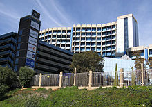
South African Reserve Bank, Port Elizabeth - Market Square, North Union Street.33°57′42.14″S25°37′27.38″E / 33.9617056°S 25.6242722°E / -33.9617056; 25.6242722[6]
OilTanking Grindrod Calulo (Ltd) Port of Ngqura - Port of Ngqura, Coega.33°44′36.64″S25°40′21.25″E / 33.7435111°S 25.6725694°E / -33.7435111; 25.6725694[8]
Former President Nelson MandelaQunu Village residence.- N2, Qunu.31°48′21.38″S28°36′23.09″E / 31.8059389°S 28.6064139°E / -31.8059389; 28.6064139[9]
SABCKimberley, Northern Cape - South East of Kimberley.28°51′14.85″S24°54′17.34″E / 28.8541250°S 24.9048167°E / -28.8541250; 24.9048167[19]
Square Kilometer Array Site (SKA) - 80 km west from the town of Carnarvon. 30°43′16.1″S21°24′40.1″E / 30.721139°S 21.411139°E / -30.721139; 21.411139[20]
ApolloTransmission Station - Rietvlei.25°55′13.41″S28°16′33.47″E / 25.9203917°S 28.2759639°E / -25.9203917; 28.2759639[25]
MinervaTransmission Station - Witbos.25°55′13.41″S28°04′50.86″E / 25.9203917°S 28.0807944°E / -25.9203917; 28.0807944[26]
South African Bank Note Company - 460 Jan van Riebeeck Street, Pretoria North .25°39′39.32″S28°10′52.74″E / 25.6609222°S 28.1813167°E / -25.6609222; 28.1813167[27]
South African Reserve Bank HQSA - 370 Helen Joseph Street, Pretoria.25°44′42.52″S28°11′48.00″E / 25.7451444°S 28.1966667°E / -25.7451444; 28.1966667[6]
South African Reserve Bank: Pta North - Jan van Riebeeck Street, Pretoria North .25°39′38.57″S28°10′46.91″E / 25.6607139°S 28.1796972°E / -25.6607139; 28.1796972[6]
South African Broadcasting Corporation headquarters in the Johannesburg suburb Uitsaaisentrum, often mistakenly referred to as being located in Auckland Park, which is a suburb bordering on Uitsaaisentrum.SABC Building Auckland Park
Pelindaba viewed from the northTransnet PipelinesRustenburg Depot - Eskom Street.25°40′24.47″S27°15′25.02″E / 25.6734639°S 27.2569500°E / -25.6734639; 27.2569500[11]
North West Provincial Legislature - Dr James Moroka Drive, Mmabatho.25°49′54.86″S25°36′40.73″E / 25.8319056°S 25.6113139°E / -25.8319056; 25.6113139[43]
Hartebeesthoek Earth Station - Farm No 502, Hartebeesthoek. 25°53′24.11″S27°41′06.12″E / 25.8900306°S 27.6850333°E / -25.8900306; 27.6850333[44]
SA National Space Agency (SANSA) - Mark Shuttleworth Street, Pretoria (Gauteng).25°44′57.18″S28°16′04.10″E / 25.7492167°S 28.2678056°E / -25.7492167; 28.2678056[46]
SABC Lt North West - Rustenburg Tower.25°36′58.11″S27°07′05.35″E / 25.6161417°S 27.1181528°E / -25.6161417; 27.1181528
SFF Oil Jetty - Port of Saldanha Bay.33°01′49.08″S17°59′05.77″E / 33.0303000°S 17.9849361°E / -33.0303000; 17.9849361[52]
Notesedit
^The originally released list is somewhat vague in details on some sites, and a best guess is used to identify the specified National Key Point. These are calculated by comparing to other sites on the list and evaluating the strategic value of the site: IE. SABC PE(Port Elizabeth): The Post Office Tower, used for Communications, Radio and T.V. transmissions is the best fit for this site. Whereas the SABC offices in Port Elizabeth would have less strategic importance, because a transmission tower would still be needed.
^A telecommunications tower is also planned to be built on this site.[5]
^The list specifically states Pump Station, however both locations are referenced as a pumps station. Signage outside Joubert street location states, "Operations", and Lomond street location states, "Depot". It can be assumed that both locations are included under this single entry.
^Address is listed simply as Church street, Pretoria west in all online references.
^The CSIR location map and website does not detail in which building on the site that the Wind tunnels are in. The GPS location is best guess, but it could be in any of the buildings on the site.
^In 2010 the SAPO National Control Centre was moved to a new building. A search of online records does not list a location or address for this computer centre.[33]
^ abGPS location of off shore facility is approximate.
Referencesedit
^Phillip de Wet; Chantelle Benjamin (22 January 2015). "National key points: The list you weren't meant to see". Mail & Guardian. Retrieved 23 March 2015.
^"List of National Key Points" (PDF). R2K. Retrieved 27 March 2015.
^"Post Office Tower in Linton Grange, Port Elizabeth, South Africa". geoview. Retrieved 23 March 2015.
^"Eskom to supply more power to Nelson Mandela Bay". Nelson Mandela Bay Business Chamber. 16 Aug 2013. Retrieved 23 March 2015.
^"Heritage Impact Assessment of Gamma Grassridge power lines and substation" (PDF). Escom. 15 June 2007. Retrieved 24 March 2015.
^ abcdefghijklmnopq"Certification and Accreditation - Transnet pipelines". SABS. Retrieved 27 March 2015.
^"The Proposed Perseus-Gamma 2nd 765kV Transmission Powerline and Substations Upgrade, Northern Cape and Free State Provinces" (PDF). Mogope Consulting. Archived from the original (PDF) on 3 April 2015. Retrieved 29 March 2015.
^ ab"Hydra Perseus Maps" (PDF). Eskom. Retrieved 30 March 2015.
^"100 Years of Electricity Supply". Centlec. Archived from the original on 13 February 2015. Retrieved 29 March 2015.
^"Naval Hill trail (including Madiba Trail, White Horse)". Archived from the original on 2 April 2015. Retrieved 29 March 2015.
^"Bloemfontein transmitter tower". wikimapia. Retrieved 30 March 2015.
^ abcdef"Power Station GPS Coordinates". Eskom. Retrieved 27 March 2015.
^"Kimberley-transmitter". wikimapia. Retrieved 30 March 2015.
^"SKA site bid outcome". SKA. 25 May 2012. Archived from the original on 26 June 2014. Retrieved 27 March 2015.
^"Contact Us". Northern Cape Provincial Legislature. Archived from the original on 14 May 2016. Retrieved 30 March 2015.
^"contact us". OBP Vaccines. Retrieved 30 March 2015.
^Leon Engelbrecht (6 June 2011). "SSA takes shape, legislation to follow". DefenceWeb. Retrieved 30 March 2015.
^"Pretoria Proes Street (TPPR) Exchange Details". broadbandstats. Retrieved 30 March 2015.
^"Proposed Tshwane Strengthening Project between the Apollo and Verwordburg Substations and Kwagga and Phoebus Substations" (PDF). eskom. Retrieved 30 March 2015.
^"South African Post Office Chooses Radvision to Expand Its Video Network and Protect Its Existing Video Endpoint Investments" (PDF). avaya. Retrieved 30 March 2015.