
KNOWPIA
WELCOME TO KNOWPIA

List of National Natural Landmarks in Ohio 
Summary
From List of National Natural Landmarks, these are the National Natural Landmarks in Ohio. There are 23 in total.
Map
.mw-parser-output .side-box{margin:4px 0;box-sizing:border-box;border:1px solid #aaa;font-size:88%;line-height:1.25em;background-color:#f9f9f9;display:flow-root}.mw-parser-output .side-box-abovebelow,.mw-parser-output .side-box-text{padding:0.25em 0.9em}.mw-parser-output .side-box-image{padding:2px 0 2px 0.9em;text-align:center}.mw-parser-output .side-box-imageright{padding:2px 0.9em 2px 0;text-align:center}@media(min-width:500px){.mw-parser-output .side-box-flex{display:flex;align-items:center}.mw-parser-output .side-box-text{flex:1;min-width:0}}@media(min-width:720px){.mw-parser-output .side-box{width:238px}.mw-parser-output .side-box-right{clear:right;float:right;margin-left:1em}.mw-parser-output .side-box-left{margin-right:1em}}.mw-parser-output .plainlist ol,.mw-parser-output .plainlist ul{line-height:inherit;list-style:none;margin:0;padding:0}.mw-parser-output .plainlist ol li,.mw-parser-output .plainlist ul li{margin-bottom:0}
Map all coordinates using OpenStreetMap
Download coordinates as:
- KML
- GPX (all coordinates)
- GPX (primary coordinates)
- GPX (secondary coordinates)
| Name | Image | Date | Location | County | Ownership | Description | |
|---|---|---|---|---|---|---|---|
| 1 | Arthur B. Williams Memorial Woods | 1974 | 41°33′44″N 81°25′36″W / 41.562282°N 81.426792°W | Cuyahoga | municipal | A remarkably pristine remnant beech-maple forest | |
| 2 | Blacklick Woods | 
|
1974 | 39°56′14″N 82°48′28″W / 39.937222°N 82.807778°W | Fairfield | county | An outstanding example of relatively undisturbed, old-growth beech-maple and swamp forest communities |
| 3 | Brown's Lake Bog | 
|
1967 | 40°40′51″N 82°03′45″W / 40.6809°N 82.0624°W | Wayne | private | One of the few well-preserved, virgin boreal acid bogs remaining in a region where wetlands have been drained for agricultural use. |
| 4 | Buzzardroost Rock, Lynx Prairie, The Wilderness | 
|
1967 | 38°45′34″N 83°24′25″W / 38.759381°N 83.407013°W | Adams | private | Supports many rare or uncommon species and it has an almost 50- year history of scientific observations. |
| 5 | Cedar Bog | 
|
1967 | 40°03′34″N 83°47′44″W / 40.059444°N 83.795556°W | Champaign | state | An excellent example of a marl swamp. Part of Cedar Bog State Nature Preserve. |
| 6 | Clear Fork Gorge | 1967 | 40°36′40″N 82°17′13″W / 40.610982°N 82.286827°W | Ashland | state | Clearly illustrates evidence of stream reversal due to the Wisconsin glacier. Located in Mohican State Park. | |
| 7 | Clifton Gorge | 
|
1967 | 39°47′38″N 83°49′53″W / 39.793903°N 83.831525°W | Greene | state | Exemplary of interglacial and postglacial canyon-cutting into the dolomites of the Niagara Escarpment. Part of Clifton Gorge State Nature Preserve. |
| 8 | Crall Woods | 1974 | 41°01′42″N 82°26′04″W / 41.028219°N 82.434376°W | Ashland | private | A near-virgin remnant of maple-basswood-beech forest-type. | |
| 9 | Cranberry Bog | 
|
1968 | 39°55′54″N 82°28′06″W / 39.931545°N 82.468232°W | Licking | state | The only known bog of its type in existence. Part of Cranberry Bog State Nature Preserve. |
| 10 | Dysart Woods | 
|
1967 | 39°59′05″N 80°59′51″W / 39.9846°N 80.9976°W | Belmont | state | One of the finest remaining examples of the white oak forests of eastern Ohio. Managed by Ohio University. |
| 11 | Fort Hill State Memorial | 
|
1974 | Hillsboro39°06′47″N 83°24′23″W / 39.1131°N 83.4063°W | Highland | state | Excellent outcrops of Silurian, Devonian, and Mississippian sedimentary bedrock and a natural bridge. |
| 12 | Glacial Grooves State Memorial | 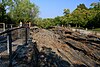
|
1967 | 41°36′59″N 82°42′23″W / 41.616304°N 82.70652°W | Erie | state | Very large limestone glacial grooves. |
| 13 | Glen Helen Natural Area | 
|
1965 | 39°48′15″N 83°52′54″W / 39.804125°N 83.881697°W | Greene | private | Includes a waterfall that carved a large travertine bowl around its pool. |
| 14 | Goll Woods | 
|
1974 | 41°33′15″N 84°21′42″W / 41.554294°N 84.361738°W | Fulton | state | One of the best remaining examples of an oak-hickory dominated forest in Ohio. Part of Goll Woods State Nature Preserve. |
| 15 | Hazelwood Botanical Preserve | 1974 | Hamilton | state | Highly detailed study of the site's plant ecology was published in 1929. Managed by the University of Cincinnati. | ||
| 16 | Highbanks Natural Area | 
|
1980 | 40°08′38″N 83°01′42″W / 40.143889°N 83.028333°W | Delaware, Franklin | county | A forested bluff overlooking the Olentangy River. |
| 17 | Holden Natural Area | 1967 | Geauga, Lake | private | A complex of three natural areas. | ||
| 18 | Hueston Woods | 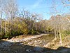
|
1967 | 39°34′21″N 84°44′29″W / 39.5725°N 84.741389°W | Butler, Preble | state | A noteworthy example of beech-maple climax forest that has never been cut. Located in Hueston Woods State Park. |
| 19 | Mantua Swamp | 1976 | 41°16′49″N 81°12′41″W / 41.280278°N 81.211389°W | Portage | private | Contains many different wetland communities. | |
| 20 | Mentor Marsh | 
|
1964 | 41°43′45″N 81°18′20″W / 41.729164°N 81.305492°W | Lake | state | Consists of marsh vegetation, aquatic plants, swamp and bottomland forest, and upland forest. Part of Mentor Marsh State Nature Preserve. |
| 21 | Serpent Mound Cryptoexplosive Structure | 
|
1980 | 39°02′00″N 83°24′00″W / 39.033333°N 83.4°W | Adams, Highland, Pike | private | A structure of undetermined origin exposed by differential erosion. |
| 22 | Tinker's Creek Gorge | 
|
1967 | 41°21′54″N 81°36′35″W / 41.365°N 81.609722°W | Cuyahoga | municipal | Contains a virgin oak-hickory and virgin beech-maple-hemlock forest. |
| 23 | White Pine Bog Forest | 1976 | Geauga | municipal, private | The only remaining near-virgin remnant white pine boreal bog in Ohio. |