
KNOWPIA
WELCOME TO KNOWPIA

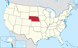
List of census-designated places in Nebraska 
Summary
This is a list of census-designated places in Nebraska. The United States Census Bureau defines census-designated places as unincorporated communities lacking elected municipal officers and boundaries with legal status.[1]
As of the 2020 census, Nebraska has 61 census-designated places,[2] up from 50 in the 2010 census.[3] Most CDPs in the state are small rural communities, although the list also includes a few bigger communities and suburbs. A total of 24,617 people live in Nebraska's CDPs, or 1,26% of the population.
Census-designated places edit
| Name | County | Population (2020)[4] |
Area (2020)[2] | Coordinates[2] | |
|---|---|---|---|---|---|
| sq mi | km2 | ||||
| Agnew | Lancaster | 30 | 0.188 | 0.5 | 41°00′51″N 96°48′51″W / 41.014234°N 96.81427°W |
| Ames | Dodge | 14 | 0.329 | 0.9 | 41°26′54″N 96°37′35″W / 41.448457°N 96.626339°W |
| Archer | Merrick | 68 | 1.002 | 2.6 | 41°10′00″N 98°08′20″W / 41.166629°N 98.138864°W |
| Aten | Cedar | 134 | 1.699 | 4.4 | 42°50′12″N 97°26′27″W / 42.836736°N 97.44081°W |
| Beacon View | Sarpy | 55 | 0.432 | 1.1 | 41°04′16″N 96°19′35″W / 41.071193°N 96.326474°W |
| Belmar | Keith | 199 | 4.582 | 11.9 | 41°18′20″N 101°56′05″W / 41.305457°N 101.934626°W |
| Berea | Box Butte | 49 | 1.193 | 3.1 | 42°12′44″N 102°58′59″W / 42.212279°N 102.982984°W |
| Bow Valley | Cedar | 95 | 0.143 | 0.4 | 42°42′56″N 97°15′08″W / 42.715424°N 97.252206°W |
| Brownlee | Cherry | 13 | 0.106 | 0.3 | 42°17′21″N 100°37′27″W / 42.289207°N 100.624178°W |
| Chalco | Sarpy | 11,064 | 2.817 | 7.3 | 41°10′54″N 96°08′07″W / 41.181645°N 96.135367°W |
| Champion | Chase | 115 | 0.246 | 0.6 | 40°28′15″N 101°44′42″W / 40.470854°N 101.744895°W |
| Cheney | Lancaster | 164 | 0.141 | 0.4 | 40°43′34″N 96°35′37″W / 40.726041°N 96.593604°W |
| Emerald | Lancaster | 45 | 0.589 | 1.5 | 40°48′47″N 96°50′07″W / 40.81313°N 96.835371°W |
| Enders | Chase | 37 | 0.131 | 0.3 | 40°27′18″N 101°32′08″W / 40.454919°N 101.535567°W |
| Fontanelle | Washington | 67 | 0.252 | 0.7 | 41°32′18″N 96°25′38″W / 41.538255°N 96.427187°W |
| Glenwood | Buffalo | 503 | 2.401 | 6.2 | 40°45′20″N 99°04′52″W / 40.755459°N 99.081007°W |
| Harrisburg | Banner | 99 | 6.469 | 16.8 | 41°33′02″N 103°43′36″W / 41.550529°N 103.726684°W |
| Holmesville | Gage | 60 | 0.225 | 0.6 | 40°12′05″N 96°39′32″W / 40.201426°N 96.65885°W |
| Inavale | Webster | 66 | 0.334 | 0.9 | 40°05′32″N 98°38′54″W / 40.092266°N 98.648391°W |
| Inland | Clay | 58 | 0.169 | 0.4 | 40°35′43″N 98°13′24″W / 40.595358°N 98.223235°W |
| Keystone | Keith | 73 | 0.201 | 0.5 | 41°13′07″N 101°35′03″W / 41.21874°N 101.584122°W |
| King Lake | Douglas | 114 | 1.111 | 2.9 | 41°18′35″N 96°18′08″W / 41.309669°N 96.302285°W |
| Kramer | Lancaster | 26 | 0.47 | 1.2 | 40°35′29″N 96°52′24″W / 40.591319°N 96.873283°W |
| Lakeview | Platte | 378 | 0.61 | 1.6 | 41°29′59″N 97°22′39″W / 41.499721°N 97.377516°W |
| La Platte | Sarpy | 50 | 0.307 | 0.8 | 41°04′20″N 95°55′35″W / 41.072261°N 95.926508°W |
| Lemoyne | Keith | 44 | 0.51 | 1.3 | 41°16′36″N 101°48′48″W / 41.276644°N 101.813356°W |
| Lindy | Knox | 13 | 0.998 | 2.6 | 42°44′06″N 97°45′00″W / 42.735114°N 97.749951°W |
| Linoma Beach | Sarpy | 43 | 0.716 | 1.9 | 41°03′26″N 96°18′51″W / 41.057297°N 96.314066°W |
| Lisco | Garden | 68 | 0.595 | 1.5 | 41°29′55″N 102°37′25″W / 41.498669°N 102.623647°W |
| Lorenzo | Cheyenne | 36 | 6.836 | 17.7 | 41°03′27″N 103°04′56″W / 41.057574°N 103.082098°W |
| Loretto | Boone | 50 | 0.281 | 0.7 | 41°45′48″N 98°04′54″W / 41.763444°N 98.081721°W |
| Macy | Thurston | 1,045 | 1.595 | 4.1 | 42°06′57″N 96°22′00″W / 42.115881°N 96.366599°W |
| Martell | Lancaster | 125 | 0.191 | 0.5 | 40°38′20″N 96°45′32″W / 40.638942°N 96.758794°W |
| Martin | Keith | 76 | 0.359 | 0.9 | 41°15′29″N 101°42′32″W / 41.258135°N 101.709005°W |
| Max | Dundy | 50 | 0.221 | 0.6 | 40°06′52″N 101°24′16″W / 40.11432°N 101.404489°W |
| Melia | Sarpy | 98 | 1.44 | 3.7 | 41°05′50″N 96°16′35″W / 41.097166°N 96.276438°W |
| Odessa | Buffalo | 132 | 1.824 | 4.7 | 40°41′57″N 99°15′16″W / 40.699108°N 99.25441°W |
| Offutt Air Force Base | Sarpy | 5,363 | 4.169 | 10.8 | 41°07′16″N 95°55′16″W / 41.120993°N 95.921108°W |
| Overland | Hamilton | 202 | 1.315 | 3.4 | 41°04′49″N 97°58′44″W / 41.08024°N 97.978905°W |
| Parks | Dundy | 12 | 0.176 | 0.5 | 40°02′37″N 101°43′30″W / 40.04362°N 101.725113°W |
| Poole | Buffalo | 22 | 2.751 | 7.1 | 40°59′32″N 98°57′38″W / 40.992269°N 98.960594°W |
| Prairie Home | Lancaster | 38 | 0.457 | 1.2 | 40°51′43″N 96°31′28″W / 40.862006°N 96.524538°W |
| Princeton | Lancaster | 51 | 0.29 | 0.8 | 40°34′34″N 96°42′21″W / 40.576029°N 96.70595°W |
| Raeville | Boone | 18 | 0.05 | 0.1 | 41°53′44″N 98°03′13″W / 41.895582°N 98.053616°W |
| Richfield | Sarpy | 42 | 1.511 | 3.9 | 41°06′39″N 96°04′35″W / 41.110763°N 96.076324°W |
| Roscoe | Keith | 44 | 0.157 | 0.4 | 41°07′54″N 101°35′07″W / 41.131613°N 101.585195°W |
| St. Libory | Howard | 241 | 0.332 | 0.9 | 41°04′56″N 98°21′33″W / 41.08214°N 98.359077°W |
| Sarben | Keith | 31 | 0.157 | 0.4 | 41°09′59″N 101°18′16″W / 41.166277°N 101.304402°W |
| Seneca | Thomas | 49 | 0.295 | 0.8 | 42°02′38″N 100°49′55″W / 42.043949°N 100.832055°W |
| Sunol | Cheyenne | 57 | 2.189 | 5.7 | 41°09′15″N 102°45′46″W / 41.154105°N 102.762746°W |
| Tamora | Seward | 44 | 0.995 | 2.6 | 40°53′40″N 97°13′46″W / 40.894442°N 97.22952°W |
| Tryon | McPherson | 107 | 1.19 | 3.1 | 41°33′30″N 100°57′13″W / 41.558444°N 100.953594°W |
| Venice | Douglas | 75 | 0.6 | 1.6 | 41°14′21″N 96°21′07″W / 41.239266°N 96.351907°W |
| Walton | Lancaster | 351 | 3.562 | 9.2 | 40°47′45″N 96°33′57″W / 40.795958°N 96.565763°W |
| Wann | Saunders | 102 | 1.49 | 3.9 | 41°08′31″N 96°21′51″W / 41.141891°N 96.364161°W |
| Westerville | Custer | 31 | 0.131 | 0.3 | 41°23′46″N 99°22′54″W / 41.396196°N 99.381796°W |
| Whiteclay[a] | Sheridan | 8 | 0.071 | 0.2 | 42°59′49″N 102°33′18″W / 42.997019°N 102.555017°W |
| Willow Island | Dawson | 25 | 2.814 | 7.3 | 40°53′24″N 100°04′15″W / 40.890044°N 100.070711°W |
| Woodland Hills | Otoe | 232 | 0.366 | 0.9 | 40°45′06″N 96°25′25″W / 40.751637°N 96.423603°W |
| Woodland Park | Stanton | 1,830 | 1.564 | 4.1 | 42°03′15″N 97°20′43″W / 42.05424°N 97.345189°W |
| Yankee Hill | Lancaster | 286 | 4.039 | 10.5 | 40°45′55″N 96°43′56″W / 40.765291°N 96.732217°W |
See also edit
Notes edit
- ^ Listed as "White Clay" by the United States Census Bureau.
References edit
- ^ "Geographic Terms and Concepts– Place". United States Census Bureau. United States Department of Commerce.
- ^ a b c "Places: Nebraska". 2020 United States Census. United States Census Bureau. Retrieved January 22, 2022.
- ^ "2010 Census Gazetteer Files". 2010 United States Census. United States Census Bureau. Retrieved January 22, 2022.
- ^ "Explore Census Data". United States Census Bureau. Retrieved January 22, 2022.