


Summary
Earthquakes intense enough to be perceptible occur annually in the U.S. state of Texas. Most earthquakes in the state have been small or have produced minimal impacts. No earthquake-related fatalities have been reported in the state, though one earthquake in Texas caused a death in the neighboring Mexican state of Chihuahua in 1923. The earliest recorded earthquake in Texas occurred near Seguin and New Braunfels on February 13, 1847.[1] Information on the intensities of early Texas earthquakes mainly arose from reports of personal experiences; more seismograph stations were installed in Texas after around 1970.[2] In the 20th century, over 100 earthquakes strong enough to be felt occurred in the state, with epicenters in 40 Texas counties.[3]: 37 While many earthquakes in Texas have natural origins, many have been induced from the waste disposal of petroleum extraction, previously believed to be the byproduct of hydraulic fracturing ,beginning with the Texas oil boom of the early 20th century. The average number of earthquakes per year with magnitudes greater than 3 increased from roughly 2 to 12 between 2008 and 2016.[2]

The regions within the state with the greatest seismic hazard include West Texas, the Texas Panhandle, North Texas, and South Central Texas. Among these areas, West Texas experiences the strongest and most frequent earthquakes, with El Paso featuring the greatest risk from earthquakes among sizable urban areas in Texas.[3]: 18–19 There are several geologic features in West Texas of interest to seismology, including the Central Basin Platform, the Hueco Bolson, and the Marathon Uplift.[3]: 20–23 Several faultlines are also located in West Texas. The strongest and most destructive earthquake in state history was the 1931 Valentine earthquake,[3]: 20 which had an estimated magnitude of mb 5.6–6.4.[4]: 1171 The second strongest earthquake in Texas history also occurred in West Texas, registering as a magnitude 5.7 tremor near Alpine in 1995.[1]
The Texas Panhandle exhibits the second highest seismic risk among regions in the state. The earthquakes in this area primarily occur on buried faults between the Amarillo Uplift and the Anadarko Basin.[3]: 24 An earthquake with a magnitude of 5.5–6.0 is expected to occur every 50–100 years in the Texas Panhandle, while an earthquake with a magnitude greater than 6.0 is expected to occur every 300 years.[5] The strongest earthquake in this region was a magnitude 4.9 earthquake that occurred in 1925.[5][6] Some of the seismic activity in the Texas Panhandle may be caused or influenced by the extraction of petroleum.[3]: 27 [5] The northern and northeastern parts of Texas, including the Dallas–Fort Worth metroplex, are another region of seismic risk. Though the area does experience some minor earthquakes, including induced earthquakes naturally-occurring tremors potentially along buried faults, shaking from distant earthquakes presents the primary seismic hazard for the region.[3]: 29–31 Some earthquakes of mostly minor strength also occur in South Central Texas and the Texas Coastal Plain. Some of these earthquakes may be associated with geological features produced by the Ouachita orogeny, and many have been attributed to petroleum production.[3]: 32–34
Notable earthquakes edit
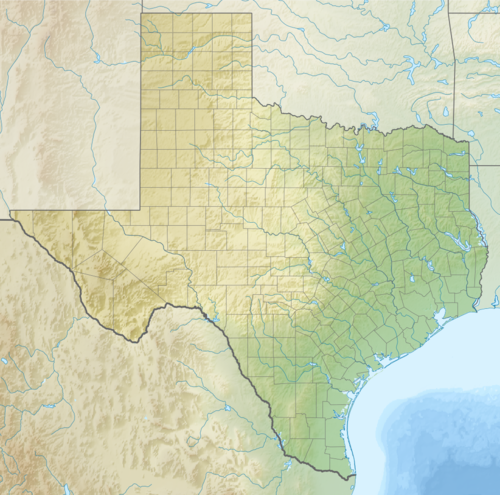
| Date and time (UTC) | Location | Epicenter | Mag. | MMI | Depth | Notes | Casualties | Ref | |
|---|---|---|---|---|---|---|---|---|---|
| Dead | Injured | ||||||||
| August 16, 1931 11:40:22 |
Presidio County | 30°30′07″N 104°34′30″W / 30.502°N 104.575°W | 5.8 mbLg | MMI VIII (Severe) | 1.0 km (0.62 mi) | All buildings in Valentine aside from wood-frame houses were damaged. Property damage was reported in Brewster, Culberson, Jeff Davis, and Presidio counties with landslides triggered as far as the Big Bend of Texas. | — | — | [7] |
| April 14, 1995 00:32:56 |
Brewster County | 30°23′06″N 103°20′49″W / 30.385°N 103.347°W | 5.7 Mw | MMI VII (Very strong) | 17.8 km (11.1 mi) | Slight damage occurred in Alpine and Fort Davis. Two people suffered minor injuries in Brewster County. Shaking was felt as far east as the Dallas–Fort Worth metroplex and San Antonio. | — | 2 | [8] |
| November 16, 2022 21:32:44 |
Reeves County | 31°38′13″N 103°59′56″W / 31.637°N 103.999°W | 5.4 ML | MMI VII (Very strong) | 6.9 km (4.3 mi) | Possibly the main shock of a sequence of 881 earthquakes. | — | — | [9] |
| November 8, 2023 10:27:49 |
Reeves County | 31°37′19″N 103°58′55″W / 31.622°N 103.982°W | 5.2 ML | MMI VII (Very strong) | 7.4 km (4.6 mi) | Possibly the main shock of a sequence of 278 earthquakes. | — | — | [10] |
| December 16, 2022 23:35:27 |
Martin County | 32°11′28″N 102°08′28″W / 32.191°N 102.141°W | 5.2 ML | MMI VI (Strong) | 8.2 km (5.1 mi) | — | — | [11] | |
| March 26, 2020 15:16:27 |
Reeves County | 31°43′01″N 104°02′31″W / 31.717°N 104.042°W | 5.0 Mww | MMI V (Moderate) | 9.5 km (5.9 mi) | Research published in Geophysical Research Letters in December 2020 concluded that stress introduced by wastewater injection likely triggered the earthquake. | — | — | [12][13] |
| July 30, 1925 12:17:00 |
Carson County | 35°24′00″N 101°18′00″W / 35.400°N 101.300°W | 4.9 Mfa | MMI VI (Strong) | — | The earthquake was the strongest on record in the Texas Panhandle and caused minor damage. | — | — | [6][3]: 140–144 |
| July 21, 2022 13:35:58 |
Culberson County | 31°40′48″N 104°25′16″W / 31.680°N 104.421°W | 4.9 ML | MMI V (Moderate) | 5.9 km (3.7 mi) | — | — | [14] | |
| October 20, 2011 12:24:41 |
Karnes County | 28°51′54″N 98°04′44″W / 28.865°N 98.079°W | 4.8 Mwr | MMI VI (Strong) | 5.0 km (3.1 mi) | Felt throughout South Central Texas and South Texas. | — | — | [15] |
| May 17, 2012 08:12:00 |
Shelby County | 31°55′34″N 94°22′08″W / 31.926°N 94.369°W | 4.8 Mwr | MMI V (Moderate) | 5.0 km (3.1 mi) | — | — | [16] | |
| August 1, 1975 07:27:57 |
Reeves County | 31°25′30″N 104°00′43″W / 31.425°N 104.012°W | 4.8 mb | — | 5.0 km (3.1 mi) | — | — | [17] | |
| February 17, 2024 06:32:54 |
Karnes County | 28°57′14″N 98°00′04″W / 28.954°N 98.001°W | 4.7 ML | MMI VI (Strong) | 6.8 km (4.2 mi) | — | — | [18] | |
| February 16, 2023 10:29:04 |
Scurry County | 32°44′46″N 100°39′32″W / 32.746°N 100.659°W | 4.7 ML | MMI V (Moderate) | 7.8 km (4.8 mi) | — | — | [19] | |
| November 24, 2022 19:19:28 |
Reeves County | 31°37′37″N 104°00′11″W / 31.627°N 104.003°W | 4.7 ML | MMI V (Moderate) | 8.5 km (5.3 mi) | — | — | [20] | |
| June 1, 2022 15:46:10 |
Culberson County | 31°42′54″N 104°33′04″W / 31.715°N 104.551°W | 4.6 ML | MMI V (Moderate) | 6.2 km (3.9 mi) | — | — | [21] | |
| March 25, 2022 03:01:58 |
Culberson County | 31°40′08″N 104°25′12″W / 31.669°N 104.420°W | 4.6 ML | MMI V (Moderate) | 6.8 km (4.2 mi) | — | — | [22] | |
| December 28, 2021 01:55:43 |
Martin County | 32°17′10″N 101°46′26″W / 32.286°N 101.774°W | 4.6 ML | MMI V (Moderate) | 8.4 km (5.2 mi) | — | — | [23] | |
| March 12, 1948 04:29:06 |
Dallam County | 36°13′16″N 102°28′41″W / 36.221°N 102.478°W | 4.5 Mfa | MMI VI (Strong) | 5.0 km (3.1 mi) | Minor damage was reported in the Texas Panhandle. | — | — | [24][25][3]: 166–168 |
| November 24, 2022 19:14:19 |
Reeves County | 31°38′02″N 103°59′17″W / 31.634°N 103.988°W | 4.5 ML | MMI V (Moderate) | 7.4 km (4.6 mi) | — | — | [26] | |
| August 11, 2022 07:17:16 |
Culberson County | 31°40′59″N 104°25′30″W / 31.683°N 104.425°W | 4.5 ML | MMI V (Moderate) | 6.6 km (4.1 mi) | — | — | [27] | |
| March 17, 2021 04:19:28 |
Culberson County | 31°39′14″N 104°21′25″W / 31.654°N 104.357°W | 4.5 ML | MMI V (Moderate) | 6.2 km (3.9 mi) | — | — | [28] | |
| February 15, 1974 13:33:49 |
Ochiltree County | 36°30′00″N 100°41′35″W / 36.500°N 100.693°W | 4.5 mb | MMI V (Moderate) | 24.0 km (14.9 mi) | Damage to the plaster walls of buildings occurred in Oklahoma and Kansas. | — | — | [29][3]: 197–198 |
References edit
- ^ a b Murr, Erika (September 1, 1995) [1976]. "Earthquakes". The Handbook of Texas. Texas State Historical Association. Retrieved February 23, 2024.
- ^ a b Frohlich, Cliff; DeShon, Heather; Stump, Brian; Hayward, Chris; Hornbach, Matt; Walter, Jacob I. (July 2016). "A Historical Review of Induced Earthquakes in Texas". Seismological Research Letters. 87 (4): 1022–1038. Bibcode:2016SeiRL..87.1022F. doi:10.1785/0220160016.
- ^ a b c d e f g h i j k Frolich, Cliff; Davis, Scott D. (2002). Texas Earthquakes. Austin, Texas: University of Texas Press. ISBN 0-292-72550-7.
- ^ Dumas, David B.; Dorman, H. James; Latham, Gary V. (August 1980). "A reevaluation of the August 16, 1931 Texas earthquake". Bulletin of the Seismological Society of America. 70 (4): 1171–1180. doi:10.1785/BSSA0700041171 (inactive January 31, 2024).
{{cite journal}}: CS1 maint: DOI inactive as of January 2024 (link) - ^ a b c "Texas Panhandle Earthquakes" (PDF). Amarillo, Texas: National Weather Service Amarillo, Texas. August 16, 2022. Retrieved February 23, 2024.
- ^ a b "M 4.9 - 9 km NE of Panhandle, Texas". Earthquake Hazards Program. United States Geological Survey. Retrieved November 15, 2023.
- ^ "M 5.8 - 12 km SW of Valentine, Texas". Earthquake Hazards Program. United States Geological Survey. Retrieved November 15, 2023.
- ^ "M 5.7 - 13 km NW of Marathon, Texas". Earthquake Hazards Program. United States Geological Survey. Retrieved November 15, 2023.
- ^ "M 5.4 - Coalson Draw, Texas". Earthquake Hazards Program. United States Geological Survey. Retrieved November 15, 2023.
- ^ "M 5.2 - Coalson Draw, Texas". Earthquake Hazards Program. United States Geological Survey. Retrieved November 15, 2023.
- ^ "M 5.2 - Range Hill, Texas". Earthquake Hazards Program. United States Geological Survey. Retrieved November 15, 2023.
- ^ "M 5.0 - 41 km W of Mentone, Texas". Earthquake Hazards Program. United States Geological Survey. Retrieved November 15, 2023.
- ^ Tung, Sui; Zhai, Guang; Shirzaei, Manoochehr (December 28, 2020). "Potential Link Between 2020 Mentone, West Texas M5 Earthquake and Nearby Wastewater Injection: Implications for Aquifer Mechanical Properties". Geophysical Research Letters. 48 (3). doi:10.1029/2020GL090551. hdl:10919/103345.
- ^ "M 4.9 - 55 km S of Whites City, New Mexico". Earthquake Hazards Program. United States Geological Survey. Retrieved February 12, 2024.
- ^ "M 4.8 - 14 km SSW of Falls City, Texas". Earthquake Hazards Program. United States Geological Survey. Retrieved November 15, 2023.
- ^ "M 4.8 - 3 km NE of Timpson, Texas". Earthquake Hazards Program. United States Geological Survey. Retrieved November 15, 2023.
- ^ "M 4.8 - 24 km WNW of Toyah, Texas". Earthquake Hazards Program. United States Geological Survey. Retrieved November 15, 2023.
- ^ "M 4.7 - 3 km SSE of Falls City, Texas". Earthquake Hazards Program. United States Geological Survey. Retrieved February 17, 2024.
- ^ "M 4.7 - 15 km NE of Hermleigh, Texas". Earthquake Hazards Program. United States Geological Survey. Retrieved November 15, 2023.
- ^ "M 4.7 - 34 km WSW of Mentone, Texas". Earthquake Hazards Program. United States Geological Survey. Retrieved November 15, 2023.
- ^ "M 4.6 - 53 km SSW of Whites City, New Mexico". Earthquake Hazards Program. United States Geological Survey. Retrieved February 12, 2024.
- ^ "M 4.6 - 56 km S of Whites City, New Mexico". Earthquake Hazards Program. United States Geological Survey. Retrieved February 12, 2024.
- ^ "M 4.6 - 17 km N of Stanton, Texas". Earthquake Hazards Program. United States Geological Survey. Retrieved November 15, 2023.
- ^ "M 4.5 - 18 km N of Dalhart, Texas". Earthquake Hazards Program. United States Geological Survey. Retrieved November 15, 2023.
- ^ "Earthquakes in Texas". Texas Almanac. 2021. Retrieved February 23, 2024.
- ^ "M 4.5 - western Texas". Earthquake Hazards Program. United States Geological Survey. Retrieved November 15, 2023.
- ^ "M 4.5 - 54 km S of Whites City, New Mexico". Earthquake Hazards Program. United States Geological Survey. Retrieved February 12, 2024.
- ^ "M 4.5 - 57 km S of Whites City, New Mexico". Earthquake Hazards Program. United States Geological Survey. Retrieved February 12, 2024.
- ^ "M 4.5 - 14 km NE of Perryton, Texas". Earthquake Hazards Program. United States Geological Survey. Retrieved November 15, 2023.