
KNOWPIA
WELCOME TO KNOWPIA

List of islands of Trinidad and Tobago 
Summary
This is a list of islands of Trinidad and Tobago. Trinidad and Tobago is an archipelagic republic in the southern Caribbean.
Major islands edit
Bocas Islands edit

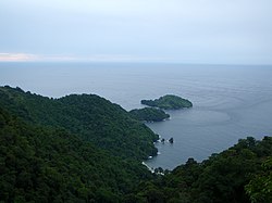
The Bocas Islands lie between Trinidad and Venezuela, in the Bocas del Dragón (Dragons' Mouth). Locally they are referred to as "Down de Islands" or "DDI".
- Chacachacare
- Monos
- Huevos
- Gaspar Grande (Gasparee)
- Gasparillo Island (Little Gasparee or Centipede Island)
Five Islands edit


The Five Islands are actually a group of six small islands lying west of Port of Spain in the Gulf of Paria. Also known as Las Cotorras.
- Caledonia Island
- Craig Island (Craig and Caledonia are joined by a man-made causeway)
- Lenagan Island
- Nelson Island
- Pelican Island
- Rock Island
San Diego Islands edit

Sometimes referred to simply as the Diego Islands, these two islets lie between the Bocas Islands and the Five Islands.
Others in the Gulf of Paria edit
North Coast of Trinidad edit
Off Tobago edit
- Little Tobago (Bird of Paradise Island)
- St. Giles Island
- Goat Island
- Sisters' Rock
List of minor islands with co-ordinates edit
Taken from the Archipelagic Baselines of Trinidad and Tobago Order, Notice No. 206 of 31 October 1988, as corrected by Legal Notice No. 77 on 5 April 1989.[1]
- East Rock 10°08′12″N 60°59′02″W / 10.13667°N 60.98389°W
- Casa Cruz Rock 10°04′22″N 61°09′45″W / 10.07278°N 61.16250°W
- Alcatras Rock 10°04′19″N 61°13′28″W / 10.07194°N 61.22444°W
- Icacos Point 10°02′28″N 61°54′30″W / 10.04111°N 61.90833°W
- Black Rock 10°03′27″N 62°01′33″W / 10.05750°N 62.02583°W
- Cabresse Point 10°41′47″N 61°45′36″W / 10.69639°N 61.76000°W
- Cabresse Island 10°41′58″N 61°45′25″W / 10.69944°N 61.75694°W
- Sisters Island 11°19′57″N 60°38′42″W / 11.33250°N 60.64500°W
- Marble Island 11°21′39″N 60°31′37″W / 11.36083°N 60.52694°W
- St. Giles Island 11°21′28″N 60°30′52″W / 11.35778°N 60.51444°W
- Little Tobago 11°17′39″N 60°29′40″W / 11.29417°N 60.49444°W
References edit
- ^ Trinidad and Tobago, Department of Navy, 2005