
KNOWPIA
WELCOME TO KNOWPIA

Little Hastings Tract 
Summary
Little Hastings Tract is a mostly submerged island in the Sacramento–San Joaquin River Delta.[2][3] It is in Solano County, California.[4][5][6] Its coordinates are 38°15′02″N 121°41′32″W / 38.25056°N 121.69222°W[1], and the United States Geological Survey gave its elevation as 0 ft (0 m) in 1981.[1] It appears, above water, on a 1978 USGS map.[7]
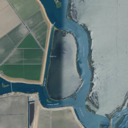 USGS aerial imagery of Little Hastings Tract | |
 Little Hastings Tract  Little Hastings Tract  Little Hastings Tract | |
| Geography | |
|---|---|
| Location | Northern California |
| Coordinates | 38°15′02″N 121°41′32″W / 38.25056°N 121.69222°W[1] |
| Adjacent to | Sacramento–San Joaquin River Delta |
| Highest elevation | 0 ft (0 m)[1] |
| Administration | |
United States | |
| State | |
| County | Solano |
References edit
- ^ a b c d U.S. Geological Survey Geographic Names Information System: Little Hastings Tract
- ^ "Dikes Holding As Flood Reaches Bay Lowlands". Chico Record. Chico, California. 1936-02-01. p. 4.
- ^ "Delta Area In Hectic Effort To Bar Floods". Santa Cruz Evening News. Santa Cruz, California. 1937-12-15. p. 1.
- ^ "High Tide Is New Delta Flood Threat". The Fresno Bee The Republican. Fresno, California. 1937-12-15. p. 1.
- ^ "Flood Crest Perils Delta". Oakland Tribune. Oakland, California. 1937-12-15. p. 1.
- ^ "Levees Bolstered". San Pedro News-Pilot. San Pedro, California. 1937-12-15. p. 1.
- ^ United States Geological Survey (1978). "Rio Vista Quadrangle, California" (Map). United States Department of the Interior Geological Survey. 1:24000.