
KNOWPIA
WELCOME TO KNOWPIA

Lobata District 
Summary
Lobata is a district of São Tomé and Príncipe, on São Tomé Island. Its area is 105 km2 (41 sq mi),[1] and its population is 19,365 (2012).[2] The district seat is Guadalupe. It is divided into the four statistical subdistricts Guadalupe, Santo Amaro, Conde and Micoló.[3][2]: 15
Lobata | |
|---|---|
District | |
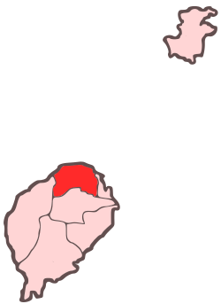 Location within São Tomé and Príncipe | |
| Coordinates: 0°22′N 6°40′E / 0.367°N 6.667°E | |
| Country | São Tomé and Príncipe |
| Island | São Tomé |
| Seat | Guadalupe |
| Area | |
| • Total | 105 km2 (41 sq mi) |
| Population (2012) | |
| • Total | 19,365 |
| • Density | 180/km2 (480/sq mi) |
| Time zone | UTC+0 (UTC) |
Geography edit
The district includes an islet called the Ilhéu das Cabras. Numerous beaches dot the coast, including Praia de Lagoa Azul, das Conchas, Guegue Micoló, das Plancas and dos Tamarindos. The eastern part of the district is increasingly urbanised due to its proximity to the city São Tomé.
Population edit
| Year | Population |
|---|---|
| 1940[4] | 9,194
|
| 1950[4] | 8,181
|
| 1960[4] | 7,905
|
| 1970[4] | 9,372
|
| 1981[4] | 11,731
|
| 1991[4] | 14,173
|
| 2001[4][2] | 15,187
|
| 2012[4][2] | 19,365
|
Settlements edit
The main settlement is the town Guadalupe. Other settlements are:
Landmarks and points of interest edit
- Lagoa Azul, a bay in the west of the district.
- Lagoa Azul Lighthouse - west of Morro Peixe
- Roça Boa Entrada
- Roça do Rio Ouro in Agostinho Neto
Politics edit
Lobata currently has six seats in the National Assembly.[5]
Notable people edit
- William Barbosa, footballer
- Olinda Beja, writer
- Aurélio Martins, journalist, businessman and politician
- Ludgério Silva, footballer
Twin towns edit
References edit
- ^ Sao Tome and Principe, citypopulation.de
- ^ a b c d Projecção a nível distrital 2012 - 2020[permanent dead link], Instituto Nacional de Estatística
- ^ Statistical divisions of São Tomé and Príncipe[permanent dead link], Instituto Nacional de Estatística
- ^ a b c d e f g h Evolução da População Recenseada, 1940 a 2012, Instituto Nacional de Estatística
- ^ Elections in São Tomé and Principe, African Elections Database.
- ^ a b c Geminações de Cidades e Vilas
External links edit
 Media related to Lobata District at Wikimedia Commons