


Summary
This is a list of local government areas (LGAs) in Queensland, Australia, sorted by region. For the history and responsibilities of local government in that state, see Local government in Queensland. For former local government areas in Queensland, see List of former local government areas of Queensland.

LGAs sorted by region edit
| Name | Council seat |
Region | Year estab. |
Area[1] (km2) |
Population | Notes | Map | |
|---|---|---|---|---|---|---|---|---|
| (2013)[2][3] | (2018)[3][1] | |||||||
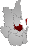
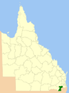
| City of Brisbane | Brisbane | South East Queensland | 1924 | 1,343 | 1,131,996 | 1,231,605 | Capital city of Queensland Administers the central portion of the South East Queensland agglomeration |
|
| City of Gold Coast | Surfers Paradise | South East Queensland | 1948 | 1,334 | 540,687 | 606,774 | The Local Government (Albert, Beaudesert and Gold Coast) Regulation 1994 was gazetted on 16 December 1994, resulting in the amalgamation of the Shire of Albert into City of Gold Coast at the 1995 local government elections. | 
|
| City of Ipswich | Ipswich | South East Queensland | 1860 | 1,094 | 183,688 | 213,638 | 
| |
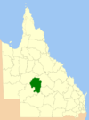
| Lockyer Valley Region | Gatton | South East Queensland | 2008 | 2,269 | 37,682 | 41,011 | The Lockyer Valley Region was created from the 15 March 2008 amalgamation of:
|
|
| Logan City | Logan Central | South East Queensland | 1978 | 958 | 300,545 | 326,615 | On 15 March 2008, Logan City expanded the northern part of the Shire of Beaudesert into its territory | 
|
| City of Moreton Bay | Caboolture | South East Queensland | 2008 | 2,042 | 410,687 | 459,585 | The Moreton Bay Regional Council was created from the amalgamation on 15 March 2008 of Councils for:
On 21 July 2023 the Council officially changed its name to City of Moreton Bay. |
|
| Shire of Noosa | Tewantin | South East Queensland | 2014 | 870 | 52,360 | 55,369 | Re-established in 2014 after being de-amalgamated from Sunshine Coast Region | 
|
| Redland City | Cleveland | South East Queensland | 1949 | 537 | 147,328 | 156,863 | 
| |
| Scenic Rim Region | Beaudesert | South East Queensland | 2008 | 4,243 | 38,732 | 42,583 | The Scenic Rim Region was created from the 15 March 2008 amalgamation of:
|

|
| Somerset Region | Esk | South East Queensland | 2008 | 5,373 | 23,619 | 25,887 | The Somerset Region was created from the 15 March 2008 amalgamation of:
|

|
| Sunshine Coast Region | Nambour | South East Queensland | 2008 | 2,254 | 281,969 | 319,922 | The Sunshine Coast Region was created from the 15 March 2008 amalgamation of:
Later, the Shire of Noosa was de-amalgamated from Sunshine Coast Region on 1 January 2014. |

|
| Shire of Banana | Biloela | Wide Bay-Burnett | 1879 | 28,550 | 14,948 | 14,291 | On 15 March 2008, the Shire of Banana expanded Division 1 of the Shire of Taroom into its territory | 
|
| Bundaberg Region | Bundaberg | Wide Bay-Burnett | 2008 | 6,431 | 93,850 | 95,302 | The Bundaberg Region was created from the 15 March 2008 amalgamation of:
|

|
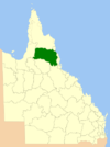
| Aboriginal Shire of Cherbourg | Cherbourg | Wide Bay-Burnett | 1986 | 32 | 1,292 | 1,315 | ||
| Fraser Coast Region | Hervey Bay | Wide Bay-Burnett | 2008 | 7,105 | 100,290 | 105,463 | The Fraser Coast Region was created from the 15 March 2008 amalgamation of:
|

|
| Gympie Region | Gympie | Wide Bay-Burnett | 2008 | 6,884 | 48,491 | 51,586 | The Gympie Region was created from the 15 March 2008 amalgamation of:
|
|
| North Burnett Region | Gayndah | Wide Bay-Burnett | 2008 | 19,670 | 10,487 | 10,628 | The North Burnett Region was created from the 15 March 2008 amalgamation of:
|

|
| South Burnett Region | Kingaroy | Wide Bay-Burnett | 2008 | 8,382 | 32,647 | 32,555 | The South Burnett Region was created from the 15 March 2008 amalgamation of:
|

|
| Goondiwindi Region | Goondiwindi | Darling Downs | 2008 | 19,258 | 10,952 | 10,728 | The Goondiwindi Region was created from the 15 March 2008 amalgamation of:
|

|
| Southern Downs Region | Warwick | Darling Downs | 2008 | 7,108 | 35,501 | 35,601 | The Southern Downs Region was created from the 15 March 2008 amalgamation of:
|
|
| Toowoomba Region | Toowoomba | Darling Downs | 2008 | 12,957 | 159,916 | 167,657 | The Toowoomba Region was created from the 15 March 2008 amalgamation of:
|

|
| Western Downs Region | Dalby | Darling Downs | 2008 | 37,937 | 33,415 | 34,467 | The Dalby Region was created from the 15 March 2008 amalgamation of:
Later it was renamed Western Downs Region in August 2009. |

|
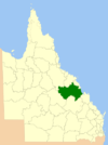
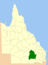
| Central Highlands Region | Emerald | Central Queensland | 2008 | 59,835 | 29,782 | 28,645 | The Central Highlands Region was created from the 15 March 2008 amalgamation of:
|

|
| Gladstone Region | Gladstone | Central Queensland | 2008 | 10,484 | 62,158 | 62,979 | The Gladstone Region was created from the 15 March 2008 amalgamation of:
|

|
| Isaac Region | Moranbah | Central Queensland | 2008 | 58,708 | 23,284 | 20,934 | The Isaac Region was created from the 15 March 2008 amalgamation of:
|
|
| Shire of Livingstone | Yeppoon | Central Queensland | 2014 | 11,758 | 35,279 | 37,638 | Re-established in 2014 after being de-amalgamated from Rockhampton Region | 
|
| Rockhampton Region | Rockhampton | Central Queensland | 2008 | 6,570 | 81,745 | 81,067 | The Rockhampton Region was created from the 15 March 2008 amalgamation of:
Later, the Shire of Livingstone was being de-amalgamated from Rockhampton Region on 1 January 2014. |

|
| Aboriginal Shire of Woorabinda | Woorabinda | Central Queensland | 1986 | 391 | 994 | 1,005 | ||
| Shire of Burdekin | Ayr | North Queensland | 1888 | 5,044 | 17,754 | 17,077 | 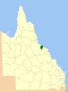
| |
| Charters Towers Region | Charters Towers | North Queensland | 2008 | 68,382 | 12,391 | 11,850 | The Charters Towers Region was created from the 15 March 2008 amalgamation of: | 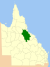
|
| Shire of Hinchinbrook | Ingham | North Queensland | 1879 | 2,807 | 11,613 | 10,805 | 
| |
| Mackay Region | Mackay | North Queensland | 2008 | 7,613 | 118,878 | 116,539 | The Mackay Region was created from the 15 March 2008 amalgamation of:
|
|
| Aboriginal Shire of Palm Island | Palm Island | North Queensland | 1986 | 72 | 2,529 | 2,637 | 
| |
| City of Townsville | Townsville | North Queensland | 2008 | 3,731 | 186,519 | 194,072 | The new City of Townsville was created from the 15 March 2008 amalgamation of:
|
|
| Whitsunday Region | Bowen | North Queensland | 2008 | 23,819 | 34,119 | 35,050 | The Whitsunday Region was created from the 15 March 2008 amalgamation of:
|
|
| Shire of Aurukun | Aurukun | Far North Queensland | 1978 | 7,424 | 1,350 | 1,382 | 
| |
| Cairns Region | Cairns | Far North Queensland | 2008 | 1,689 | 156,764 | 165,525 | The Cairns Region was created from the 15 March 2008 amalgamation of:
Later, the Shire of Douglas was being de-amalgamated from Cairns Region on 1 January 2014. |

|
| Cassowary Coast Region | Innisfail | Far North Queensland | 2008 | 4,688 | 28,950 | 29,689 | The Cassowary Coast Region was created from the 15 March 2008 amalgamation of:
|

|
| Shire of Cook | Cooktown | Far North Queensland | 1919 | 105,719 | 4,222 | 4,445 | 
| |
| Shire of Douglas | Mossman | Far North Queensland | 2014 | 2,428 | 11,585 | 12,257 | Re-established in 2014 after being de-amalgamated from Cairns Region | 
|
| Aboriginal Shire of Hope Vale | Hope Vale | Far North Queensland | 1986 | 1,112 | 1,043 | 1,081 | ||
| Aboriginal Shire of Kowanyama | Kowanyama | Far North Queensland | 1987 | 2,555 | 1,042 | 977 | 
| |
| Aboriginal Shire of Lockhart River | Lockhart River | Far North Queensland | 1987 | 3,576 | 626 | 782 | ||
| Aboriginal Shire of Mapoon | Mapoon | Far North Queensland | 2002 | 537 | 293 | 325 | ||
| Shire of Mareeba | Mareeba | Far North Queensland | 2014 | 53,491 | 21,379 | 22,517 | Re-established in 2014 after being de-amalgamated from Tablelands Region | 
|
| Aboriginal Shire of Napranum | Napranum | Far North Queensland | 1989 | 2,004 | 922 | 1,048 | ||
| Northern Peninsula Area Region | Bamaga | Far North Queensland | 2008 | 1,052 | 2,620 | 3,069 | ||
| Aboriginal Shire of Pormpuraaw | Pormpuraaw | Far North Queensland | 1987 | 4,395 | 737 | 833 | 
| |
| Tablelands Region | Malanda | Far North Queensland | 2008 | 11,293 | 24,827 | 25,541 | The Tablelands Region was created from the 15 March 2008 amalgamation of:
Later, the Shire of Mareeba was being de-amalgamated from Tablelands Region on 1 January 2014. |
|
| Shire of Torres | Thursday Island | Far North Queensland | 1974 | 884 | 3,647 | 3,848 | ||
| Torres Strait Island Region | Thursday Island | Far North Queensland | 2008 | 490 | 4,614 | 4,994 | ||
| Weipa Town | Weipa | Far North Queensland | 1963 | 10.8 | 3,811 | 4,240 | Administered under own Act by Rio Tinto Group | |
| Aboriginal Shire of Wujal Wujal | Wujal Wujal | Far North Queensland | 1987 | 12 | 289 | 306 | ||
| Aboriginal Shire of Yarrabah | Yarrabah | Far North Queensland | 1986 | 159 | 2,686 | 2,848 | 
| |
| Shire of Burke | Burketown | North West Queensland | 1885 | 39,684 | 506 | 352 | 
| |
| Shire of Carpentaria | Normanton | North West Queensland | 1883 | 64,121 | 2,146 | 1,974 | 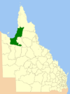
| |
| Shire of Cloncurry | Cloncurry | North West Queensland | 1884 | 47,971 | 3,327 | 3,091 | 
| |
| Shire of Croydon | Croydon | North West Queensland | 1887 | 29,498 | 308 | 288 | 
| |
| Aboriginal Shire of Doomadgee | Doomadgee | North West Queensland | 1987 | 1,828 | 1,400 | 1,507 | 
| |
| Shire of Etheridge | Georgetown | North West Queensland | 1882 | 39,199 | 864 | 804 | 
| |
| Shire of Flinders | Hughenden | North West Queensland | 1882 | 41,200 | 1,754 | 1,499 | 
| |
| Shire of Mckinlay | Julia Creek | North West Queensland | 1891 | 40,737 | 992 | 814 | 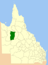
| |
| Shire of Mornington | Gununa | North West Queensland | 1978 | 1,248 | 1,206 | 1,218 | ||
| City of Mount Isa | Mount Isa | North West Queensland | 1914 | 43,713 | 21,822 | 18,878 | 
| |
| Shire of Richmond | Richmond | North West Queensland | 1910 | 26,581 | 839 | 806 | 
| |
| Barcaldine Region | Barcaldine | Central West Queensland | 2008 | 53,383 | 3,232 | 2,852 | The Barcaldine Region was created from the 15 March 2008 amalgamation of:
|

|
| Shire of Barcoo | Jundah | Central West Queensland | 1885 | 61,830 | 333 | 267 | 
| |
| Blackall-Tambo Region | Blackall | Central West Queensland | 2008 | 30,537 | 2,214 | 1,863 | The Blackall-Tambo Region was created from the 15 March 2008 amalgamation of:
|

|
| Shire of Boulia | Boulia | Central West Queensland | 1887 | 60,906 | 481 | 425 | 
| |
| Shire of Diamantina | Bedourie | Central West Queensland | 1879 | 94,731 | 299 | 292 | 
| |
| Longreach Region | Longreach | Central West Queensland | 2008 | 40,572 | 4,104 | 3,530 | The Longreach Region was created from the 15 March 2008 amalgamation of:
|
|
| Shire of Winton | Winton | Central West Queensland | 1886 | 53,814 | 1,312 | 1,157 | 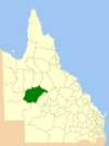
| |
| Shire of Balonne | St George | South West Queensland | 1883 | 31,104 | 4,776 | 4,334 | 
| |
| Shire of Bulloo | Thargomindah | South West Queensland | 1880 | 73,724 | 396 | 330 | 
| |
| Maranoa Region | Roma | South West Queensland | 2008 | 58,705 | 13,515 | 12,791 | The Roma Region was created from the 15 March 2008 amalgamation of:
Later it was renamed Maranoa Region in June 2009. |
|
| Shire of Murweh | Charleville | South West Queensland | 1879 | 40,700 | 4,685 | 4,318 | 
| |
| Shire of Paroo | Cunnamulla | South West Queensland | 1879 | 47,613 | 1,849 | 1,586 | 
| |
| Shire of Quilpie | Quilpie | South West Queensland | 1930 | 67,415 | 944 | 790 | 
| |
See also edit
References edit
- ^ a b "3218.0 – Regional Population Growth, Australia, 2017-18: Population Estimates by Local Government Area (ASGS 2018), 2017 to 2018". Australian Bureau of Statistics. Australian Bureau of Statistics. 27 March 2019. Retrieved 25 October 2019. Estimated resident population, 30 June 2018.
- ^ "3218.0 – Regional Population Growth, Australia, 2016–17". Australian Bureau of Statistics. 24 April 2018. Archived from the original on 26 April 2018. Retrieved 10 July 2018.
- ^ a b "People: Population: ERP by LGA (ASGS 2018), 2001 to 2018". ABS.Stat. Australian Bureau of Statistics. 27 March 2019. Retrieved 29 November 2019.
- ^ "Agency ID 11054, Gympie Regional Council". Queensland State Archives. Retrieved 9 September 2013.
External links edit
- "Shires of Australia". Statoids.
- "Local Government Association of Queensland". Local Government Association of Queensland. Retrieved 5 May 2011.