
KNOWPIA
WELCOME TO KNOWPIA

Lopez Island Airport 
Summary
Lopez Island Airport (FAA LID: S31) is a public use airport located three nautical miles (6 km) south of the central business district of Lopez, a village on Lopez Island in San Juan County, Washington, United States. It is owned by the Port of Lopez.[1]
Lopez Island Airport | |||||||||||
|---|---|---|---|---|---|---|---|---|---|---|---|
| Summary | |||||||||||
| Airport type | Public | ||||||||||
| Owner | Port of Lopez | ||||||||||
| Location | Lopez Island, Washington | ||||||||||
| Elevation AMSL | 209 ft / 64 m | ||||||||||
| Coordinates | 48°29′02″N 122°56′16″W / 48.48389°N 122.93778°W | ||||||||||
| Map | |||||||||||
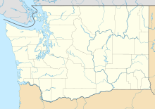 S31  S31 | |||||||||||
| Runways | |||||||||||
| |||||||||||
| Statistics (2021) | |||||||||||
| |||||||||||
Facilities and aircraft edit
Lopez Island Airport covers an area of 93 acres (38 ha) at an elevation of 209 feet (64 m) above mean sea level. It has one runway designated 16/34 with an asphalt surface measuring 2,905 by 61 feet (885 x 19 m).[1]
For the 12-month period ending December 31, 2021, the airport had 10,004 aircraft operations, an average of 27 per day: 75% general aviation, 25% air taxi, and <1% military. At that time there were 26 aircraft based at this airport: 25 single-engine, and 1 multi-engine.[1]
Airlines and destinations edit
| Airlines | Destinations |
|---|---|
| San Juan Airlines | Anacortes, Bellingham, Friday Harbor |
See also edit
References edit
External links edit
- Lopez Island Airport at Washington State DOT
- Aerial image as of 21 July 1998 from USGS The National Map
- Resources for this airport:
- FAA airport information for S31
- AirNav airport information for S31
- FlightAware airport information and live flight tracker
- SkyVector aeronautical chart for S31