


Summary
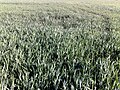
The Loukkos River (واد لوكوس) (Spanish:Río Luco) is a major river in northern Morocco. Although it is relatively short (about 100 km), the river is the third largest in Morocco with an average flow of 50 m³/s. The Loukkos river's source is located in the Rif Mountains and flows into the Atlantic Ocean in the city of Larache; the city's port is on the river. The Loukkos river basin is 3,730 km2 and contains one of the most fertile and productive agricultural lands in the country. One of the river's tributaries, Oued Makhazine, bears great historical importance since it witnessed one of the most decisive battles in the history of Morocco: the Battle of Alcácer Quibir. In the battle on 4 August 1578, the joint army of deposed Moroccan monarch Abu Abdallah Mohammed II Saadi and his ally, King Sebastian of Portugal, was defeated by the army of the new Moroccan sultan from the same Saadi dynasty (who was also Abu Abdallah's uncle).
| Designations | |
|---|---|
| Official name | Complexe du bas Loukkos |
| Designated | 15 January 2005 |
| Reference no. | 1475[1] |


The Lukkus is the largest river in northern Morocco. Although it is relatively short, this river carries the third largest water flow in Morocco. The river can cause great flooding in times of flood. In 1775 the river appeared on a map by Tomás López and Vargas with the denomination of "River Lucos.[2] For a time the river formed a border between Morocco and the French imperial lands.
Ancient history edit
Ancient Lixus is located on Tchemmich Hill on the right bank of the Loukkos River (other names: Oued Loukous; Locus River), just to the north of the modern seaport of Larache.[3] The site lies within the urban perimeter of Larache, and about three kilometres inland from the mouth of the river and the Atlantic Ocean. From its 80 metres above the plain the site dominates the marshes through which the river flows.
Lixus was established as a Phoenician colony, subsequent to Phoenician navigators traversing the Alboran Sea to reach the Atlantic Ocean.[4] Among the ruins at Lixus there are baths, temples, 4th century AD walls, a mosaic floor, and the intricate remains of the Capitol Hill.
Further upstream, El-Ksar el Kebir, was established as a Carthaginian colony which after the Punic Wars came under Roman control with the name Oppidum Novum[5]
Modern History edit

The confluence of the Loukkos River and its tributaries, the al-Mahazin, was the site of a significant battle in 1578 - the Battle of Alcácer Quibir,[6] in which two rival claimant to the throne of Morocco were both killed as was the king of Portugal. Sebastian of Portugal, king Abu Marwan Abd al-Malik I Saadi and his rival Abu Abdallah Mohammed II Saadi were all killed and ended Portugal's ambitions to invade and Christianize the Maghreb.
.[7] One of the main reasons for the defeat of the Portuguese troops was the rise in the water Loukkos River during the battle. As a result of this battle, Portugal lost its status as a great power.
In 1970 Thor Heyerdahl visited Loukkos River estuary, and studied the reed boats, manufactured by local fishermen in his plans to sail "Ra II. According to Heyerdahl ancient Phoenician and Egyptian sailors who became the founders of Mesoamerican cultures. set out from somewhere like the Lukkus.[8]
-
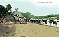
 Grand Palace basin.
 -
 the site of Lixus
 -
 Larache at the mouth of the Oued Loukous.
 -
 El Ksar 1900


References edit
- ^ "Complexe du bas Loukkos". Ramsar Sites Information Service. Retrieved 25 April 2018.
- ^ Mapa general que comprehende los Reynos de Marruecos, Fez, Argel y Túnez Material cartográfico / Compuesto Con los mejores Mapas, y con lo que escribieron Mármol, Torres, Haedo, Dapper, Abreville, Daviti, La Mote y otros. Por D. Tomás López y Vargas, Geógrafo por S. M. de sus dominios, de la Real Academia de San Fernando, de la Real Sociedad Bascongada de los Amigos del País, y de la Real de Buenas Letras de Sevilla Archived 2017-09-28 at the Wayback Machine.
- ^ Prehistoria de España: Trabajos dedicados al IV Congreso Internacional, Santiago Alcobé y Noguer
- ^ C.Michael Hogan. 2011. Alboran Sea. eds. P. Saundry & C. J. Cleveland. Encyclopedia of Earth. National Council for Science and the Environment. Washington DC
- ^ M. Ponsich, "Territoires utiles du Maroc punique," in H. G. Niemeyer, ed. Phoenizier im Westen. Mainz, 1982, 438.
- ^ Chisholm, Hugh, ed. (1911). "Al Kasr al Kebir". Encyclopædia Britannica. 1 (11th ed.). Cambridge University Press. p. 686.
- ^ Chisholm, Hugh, ed. (1911). "Al Kasr al Kebir". Encyclopædia Britannica. 1 (11th ed.). Cambridge University Press. p. 686.
- ^ Тур Хейердал, «Ра», гл. 11.
35°12′15″N 6°08′34″W / 35.20417°N 6.14278°W