


Summary
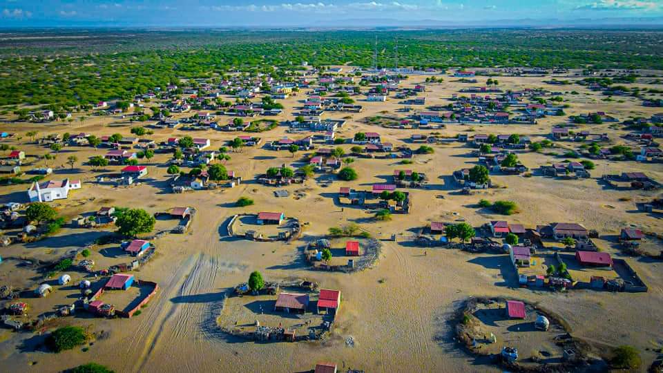
Lughaya (Arabic: لوغهيا) is a coastal town in the northwestern Awdal region of Somaliland.[2]
Lughaya | |
|---|---|
Town | |

 | |
 Lughaya Location in Somaliland  Lughaya Lughaya (Somaliland) | |
| Coordinates: 10°43′07″N 43°56′11″E / 10.71861°N 43.93639°E | |
| Country | |
| Region | Awdal |
| District | Lughaya District |
| Government | |
| • Mayor | Abdullahi Ali Aw Nuur[1] |
| Time zone | UTC+3 (EAT) |
| Climate | BWh |
Demographics edit
The broader Lughaya District has a total population of 101,104 residents.[2] The town is mainly inhabited by the Mahad 'Ase subclan of the Gadabuursi Dir clan who make up the predominant clan in the district,[3][4] dominating local government representation and having always occupied the seat of the mayor.[5][6][1]
Malte Sommerlatte (2000) states:
"In the centre of the study area are the Gadabursi, who extend from the coastal plains around Lughaye, through the Baki and Borama districts into the Ethiopian highlands west of Jijiga."[7]
In the Ruin and Renewal: The story of Somaliland (2004), the author states:
"So too is the boundary of Lughaya district whose predominant (if not exclusive) inhabitants are today Gadabursi."[4]
The FSAU Monthly Food Security Report March (2003) states that the Gadabuursi clan are the main local inhabitants of the Lughaya District whilst Issa pastoralists migrate to the region seasonally from Ethiopia:
"Following discussions with the Issa (from Ethiopia) and Gadabursi (local inhabitants) livestock owners and local leaders in Gerissa , Jidhi, Karuure, Ceel Gal, Kalalwe and Osooli."[8]
There is also a sizeable minority of the Issa subclan of the Dir who mainly inhabit the Zeila District.[9]
See also edit
Notes edit
- ^ a b Sarman, J (2018). UNICEF support reaches families affected by Cyclone Sagar.
{{cite book}}: CS1 maint: numeric names: authors list (link) - ^ a b "Regions, districts, and their populations: Somalia 2005 (draft)" (PDF). UNDP. Archived from the original (PDF) on 28 July 2017. Retrieved 21 September 2013.
- ^ Ambroso, Guido (August 2002). Pastoral society and transnational refugees: population movements in Somaliland and eastern Ethiopia. UNHCR Brussels.
Chart showing the Gadabursi inhabiting the Lughaya district
- ^ a b "RUIN AND RENEWAL: THE STORY OF SOMALILAND". 2004.
So too is the boundary of Lughaya district whose predominant (if not exclusive) inhabitants are today Gadabursi.
- ^ Interface (2015). PILLARS OF PEACE Confronting the Future of Somaliland’s Democracy: Lessons from a Decade of Multi-Partyism and the Way Forward (PDF).
{{cite book}}: CS1 maint: numeric names: authors list (link) - ^ "NEC Starts to release Provisional Results of 5 electoral districts". Somaliland Standard. 2 June 2021. Archived from the original on 3 June 2021. Retrieved 3 June 2021.
- ^ "An Ecological Assessment of the Coastal Plains of North Western Somalia (Somaliland)" (PDF). 2000. p. 11.
In the centre of the study area are the Gadabursi, who extend from the coastal plains around Lughaye, through the Baki and Borama districts into the Ethiopian highlands west of Jijiga.
- ^ An FSAU Awdal Situation Analysis focusing on Livestock in the Region (PDF). 2003. p. 6. Retrieved 2020-02-03.
Following discussions with the Issa (from Ethiopia) and Gadabursi (local inhabitants) livestock owners and local leaders in Gerissa, Xariradd, Jidhi, Karuure, Ceel Gal, Zeyla, Lughaye, Kalalwe and Osooli.
- ^ Ambroso, Guido (August 2002). Pastoral society and transnational refugees: population movements in Somaliland and eastern Ethiopia. UNHCR Brussels.
References edit
- Somaliland Regions Regions of Somaliland