


Summary
Lutayan, officially the Municipality of Lutayan (Hiligaynon: Banwa sang Lutayan; Maguindanaon: Inged nu Lutayan, Jawi: ايڠد نو لتاين; Tagalog: Bayan ng Lutayan), is a 2nd class municipality in the province of Sultan Kudarat, Philippines. According to the 2020 census, it has a population of 65,644 people.[3]
Lutayan | |
|---|---|
| Municipality of Lutayan | |
| Other transcription(s) | |
| • Jawi | لتاين |
 Flag  Seal | |
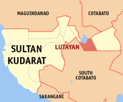 Map of Sultan Kudarat with Lutayan highlighted | |
OpenStreetMap .mw-parser-output .locmap .od{position:absolute}.mw-parser-output .locmap .id{position:absolute;line-height:0}.mw-parser-output .locmap .l0{font-size:0;position:absolute}.mw-parser-output .locmap .pv{line-height:110%;position:absolute;text-align:center}.mw-parser-output .locmap .pl{line-height:110%;position:absolute;top:-0.75em;text-align:right}.mw-parser-output .locmap .pr{line-height:110%;position:absolute;top:-0.75em;text-align:left}.mw-parser-output .locmap .pv>div{display:inline;padding:1px}.mw-parser-output .locmap .pl>div{display:inline;padding:1px;float:right}.mw-parser-output .locmap .pr>div{display:inline;padding:1px;float:left}html.skin-theme-clientpref-night .mw-parser-output .od,html.skin-theme-clientpref-night .mw-parser-output .od .pv>div,html.skin-theme-clientpref-night .mw-parser-output .od .pl>div,html.skin-theme-clientpref-night .mw-parser-output .od .pr>div{background:#000;color:#fff}html.skin-theme-clientpref-night .mw-parser-output .locmap{filter:grayscale(0.6)}@media(prefers-color-scheme:dark){html.skin-theme-clientpref-os .mw-parser-output .locmap{filter:grayscale(0.6)}html.skin-theme-clientpref-os .mw-parser-output .od,html.skin-theme-clientpref-os .mw-parser-output .od .pv>div,html.skin-theme-clientpref-os .mw-parser-output .od .pl>div,html.skin-theme-clientpref-os .mw-parser-output .od .pr>div{background:#000;color:#fff}}  Lutayan Location within the Philippines | |
| Coordinates: 6°36′N 124°51′E / 6.6°N 124.85°E | |
| Country | Philippines |
| Region | Soccsksargen |
| Province | Sultan Kudarat |
| District | 1st district |
| Barangays | 11 (see Barangays) |
| Government | |
| • Type | Sangguniang Bayan |
| • Mayor | Pax Mangudadatu |
| • Vice Mayor | Datu Prince Raden M. Sakaluran |
| • Representative | Bai Rihan M. Sakaluran |
| • Municipal Council | Members |
| • Electorate | 34,816 voters (2022) |
| Area | |
| • Total | 271.00 km2 (104.63 sq mi) |
| Elevation | 25 m (82 ft) |
| Highest elevation | 66 m (217 ft) |
| Lowest elevation | 7 m (23 ft) |
| Population (2020 census)[3] | |
| • Total | 65,644 |
| • Density | 240/km2 (630/sq mi) |
| • Households | 13,113 |
| Economy | |
| • Income class | 2nd municipal income class |
| • Poverty incidence | 39.90 |
| • Revenue | ₱ 225.9 million (2020) |
| • Assets | ₱ 234.9 million (2020) |
| • Expenditure | ₱ 216.4 million (2020) |
| • Liabilities | ₱ 112.3 million (2020) |
| Service provider | |
| • Electricity | South Cotabato 1 Electric Cooperative (SOCOTECO 1) |
| Time zone | UTC+8 (PST) |
| ZIP code | 9803 |
| PSGC | 126507000 |
| IDD : area code | +63 (0)64 |
| Native languages | Hiligaynon Maguindanao Tagalog |
| Website | www |
This lakeside town shares Lake Buluan with its neighboring municipality, Buluan, Maguindanao. Lutayan was carved out from Buluan in 1966. The first appointed mayor was the wife of the then-mayor of Buluan, a royalty from the Buayan Sultanate, Bai Linilang Mangelen. She was also the first ever elected Mayor of the town and served for two decades.
Geography edit
Barangays edit
Lutayan is politically subdivided into 11 barangays. Each barangay consists of puroks while some have sitios.
- Antong
- Bayasong
- Blingkong
- Lutayan Proper
- Maindang
- Mamali
- Manili
- Palavilla
- Sampao
- Sisiman
- Tamnag
Climate edit
| Climate data for Lutayan, Sultan Kudarat | |||||||||||||
|---|---|---|---|---|---|---|---|---|---|---|---|---|---|
| Month | Jan | Feb | Mar | Apr | May | Jun | Jul | Aug | Sep | Oct | Nov | Dec | Year |
| Mean daily maximum °C (°F) | 31 (88) |
31 (88) |
32 (90) |
32 (90) |
31 (88) |
30 (86) |
30 (86) |
30 (86) |
30 (86) |
30 (86) |
30 (86) |
31 (88) |
31 (87) |
| Mean daily minimum °C (°F) | 23 (73) |
23 (73) |
23 (73) |
24 (75) |
24 (75) |
24 (75) |
24 (75) |
24 (75) |
24 (75) |
24 (75) |
24 (75) |
23 (73) |
24 (74) |
| Average precipitation mm (inches) | 64 (2.5) |
45 (1.8) |
59 (2.3) |
71 (2.8) |
140 (5.5) |
179 (7.0) |
192 (7.6) |
198 (7.8) |
163 (6.4) |
147 (5.8) |
113 (4.4) |
66 (2.6) |
1,437 (56.5) |
| Average rainy days | 12.2 | 10.3 | 12.7 | 15.7 | 26.0 | 27.4 | 28.1 | 28.2 | 26.0 | 26.7 | 22.9 | 16.6 | 252.8 |
| Source: Meteoblue[5] | |||||||||||||
Demographics edit
| Year | Pop. | ±% p.a. |
|---|---|---|
| 1970 | 9,581 | — |
| 1975 | 6,730 | −6.84% |
| 1980 | 19,090 | +23.18% |
| 1990 | 30,276 | +4.72% |
| 1995 | 34,654 | +2.56% |
| 2000 | 40,881 | +3.61% |
| 2007 | 51,640 | +3.27% |
| 2010 | 56,179 | +3.11% |
| 2020 | 65,644 | +1.52% |
| Source: Philippine Statistics Authority[6][7][8][9] | ||
Economy edit
References edit
- ^ Municipality of Lutayan | (DILG)
- ^ "2015 Census of Population, Report No. 3 – Population, Land Area, and Population Density" (PDF). Philippine Statistics Authority. Quezon City, Philippines. August 2016. ISSN 0117-1453. Archived (PDF) from the original on May 25, 2021. Retrieved July 16, 2021.
- ^ a b Census of Population (2020). "Region XII (Soccsksargen)". Total Population by Province, City, Municipality and Barangay. Philippine Statistics Authority. Retrieved 8 July 2021.
- ^ "PSA Releases the 2018 Municipal and City Level Poverty Estimates". Philippine Statistics Authority. 15 December 2021. Retrieved 22 January 2022.
- ^ "Lutayan: Average Temperatures and Rainfall". Meteoblue. Retrieved 15 May 2020.
- ^ Census of Population (2015). "Region XII (Soccsksargen)". Total Population by Province, City, Municipality and Barangay. Philippine Statistics Authority. Retrieved 20 June 2016.
- ^ Census of Population and Housing (2010). "Region XII (Soccsksargen)" (PDF). Total Population by Province, City, Municipality and Barangay. National Statistics Office. Retrieved 29 June 2016.
- ^ Censuses of Population (1903–2007). "Region XII (Soccsksargen)". Table 1. Population Enumerated in Various Censuses by Province/Highly Urbanized City: 1903 to 2007. National Statistics Office.
{{cite encyclopedia}}: CS1 maint: numeric names: authors list (link) - ^ "Province of Sultan Kudarat". Municipality Population Data. Local Water Utilities Administration Research Division. Retrieved 17 December 2016.
- ^ "Poverty incidence (PI):". Philippine Statistics Authority. Retrieved December 28, 2020.
- ^ "Estimation of Local Poverty in the Philippines" (PDF). Philippine Statistics Authority. 29 November 2005.
- ^ "2003 City and Municipal Level Poverty Estimates" (PDF). Philippine Statistics Authority. 23 March 2009.
- ^ "City and Municipal Level Poverty Estimates; 2006 and 2009" (PDF). Philippine Statistics Authority. 3 August 2012.
- ^ "2012 Municipal and City Level Poverty Estimates" (PDF). Philippine Statistics Authority. 31 May 2016.
- ^ "Municipal and City Level Small Area Poverty Estimates; 2009, 2012 and 2015". Philippine Statistics Authority. 10 July 2019.
- ^ "PSA Releases the 2018 Municipal and City Level Poverty Estimates". Philippine Statistics Authority. 15 December 2021. Retrieved 22 January 2022.
External links edit
- Lutayan Profile at PhilAtlas.com
- Lutayan Profile at the DTI Cities and Municipalities Competitive Index
- Philippine Standard Geographic Code
- Philippine Census Information
- Local Governance Performance Management System