


Summary
The Main Central Road popularly known as MC Road is the arterial State Highway starting from Kesavadasapuram in Trivandrum city and ends at Angamaly, a suburb of Kochi city in Ernakulam District, in the state of Kerala, India. It is designated as State Highway 1 by the Kerala Public Works Department. The highway was built by Raja Kesavadas, Dewan of Travancore, in the 1790s. Plan for a new highway called Thiruvananthapuram–Angamaly Greenfield Highway, which runs parallel to the MC Road is proposed and is under early stage of development.
 | ||||
|---|---|---|---|---|
 SH 1 highlighted in red | ||||
| Route information | ||||
| Maintained by Kerala Public Works Department | ||||
| Length | 240.6 km (149.5 mi) | |||
| Existed | 1790s–present | |||
| Component highways | National Highway 183 near Chengannur to Kottayam | |||
| Major junctions | ||||
| South end | Kesavadasapuram, Thiruvananthapuram | |||
| North end | ||||
| Location | ||||
| Country | India | |||
| State | Kerala | |||
| Districts | Thiruvananthapuram, Kollam, Pathanamthitta, Alappuzha, Kottayam, Ernakulam | |||
| Highway system | ||||
| State Highways in Kerala | ||||
| ||||
Route description edit
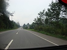
This road starts from National Highway 66 at Kesavadasapuram in Thiruvananthapuram the capital city of Kerala and joins the NH 544 at Angamaly[1] Ernakulam district. The MC Road passes through Venjaramoodu, Kilimanoor, Nilamel, Ayoor, Kottarakkara, Enathu, Adoor, Pandalam, Chengannur, Tiruvalla, Changanassery, Kottayam, Ettumanoor, Kuravilangad, Monippally, Puthuvely, Koothattukulam, Muvattupuzha, Pezhakkappilly , Mannoor , Pulluvazhy, Perumbavoor and Kalady. In addition, an MC bypass road linking thaikkad with Vettu road junction near NH66 in Kazhakoottam is also part of the road in Thiruvananthapuram district. Before NH 544 was built through Angamaly, MC road extended up to Karukutty village 6 km (3.7 mi) away from Angamaly town in the Chalakudy road. A section of this road between Mulakuzha and Kottayam is now upgraded as a section of NH 183. MC Road is a popular route to access the shrine of Sabarimala. It covers many important towns of Central and South Kerala.
History edit
The highway was built by Raja Kesavadas, the dewan of the Travancore Kingdom. The MC road was renovated under the World Bank aided 'Kerala State Transport Project (2006)'. The upgrading was carried out in two phases. Under phase 1, two stretches, Thaikkod (near Venjarammoodu) – Chengannur and Muvattupuzha – Angamaly were upgraded and works were completed in 2010. In addition, a new road link to NH 66 has been completed between Thaikkad and Vettu road (near Kazhakootam in Trivandrum). In phase 2, the Chengannur – Ettumanoor 47 km (29 mi) stretch was upgraded. The road has a total width of 10 metres (33 ft) and facilitates two-lane traffic. The road also have a 7-metre (23 ft) carriageway and a sealed shoulder, having width of 1.5 metres (4 ft 11 in). The project also features protection walls and adequate drainage facilities. The construction of seven bridges has also been envisaged as part of the project. This includes the constructions at Neelimangalam, Manipuzha, Pannikuzhy, Arattukadavu, Illimala, Thondara, and Kallissery. In addition, three existing bridges along the route is also widened. The work was launched on 14 September 2014 and completed in 2018.[2]
Main intersections edit
- Kesavadasapuram in Trivandrum joins with the National Highway 66
- Mannanthala -(Sreekaryam - Peroorkada Road)
- Vattapara - (Pothencode- Nedumangad Road)
- Vembayam - State Highway 47 (Kerala) connecting Attingal and Nedumangadu
- Thaikkad jn - MC Bypass road
- Venjarammoodu - State Highway 47 (Kerala) connecting Attingal and Nedumangadu
- Kilimanoor - State Highway 46 (Kerala) connecting Attingal and Kilimanoor
- Nilamel - State Highway 64 Connecting Varkala & Madathara
- Ayoor (Kollam Road & State Highway 48)
- Kottarakara NH 744 (Kollam- Thirumangalam Road crosses)
- Adoor Central Junction (Pathanamthitta road National Highway 183A (India) & State Highway 5 )
- Adoor High School Junction (State Highway 5)
- Pandalam Medical Mission Junction (Pandalam- Nooranad- Kayamkulam road via Kudassanad)
- Pandalam (Mavelikkara-Pathanamthitta road)
- Pandalam (Kulanada T.B Junction Pandalam - Aranmula road via Kulanada)
- Mulakuzha (Mavelikara- road via Kodukulanji)
- Chengannur (Mavelikara road via Puliyoor, Kerala)
- Thiruvalla (SH-07 towards Pathanamthitta & Kumbazha)
- Thiruvalla (Ambalapuzha, Kayamkulam road)
- Changanassery (Alapuzha road)
- Changanassery (Vakathanam Road & Vazhoor Road)
- Kottayam (NH 220 towards Kumily & Teni)
- Kottayam Baker Jn. (Kumarakom) & Cherthala
- Ettumanur (MG University road)
- Ettumanur (Pala & Poonjar road)
- Ettumanur (Vaikom & Ernakulam road)
- Kuravilangad (Vaikom & Alapuzha road)
- Kuravilangad (Pala road)
- Kuravilangad (Njeezhoor & Peruva & piravom road)
- Monippally (Ernakulam-Palai road, Piravom, Peruva, Vaikom, Ramapuram, Uzhavoor road)
- Koothattukulam (Palai, Piravom & Kalamassery Proposed NH Road)
- Muvattupuzha (Thodupuzha Road, Main Eastern Highway End Reach)
- Muvattupuzha (Kochi-Madurai NH 49 Intersection)
- Perumbavoor (Aluva-Munnar Road & Kolenchery Road)
- Kalady (Malayattoor Road & Aluva Deasm Road)
- Kalady (Mattoor Junction, Nedumbassery Airport, North Paravur Road)
- Angamali (NH 544)
Surveillance edit
The Motor Vehicles Department, in partnership with the Kerala Road Safety Authority (KRSA) and the police has installed automatic traffic enforcement camera systems in between Venjaramoodu - Chengannur section of MC road for detecting speed violations of vehicles.[3]