
KNOWPIA
WELCOME TO KNOWPIA

Mandres-sur-Vair 
Summary
Mandres-sur-Vair (French pronunciation: [mɑ̃dʁ syʁ vɛʁ] ⓘ, literally Mandres on Vair) is a commune in the Vosges département in Grand Est in northeastern France.
Mandres-sur-Vair | |
|---|---|
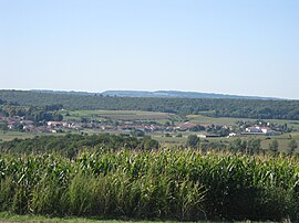 A general view of Mandres-sur-Vair | |
 Coat of arms | |
Location of Mandres-sur-Vair .mw-parser-output .locmap .od{position:absolute}.mw-parser-output .locmap .id{position:absolute;line-height:0}.mw-parser-output .locmap .l0{font-size:0;position:absolute}.mw-parser-output .locmap .pv{line-height:110%;position:absolute;text-align:center}.mw-parser-output .locmap .pl{line-height:110%;position:absolute;top:-0.75em;text-align:right}.mw-parser-output .locmap .pr{line-height:110%;position:absolute;top:-0.75em;text-align:left}.mw-parser-output .locmap .pv>div{display:inline;padding:1px}.mw-parser-output .locmap .pl>div{display:inline;padding:1px;float:right}.mw-parser-output .locmap .pr>div{display:inline;padding:1px;float:left}html.skin-theme-clientpref-night .mw-parser-output .od,html.skin-theme-clientpref-night .mw-parser-output .od .pv>div,html.skin-theme-clientpref-night .mw-parser-output .od .pl>div,html.skin-theme-clientpref-night .mw-parser-output .od .pr>div{background:#000;color:#fff}html.skin-theme-clientpref-night .mw-parser-output .locmap{filter:grayscale(0.6)}@media(prefers-color-scheme:dark){html.skin-theme-clientpref-os .mw-parser-output .locmap{filter:grayscale(0.6)}html.skin-theme-clientpref-os .mw-parser-output .od,html.skin-theme-clientpref-os .mw-parser-output .od .pv>div,html.skin-theme-clientpref-os .mw-parser-output .od .pl>div,html.skin-theme-clientpref-os .mw-parser-output .od .pr>div{background:#000;color:#fff}}  Mandres-sur-Vair  Mandres-sur-Vair | |
| Coordinates: 48°13′29″N 5°53′36″E / 48.2247°N 5.8933°E | |
| Country | France |
| Region | Grand Est |
| Department | Vosges |
| Arrondissement | Neufchâteau |
| Canton | Vittel |
| Intercommunality | CC Terre d'eau |
| Government | |
| • Mayor (2020–2026) | Daniel Thiriat[1] |
| Area 1 | 11.93 km2 (4.61 sq mi) |
| Population (2021)[2] | 438 |
| • Density | 37/km2 (95/sq mi) |
| Time zone | UTC+01:00 (CET) |
| • Summer (DST) | UTC+02:00 (CEST) |
| INSEE/Postal code | 88285 /88000 |
| Elevation | 319–421 m (1,047–1,381 ft) (avg. 340 m or 1,120 ft) |
| 1 French Land Register data, which excludes lakes, ponds, glaciers > 1 km2 (0.386 sq mi or 247 acres) and river estuaries. | |
Inhabitants are called Mandrions.
Unusual feature edit
The private school "Bienheureux Frassati" opened to students in 2007.[3] The school, which takes its name from Pier Giorgio Frassati, is a traditional Roman Catholic school for boys, installed in a former château.
See also edit
References edit
- ^ "Répertoire national des élus: les maires". data.gouv.fr, Plateforme ouverte des données publiques françaises (in French). 2 December 2020.
- ^ "Populations légales 2021". The National Institute of Statistics and Economic Studies. 28 December 2023.
- ^ Website of the Collège Frassati (in French)
Wikimedia Commons has media related to Mandres-sur-Vair.