


Summary
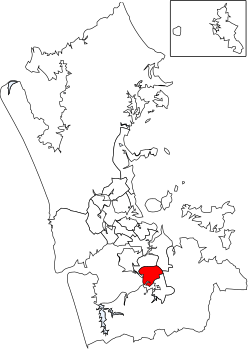
The Manurewa Local Board is one of the 21 local boards of the Auckland Council. It is overseen by the Manurewa-Papakura ward councillor.[3]
Manurewa Local Board | |
|---|---|
 | |
| Country | New Zealand |
| Region | Auckland |
| Territorial authority | Auckland |
| Ward | Manurewa-Papakura ward |
| Legislated | 2010 |
| Government | |
| • Board chair | Joseph Allan |
| Area | |
| • Land | 37.12 km2 (14.33 sq mi) |
| Population (June 2023)[2] | |
| • Total | 110,900 |
Local Board Members | |
|---|---|
| Structure | |
Manurewa Action Team | 8 / 8 |
| Elections | |
Last election | 2022 |
Next election | 2025 |
The local board area includes the areas of Wiri, Hillpark, Manurewa East, Homai, Weymouth and Wattle Downs.[3]
Demographics edit
Manurewa Local Board Area covers 37.12 km2 (14.33 sq mi)[1] and had an estimated population of 110,900 as of June 2023,[2] with a population density of 2,988 people per km2.
| Year | Pop. | ±% p.a. |
|---|---|---|
| 2006 | 77,190 | — |
| 2013 | 82,242 | +0.91% |
| 2018 | 95,670 | +3.07% |
| Source: [4] | ||
Manurewa Local Board Area had a population of 95,670 at the 2018 New Zealand census, an increase of 13,428 people (16.3%) since the 2013 census, and an increase of 18,480 people (23.9%) since the 2006 census. There were 23,562 households, comprising 47,841 males and 47,826 females, giving a sex ratio of 1.0 males per female. The median age was 29.5 years (compared with 37.4 years nationally), with 24,687 people (25.8%) aged under 15 years, 23,985 (25.1%) aged 15 to 29, 39,021 (40.8%) aged 30 to 64, and 7,977 (8.3%) aged 65 or older.
Ethnicities were 29.2% European/Pākehā, 26.0% Māori, 36.3% Pacific peoples, 25.4% Asian, and 2.7% other ethnicities. People may identify with more than one ethnicity.
The percentage of people born overseas was 36.3, compared with 27.1% nationally.
Although some people chose not to answer the census's question about religious affiliation, 28.1% had no religion, 46.1% were Christian, 2.8% had Māori religious beliefs, 7.6% were Hindu, 2.7% were Muslim, 1.6% were Buddhist and 5.4% had other religions.
Of those at least 15 years old, 10,281 (14.5%) people had a bachelor's or higher degree, and 14,673 (20.7%) people had no formal qualifications. The median income was $27,400, compared with $31,800 nationally. 7,311 people (10.3%) earned over $70,000 compared to 17.2% nationally. The employment status of those at least 15 was that 35,928 (50.6%) people were employed full-time, 7,569 (10.7%) were part-time, and 4,377 (6.2%) were unemployed.[4]
2019–2022 term edit
The current board members, elected at the 2019 local body elections, are:[5]
- Joseph Allan, Manurewa Action Team – (7027 votes)
- Anne Candy, Manurewa Action Team – (6712 votes)
- Rangi Mclean, Manurewa Action Team – (6695 votes)
- Ken Penney, Manurewa Action Team – (6682 votes)
- Glenn Murphy, Manurewa Action Team – (6041 votes)
- Melissa Atama, Manurewa Action Team – (6030 votes)
- David Pizzini, Manurewa Action Team – (5843 votes)
- Tabetha Gorrie, Manurewa Action Team – (4963 votes)
2016–2019 term edit
The board members who served from the 2016 local body elections to the 2019 elections were:[6]
- Angela Dalton (Chair)
- Stella Cattle (Deputy chair)
- Joseph Allan
- Rangi McLean
- Sarah Colcord
- Angela Cunningham-Marino
- Ken Penney
- Dave Pizzini
References edit
- ^ a b "ArcGIS Web Application". statsnz.maps.arcgis.com. Retrieved 25 February 2022.
- ^ a b "Subnational population estimates (RC, SA2), by age and sex, at 30 June 1996-2023 (2023 boundaries)". Statistics New Zealand. Retrieved 25 October 2023. (regional councils); "Subnational population estimates (TA, SA2), by age and sex, at 30 June 1996-2023 (2023 boundaries)". Statistics New Zealand. Retrieved 25 October 2023. (territorial authorities); "Subnational population estimates (urban rural), by age and sex, at 30 June 1996-2023 (2023 boundaries)". Statistics New Zealand. Retrieved 25 October 2023. (urban areas)
- ^ a b "About Local Board". aucklandcouncil.govt.nz. Auckland Council.
- ^ a b "Statistical area 1 dataset for 2018 Census". Statistics New Zealand. March 2020. Manurewa Local Board Area (CMB07619). 2018 Census place summary: Manurewa Local Board Area
- ^ "Local board members" (PDF). Auckland Council. 18 October 2019. Retrieved 27 October 2019.
- ^ "Contact Local Board". aucklandcouncil.govt.nz. Auckland Council.
37°01′15″S 174°53′49″E / 37.0208658°S 174.89691986°E