
KNOWPIA
WELCOME TO KNOWPIA

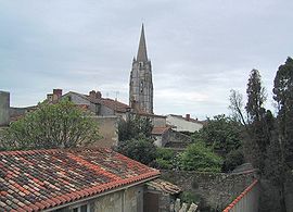
Marennes, Charente-Maritime 
Summary
Marennes (French pronunciation: [maʁɛn]) is a former commune in the Charente-Maritime department, southwestern France. On 1 January 2019, it was merged into the new commune Marennes-Hiers-Brouage.[2]
Marennes | |
|---|---|
Part of Marennes-Hiers-Brouage | |
 | |
 Coat of arms | |
Location of Marennes .mw-parser-output .locmap .od{position:absolute}.mw-parser-output .locmap .id{position:absolute;line-height:0}.mw-parser-output .locmap .l0{font-size:0;position:absolute}.mw-parser-output .locmap .pv{line-height:110%;position:absolute;text-align:center}.mw-parser-output .locmap .pl{line-height:110%;position:absolute;top:-0.75em;text-align:right}.mw-parser-output .locmap .pr{line-height:110%;position:absolute;top:-0.75em;text-align:left}.mw-parser-output .locmap .pv>div{display:inline;padding:1px}.mw-parser-output .locmap .pl>div{display:inline;padding:1px;float:right}.mw-parser-output .locmap .pr>div{display:inline;padding:1px;float:left}html.skin-theme-clientpref-night .mw-parser-output .od,html.skin-theme-clientpref-night .mw-parser-output .od .pv>div,html.skin-theme-clientpref-night .mw-parser-output .od .pl>div,html.skin-theme-clientpref-night .mw-parser-output .od .pr>div{background:#000;color:#fff}html.skin-theme-clientpref-night .mw-parser-output .locmap{filter:grayscale(0.6)}@media(prefers-color-scheme:dark){html.skin-theme-clientpref-os .mw-parser-output .locmap{filter:grayscale(0.6)}html.skin-theme-clientpref-os .mw-parser-output .od,html.skin-theme-clientpref-os .mw-parser-output .od .pv>div,html.skin-theme-clientpref-os .mw-parser-output .od .pl>div,html.skin-theme-clientpref-os .mw-parser-output .od .pr>div{background:#000;color:#fff}}  Marennes  Marennes | |
| Coordinates: 45°49′21″N 1°06′19″W / 45.8225°N 1.1052°W | |
| Country | France |
| Region | Nouvelle-Aquitaine |
| Department | Charente-Maritime |
| Arrondissement | Rochefort |
| Canton | Marennes |
| Commune | Marennes-Hiers-Brouage |
| Area 1 | 20.09 km2 (7.76 sq mi) |
| Population (2019)[1] | 5,628 |
| • Density | 280/km2 (730/sq mi) |
| Time zone | UTC+01:00 (CET) |
| • Summer (DST) | UTC+02:00 (CEST) |
| Postal code | 17320 |
| Elevation | 0–21 m (0–69 ft) |
| 1 French Land Register data, which excludes lakes, ponds, glaciers > 1 km2 (0.386 sq mi or 247 acres) and river estuaries. | |
History edit
For a long time it was one of the most prosperous cities of the Saintonge due to its location in the middle of the salt-water marshes at a time where salt was a valuable commodity. Marennes is a center for oyster farming.
Population edit
|
|
References edit
External links edit
Wikimedia Commons has media related to Marennes (Charente-Maritime).