


Summary
Martinvelle (French pronunciation: [maʁtɛ̃vɛl] ⓘ) is a commune in the Vosges department in Grand Est in northeastern France.
Martinvelle | |
|---|---|
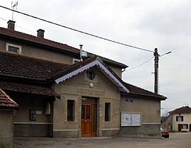 The town hall in Martinvelle | |
 Coat of arms | |
Location of Martinvelle .mw-parser-output .locmap .od{position:absolute}.mw-parser-output .locmap .id{position:absolute;line-height:0}.mw-parser-output .locmap .l0{font-size:0;position:absolute}.mw-parser-output .locmap .pv{line-height:110%;position:absolute;text-align:center}.mw-parser-output .locmap .pl{line-height:110%;position:absolute;top:-0.75em;text-align:right}.mw-parser-output .locmap .pr{line-height:110%;position:absolute;top:-0.75em;text-align:left}.mw-parser-output .locmap .pv>div{display:inline;padding:1px}.mw-parser-output .locmap .pl>div{display:inline;padding:1px;float:right}.mw-parser-output .locmap .pr>div{display:inline;padding:1px;float:left}html.skin-theme-clientpref-night .mw-parser-output .od,html.skin-theme-clientpref-night .mw-parser-output .od .pv>div,html.skin-theme-clientpref-night .mw-parser-output .od .pl>div,html.skin-theme-clientpref-night .mw-parser-output .od .pr>div{background:#000;color:#fff}html.skin-theme-clientpref-night .mw-parser-output .locmap{filter:grayscale(0.6)}@media(prefers-color-scheme:dark){html.skin-theme-clientpref-os .mw-parser-output .locmap{filter:grayscale(0.6)}html.skin-theme-clientpref-os .mw-parser-output .od,html.skin-theme-clientpref-os .mw-parser-output .od .pv>div,html.skin-theme-clientpref-os .mw-parser-output .od .pl>div,html.skin-theme-clientpref-os .mw-parser-output .od .pr>div{background:#000;color:#fff}}  Martinvelle  Martinvelle | |
| Coordinates: 47°58′35″N 5°59′54″E / 47.9764°N 5.9983°E | |
| Country | France |
| Region | Grand Est |
| Department | Vosges |
| Arrondissement | Neufchâteau |
| Canton | Darney |
| Intercommunality | CC Vosges côté Sud-Ouest |
| Government | |
| • Mayor (2020–2026) | Monique Roche[1] |
| Area 1 | 24.73 km2 (9.55 sq mi) |
| Population (2021)[2] | 133 |
| • Density | 5.4/km2 (14/sq mi) |
| Time zone | UTC+01:00 (CET) |
| • Summer (DST) | UTC+02:00 (CEST) |
| INSEE/Postal code | 88291 /88410 |
| Elevation | 249–370 m (817–1,214 ft) (avg. 336 m or 1,102 ft) |
| 1 French Land Register data, which excludes lakes, ponds, glaciers > 1 km2 (0.386 sq mi or 247 acres) and river estuaries. | |
Inhabitants are called Martinvillois.
Geography edit
The commune lies on the southwest of the Vôge Plateau and at the edge of the department, beside the adjacent Haute-Saône department. The northern part of the commune is within the Forest of Darney.
The village is 25 kilometres (16 mi) southeast of Contrexéville, 10 kilometres (6 mi) to the south-south-east of Monthureux-sur-Saône and 9 kilometres (6 mi) north of Corre.
The intersection of the 48th parallel north with the 6th meridian east lies within the commune.
History edit
The village's history is more linked with that of the adjacent Franche-Comté than that of Lorraine. Until the French Revolution the lords of Passavant ruled here.
The coat of arms includes images of an oak leaf and of a mechanical hay rake, reflecting the importance here both of the forest and of agriculture, and recalling the factory that manufactured agricultural implements locally between 1860 and 1962.
See also edit
References edit
- ^ "Répertoire national des élus: les maires". data.gouv.fr, Plateforme ouverte des données publiques françaises (in French). 9 August 2021.
- ^ "Populations légales 2021". The National Institute of Statistics and Economic Studies. 28 December 2023.