


Summary
Matanog, officially the Municipality of Matanog (Iranun and Mëranaw: Ingëd a Matanog; Filipino: Bayan ng Matanog; Arabic: بلدية ماتانوج) , is a 4th class municipality in the province of Maguindanao del Norte, Philippines. According to the 2020 census, it has a population of 36,034 people.[3]
Matanog
Ingëd a Matanog Bayan ng Matanog ماتانوج | |
|---|---|
| Municipality of Matanog | |
 Poblacion of Matanog | |
 Seal | |
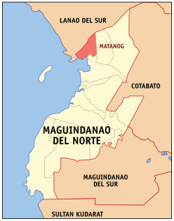 Map of Maguindanao del Norte with Matanog highlighted | |
OpenStreetMap .mw-parser-output .locmap .od{position:absolute}.mw-parser-output .locmap .id{position:absolute;line-height:0}.mw-parser-output .locmap .l0{font-size:0;position:absolute}.mw-parser-output .locmap .pv{line-height:110%;position:absolute;text-align:center}.mw-parser-output .locmap .pl{line-height:110%;position:absolute;top:-0.75em;text-align:right}.mw-parser-output .locmap .pr{line-height:110%;position:absolute;top:-0.75em;text-align:left}.mw-parser-output .locmap .pv>div{display:inline;padding:1px}.mw-parser-output .locmap .pl>div{display:inline;padding:1px;float:right}.mw-parser-output .locmap .pr>div{display:inline;padding:1px;float:left}html.skin-theme-clientpref-night .mw-parser-output .od,html.skin-theme-clientpref-night .mw-parser-output .od .pv>div,html.skin-theme-clientpref-night .mw-parser-output .od .pl>div,html.skin-theme-clientpref-night .mw-parser-output .od .pr>div{background:#000;color:#fff}html.skin-theme-clientpref-night .mw-parser-output .locmap{filter:grayscale(0.6)}@media(prefers-color-scheme:dark){html.skin-theme-clientpref-os .mw-parser-output .locmap{filter:grayscale(0.6)}html.skin-theme-clientpref-os .mw-parser-output .od,html.skin-theme-clientpref-os .mw-parser-output .od .pv>div,html.skin-theme-clientpref-os .mw-parser-output .od .pl>div,html.skin-theme-clientpref-os .mw-parser-output .od .pr>div{background:#000;color:#fff}}  Matanog Location within the Philippines | |
| Coordinates: 7°28′N 124°15′E / 7.47°N 124.25°E | |
| Country | Philippines |
| Region | Bangsamoro Autonomous Region in Muslim Mindanao |
| Province | Maguindanao del Norte |
| District | Lone district |
| Founded | August 25, 1975 |
| Barangays | 8 (see Barangays) |
| Government | |
| • Type | Sangguniang Bayan |
| • Mayor | Zohria S. Bansil-Guro |
| • Vice Mayor | Sanaira I. Ali |
| • Representative | Sittie Shahara "Dimple" I. Mastura |
| • Municipal Council | Members |
| • Electorate | 19,592 voters (2022) |
| Area | |
| • Total | 146.50 km2 (56.56 sq mi) |
| Elevation | 328 m (1,076 ft) |
| Highest elevation | 1,064 m (3,491 ft) |
| Lowest elevation | 7 m (23 ft) |
| Population (2020 census)[3] | |
| • Total | 36,034 |
| • Density | 250/km2 (640/sq mi) |
| • Households | 5,711 |
| Economy | |
| • Income class | 4th municipal income class |
| • Poverty incidence | 64.66 |
| • Revenue | ₱ 132.3 million (2020) |
| • Assets | ₱ 441.9 million (2020) |
| • Expenditure | ₱ 105.4 million (2020) |
| • Liabilities | ₱ 353.5 million (2020) |
| Service provider | |
| • Electricity | Maguindanao Electric Cooperative (MAGELCO) |
| Time zone | UTC+8 (PST) |
| ZIP code | 9613 |
| PSGC | 153809000 |
| IDD : area code | +63 (0)64 |
| Native languages | Maguindanao Maranao Tagalog |
| Website | www |
History edit
Establishment and early years edit
Matanog was established by virtue of Presidential Decree No. 780, signed by President Ferdinand Marcos on August 25, 1975, when six barangays of Parang in what was then Maguindanao were separated. The seat of government was designated at Barangay Langkong.[5]
Matanog is among the municipalities inhabited mainly by the Iranun people, along with Buldon and Barira;[6] much parts of these had constituted the Camp Abubakar, the main camp of the Moro National Liberation Front (MILF) since the 1980s.[6][7] The local government units had held office either in Cotabato City or in Parang since the Marcos presidency, with the municipal halls in Matanog and Buldon being almost vacant.[6]
Narciso Ramos Highway (Parang–Malabang Road), connecting the present-day provinces of Maguindanao del Norte and Lanao del Sur and was completed on April 15, 1996, was later extended to Langkong junction which became the access road leading to the rebel camp.[7]
2000 battles edit
Matanog was among those municipalities where series of battles occurred, leading to the camp's fall in 2000. Part of the Narciso Ramos Highway in the municipality was heavily fortified; as being the gateway to the camp, became easy for government armor assets to access. During the military's Operation Dominance from April 29 to June 3, MILF installations in eight barangays were captured; 63 soldiers and some 424 rebels were killed.[7]
Post-battle edit
The recovery of the municipality following the war of 2000 became difficult due to political rivalry that caused rido between the two factions, Imam and Macapeges–Lidasan clans,[8] one of the region's well-known disputes.[9][10] The feud began when Nasser Imam defeated incumbent mayor Kahir Macapeges in 2001, with the election results being disputed.[10] It worsened armed hostilities among political clans, especially in 2002;[6][8] and left nine relatives and two others dead.[9][10] In what would be the largest settlement,[9] the families formally reconciled in Davao City on January 30, 2008.[10][11]
The town was part of the province of Shariff Kabunsuan from October 2006 until its nullification by the Supreme Court in July 2008.
Geography edit
Barangays edit

Matanog is politically subdivided into 8 barangays. Each barangay consists of puroks while some have sitios.
- Bayanga Norte
- Bayanga Sur
- Bugasan Norte
- Bugasan Sur (Poblacion)
- Kidama
- Sapad
- Langco
- Langkong
Climate edit
| Climate data for Matanog, Maguindanao | |||||||||||||
|---|---|---|---|---|---|---|---|---|---|---|---|---|---|
| Month | Jan | Feb | Mar | Apr | May | Jun | Jul | Aug | Sep | Oct | Nov | Dec | Year |
| Mean daily maximum °C (°F) | 28 (82) |
28 (82) |
28 (82) |
29 (84) |
28 (82) |
27 (81) |
27 (81) |
27 (81) |
27 (81) |
27 (81) |
27 (81) |
28 (82) |
28 (82) |
| Mean daily minimum °C (°F) | 22 (72) |
22 (72) |
22 (72) |
23 (73) |
23 (73) |
23 (73) |
22 (72) |
22 (72) |
22 (72) |
22 (72) |
23 (73) |
22 (72) |
22 (72) |
| Average precipitation mm (inches) | 236 (9.3) |
225 (8.9) |
244 (9.6) |
235 (9.3) |
304 (12.0) |
287 (11.3) |
200 (7.9) |
175 (6.9) |
158 (6.2) |
200 (7.9) |
287 (11.3) |
243 (9.6) |
2,794 (110.2) |
| Average rainy days | 24.3 | 22.3 | 26.0 | 27.2 | 28.3 | 27.2 | 25.8 | 24.8 | 22.2 | 25.4 | 27.2 | 25.8 | 306.5 |
| Source: Meteoblue (modeled/calculated data, not measured locally)[12] | |||||||||||||
Demographics edit
| Year | Pop. | ±% p.a. |
|---|---|---|
| 1980 | 8,300 | — |
| 1990 | 14,759 | +5.93% |
| 1995 | 16,018 | +1.55% |
| 2000 | 19,006 | +3.73% |
| 2007 | 36,319 | +9.34% |
| 2010 | 23,269 | −14.96% |
| 2015 | 29,770 | +4.80% |
| 2020 | 36,034 | +3.83% |
| Source: Philippine Statistics Authority[13][14][15] | ||
Economy edit
Gross Domestic Product The Gross Domestic Product of the Municipality (2022) is 9,128,700,000(PHP).
References edit
- ^ Municipality of Matanog | (DILG)
- ^ "2015 Census of Population, Report No. 3 – Population, Land Area, and Population Density" (PDF). Philippine Statistics Authority. Quezon City, Philippines. August 2016. ISSN 0117-1453. Archived (PDF) from the original on May 25, 2021. Retrieved July 16, 2021.
- ^ a b Census of Population (2020). "Bangsamoro (BARMM)". Total Population by Province, City, Municipality and Barangay. Philippine Statistics Authority. Retrieved 8 July 2021.
- ^ "PSA Releases the 2018 Municipal and City Level Poverty Estimates". Philippine Statistics Authority. 15 December 2021. Retrieved 22 January 2022.
- ^ "Presidential Decree No. 780, s. 1975". Official Gazette (Philippines). Government of the Philippines. August 25, 1975.
- ^ a b c d Quimpo, Nathan Gilbert (October 2004). Contested Democracy and the Left in the Philippines after Marcos (thesis) (PDF). Canberra, Australia: Australian National University. Retrieved April 12, 2024 – via ANU Open Research Library.
- ^ a b c Restoring a fragile peace: The 2000 Battle for Central Mindanao (PDF). Fort Bonifacio, Taguig: Operations Research Center, Philippine Army. 2019. Retrieved April 11, 2024.
- ^ a b Unson, John (December 2, 2002). "More troops fielded vs clan war". The Philippine Star. Retrieved April 13, 2024.
- ^ a b c Conflict management program in the Philippines: A semi-annual report (01 July 2007 – 31 December 2007) (PDF). The Asia Foundation. n.d. p. 3. Retrieved April 13, 2024 – via United States Agency for International Development.
- ^ a b c d Torres, Wilfredo III (March 2010). "Part I, Chapter V: Letting a Thousand Flowers Bloom: Clan Conflicts and their Management". Challenges to Human Security in Complex Situations: The case of conflict in the Southern Philippines (PDF). Malaysia; India: Asian Disaster Reduction and Response Network. p. 49. Retrieved April 13, 2024 – via Global Interagency Security Forum.
- ^ "2 clans in Matanog settle rido, sign peace pact". MindaNews. January 30, 2008. Retrieved April 13, 2024.
- ^ "Matanog, Maguindanao : Average Temperatures and Rainfall". Meteoblue. Retrieved 19 January 2019.
- ^ Census of Population (2015). "ARMM – Autonomous Region in Muslim Mindanao". Total Population by Province, City, Municipality and Barangay. Philippine Statistics Authority. Retrieved 20 June 2016.
- ^ Census of Population and Housing (2010). "ARMM – Autonomous Region in Muslim Mindanao" (PDF). Total Population by Province, City, Municipality and Barangay. National Statistics Office. Retrieved 29 June 2016.
- ^ Censuses of Population (1903–2007). "ARMM – Autonomous Region in Muslim Mindanao". Table 1. Population Enumerated in Various Censuses by Province/Highly Urbanized City: 1903 to 2007. National Statistics Office.
{{cite encyclopedia}}: CS1 maint: numeric names: authors list (link)
External links edit
- Philippine Standard Geographic Code
- Matanog Profile at the DTI Cities and Municipalities Competitive Index
- Philippine Census Information
- Local Governance Performance Management System