


Summary
Mayakovskoye (Russian: Маяко́вское; German: Nemmersdorf; Lithuanian: Nemirkiemis) is a rural locality (a settlement) in Gusevsky District of Kaliningrad Oblast, Russia, located on the banks of the Angrapa River. It lies approximately 11 kilometres (7 mi) south-west of Gusev.[4]
Mayakovskoye
Маяко́вское | |
|---|---|
 The Angrapa River in Mayakovskoye | |
Location of Mayakovskoye .mw-parser-output .locmap .od{position:absolute}.mw-parser-output .locmap .id{position:absolute;line-height:0}.mw-parser-output .locmap .l0{font-size:0;position:absolute}.mw-parser-output .locmap .pv{line-height:110%;position:absolute;text-align:center}.mw-parser-output .locmap .pl{line-height:110%;position:absolute;top:-0.75em;text-align:right}.mw-parser-output .locmap .pr{line-height:110%;position:absolute;top:-0.75em;text-align:left}.mw-parser-output .locmap .pv>div{display:inline;padding:1px}.mw-parser-output .locmap .pl>div{display:inline;padding:1px;float:right}.mw-parser-output .locmap .pr>div{display:inline;padding:1px;float:left}html.skin-theme-clientpref-night .mw-parser-output .od,html.skin-theme-clientpref-night .mw-parser-output .od .pv>div,html.skin-theme-clientpref-night .mw-parser-output .od .pl>div,html.skin-theme-clientpref-night .mw-parser-output .od .pr>div{background:#000;color:#fff}html.skin-theme-clientpref-night .mw-parser-output .locmap{filter:grayscale(0.6)}@media(prefers-color-scheme:dark){html.skin-theme-clientpref-os .mw-parser-output .locmap{filter:grayscale(0.6)}html.skin-theme-clientpref-os .mw-parser-output .od,html.skin-theme-clientpref-os .mw-parser-output .od .pv>div,html.skin-theme-clientpref-os .mw-parser-output .od .pl>div,html.skin-theme-clientpref-os .mw-parser-output .od .pr>div{background:#000;color:#fff}} 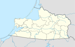 Mayakovskoye Location of Mayakovskoye  Mayakovskoye Mayakovskoye (European Russia)  Mayakovskoye Mayakovskoye (Russia) | |
| Coordinates: 54°31′12″N 22°03′56″E / 54.52000°N 22.06556°E | |
| Country | Russia |
| Federal subject | Kaliningrad Oblast |
| Administrative district | Gusevsky District |
| First mentioned | 1515 |
| Elevation | 60 m (200 ft) |
| Population | |
| • Total | 913 |
| Time zone | UTC+2 (MSK–1 |
| Postal code(s)[3] | 238033 |
| OKTMO ID | 27709000231 |
The village became known during World War II on October 22, 1944 as the site of the first Soviet war crime on German territory against German women, French and Belgian POWs—the Nemmersdorf massacre.
History edit

The first documented mention of Nemmersdorf was in 1515 in a decree of the Insterburg Central Office.[5] At that time, it was part of the Kingdom of Poland as a fief held by the Teutonic Order,[6] and from 1525 held by Ducal Prussia. A prehistoric cemetery was located near the village.[4] From the 18th century it was part of the Kingdom of Prussia, and from 1871 to 1945 it was also part of Germany. In 1878, the village had a population of 479, predominantly employed in agriculture and cattle and horse breeding.[4] By 1910, it counted a total of 484 residents, further increasing to 637 by 1939.[7] Between 1874 and 1945, Nemmersdorf was the principal urban locality in Gumbinnen administrative district within the county of Nemmersdorf-Gumbinnen in East Prussia. The municipality included thirteen rural communities.[8]
On October 22, 1944, Nemmersdorf was the scene of a massacre perpetrated by the Soviet soldiers against German civilians and French and Belgian noncombatants. Determining the facts has aroused controversy.[9]
Following World War II, Nemmersdorf came under the Soviet administration and was given its present name in 1946. The native German population who survived the massacre either fled or were formally expelled in accordance to the Potsdam Agreement.
Religion edit
The Nemmersdorf stone church was constructed on the orders of Albert, Duke of Prussia, but it was completed after his death, in 1589. It was a simple rectangular bay near the Angrapa River, with sacristy facing east. In 1769, the church was renovated with an altar from the workshop of Isaac of Riga.[10]
Despite the damage in 1944, the church has survived two world wars. The nave has been preserved, now with a flat ceiling, but the tower is missing. After 1945, the church was used for other purposes and as a business building. In the early 1960s, it was rebuilt and now serves as a cultural center and library.
Until 1945, Nemmersdorf was predominantly Protestant with thirty Protestant clergy.[11] During the Soviet period, church life was discouraged. Only in the 1990s was the new Kaliningrad Oblast Evangelical Church established. The Parish belongs to the Provost's Kaliningrad Evangelical Lutheran Church in European Russia.[12]
References edit
Notes edit
- ^ Russian Federal State Statistics Service (2011). Всероссийская перепись населения 2010 года. Том 1 [2010 All-Russian Population Census, vol. 1]. Всероссийская перепись населения 2010 года [2010 All-Russia Population Census] (in Russian). Federal State Statistics Service.
- ^ "Об исчислении времени". Официальный интернет-портал правовой информации (in Russian). June 3, 2011. Retrieved January 19, 2019.
- ^ Почта России. Информационно-вычислительный центр ОАСУ РПО. (Russian Post). Поиск объектов почтовой связи (Postal Objects Search) (in Russian)
- ^ a b c Słownik geograficzny Królestwa Polskiego i innych krajów słowiańskich, Tom VI (in Polish). Warszawa. 1885. p. 951.
{{cite book}}: CS1 maint: location missing publisher (link) - ^ Kreisgemeinschaft Gumbinnen. Nemmersdorf mit weiteren Gütern (in German)
- ^ Górski, Karol (1949). Związek Pruski i poddanie się Prus Polsce: zbiór tekstów źródłowych (in Polish). Poznań: Instytut Zachodni. pp. 96–97, 214–215.
- ^ Verwaltungsgeschichte.de Landkreis Gumbinnen (in German)
- ^ Territorial.de. Amtsbezirk Nemmersdorf (in German)
- ^ Fisch, Bernhard. Nemmersdorf, Oktober 1944: Was in Ostpreußen tatsächlich geschah. Berlin: 1997. ISBN 3-932180-26-7
- ^ "Portal für bedeutende Personen berühmte Orte Reisetipps - Ostpreussen".
- ^ Friedwald Moeller, Altpreußisches evangelisches Pfarrerbuch von der Reformation bis zur Vertreibung im Jahre 1945; Hamburg, 1968; page 100.
- ^ "Evangelisch-lutherische Propstei Kaliningrad/Königsberg". Archived from the original on August 29, 2011. Retrieved October 19, 2011.
Sources edit
- Brandenburg, Christel Weiss and Dan Laing. Ruined by the Reich: Memoir of an East Prussian Family, 1916-1945. McFarland & Company. ISBN 0-7864-1615-7
- Dönhoff, Marion. Namen die keiner mehr nennt. Munich: Deutscher Taschenbücher Verlag, 1962.
- Fisch, Bernhard. Nemmersdorf, Oktober 1944: Was in Ostpreußen tatsächlich geschah. Berlin: 1997. ISBN 3-932180-26-7
- Samuel, Wolfgang. "War on the Ground", in The War of Our Childhood: Memories of World War II, University Press of Mississippi. ISBN 1-57806-482-1
- Thorwald, Jürgen.Wielka ucieczka (Große Flucht). Kraków: Wydawnictwo Literackie, 1998. ISBN 83-08-02890-X