
KNOWPIA
WELCOME TO KNOWPIA

Mbarara Airport 
Summary
Mbarara Airport (IATA: MBQ, ICAO: HUMA) is a civilian airport that serves the city of Mbarara in the Ankole sub-region, Uganda. It is one of 12 upcountry airports administered by the Civil Aviation Authority of Uganda.[3] The airport was originally named Nyakisharara Airport.
Mbarara Airport Nyakisharara International Airport | |||||||||||
|---|---|---|---|---|---|---|---|---|---|---|---|
| Summary | |||||||||||
| Airport type | Public | ||||||||||
| Owner | Civil Aviation Authority of Uganda | ||||||||||
| Serves | Mbarara, Uganda | ||||||||||
| Elevation AMSL | 4,600 ft / 1,402 m | ||||||||||
| Coordinates | 00°33′18″S 30°36′00″E / 0.55500°S 30.60000°E | ||||||||||
| Map | |||||||||||
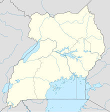 MBQ Location of Mbarara Airport in Uganda | |||||||||||
| Runways | |||||||||||
| |||||||||||
The airport is approximately 9 kilometres (5.6 mi) north-west of Mbarara, on the road to Bwizibwera and Ibanda.[1]
The runway length includes gravelled overruns of 190 and 85 metres (623 and 279 ft) on the east and west ends respectively.
Airlines and destinations edit
| Airlines | Destinations |
|---|---|
| BAR Aviation | Entebbe, Jinja, Pakuba[4] |
See also edit
 Uganda portal
 Aviation portal
- List of airports in Uganda
- Transport in Uganda
References edit
External links edit
- OpenStreetMap - Mbarara Airport
- SkyVector - Mbarara Airport
- OurAirports - Mbarara Airport
- Uganda Civil Aviation Authority Homepage
- Accident history for Mbarara Airport at Aviation Safety Network