


Summary
Melita (/məˈlɪtə/) is a town located in the south-western corner of the Canadian province of Manitoba. It is surrounded by the Municipality of Two Borders and occupies a bend of the Souris River. Graham Creek runs along the west side of town and into the Souris River. The population at the 2016 census was 1,042.[2] It sits at the junction of Highways 3 and 83, approximately 320 km southwest of Winnipeg. Melita is known as the "Grasslands Bird Capital of Manitoba"[3] and is located in Manitoba's banana belt.
Melita | |
|---|---|
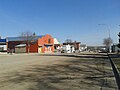
 Front Street | |
 Town boundaries | |
 Melita | |
| Coordinates: 49°16′05″N 100°59′45″W / 49.26806°N 100.99583°W | |
| Country | Canada |
| Province | Manitoba |
| Rural Municipality | Two Borders |
| Area | |
| • Total | 3.19 km2 (1.23 sq mi) |
| Population | |
| • Total | 1,041 |
| • Density | 330/km2 (850/sq mi) |
| Time zone | UTC−5 (CST) |
| • Summer (DST) | UTC−6 (CDT) |
History edit
Evidence of First Nations habitation in the area includes the Linear Mounds Archaeological Site and the Brockinton Archaeological Site, which have provided artifacts dating back to 800 AD.[4] The site has been designated a National Historic Site of Canada.[5]
Charles West was the first recorded European settler, in 1879.[6] The early inhabitants chose the name "Melita" for the town after hearing a Bible reading (Acts 28:1) about St. Paul's shipwreck on the island of Malta (Melita is an older name for the island).[7]
-
 Main Street (2014)
 -
 Water tower


Demographics edit
In the 2021 Census of Population conducted by Statistics Canada, Melita had a population of 1,041 living in 465 of its 548 total private dwellings, a change of -0.1% from its 2016 population of 1,042. With a land area of 3.19 km2 (1.23 sq mi), it had a population density of 326.3/km2 (845.2/sq mi) in 2021.[1]
Notable people edit
- James Breakey, politician
- John Cobb (Manitoba politician), politician
- Jim Downey (politician), politician
- Betty Fox, cancer research activist and mother of Terry Fox, was raised in Melita.[8]
- Wayne Hall, professional hockey player
- Kory Karlander, professional hockey player
- J. Arthur Ross, politician
See also edit
References edit
- ^ a b "Population and dwelling counts: Canada, provinces and territories, and census subdivisions (municipalities), Manitoba". Statistics Canada. 9 February 2022. Retrieved 20 February 2022.
- ^ "Melita, Town". Census Profile. Statistics Canada.
- ^ "Bird Watching". Town of Melita. Retrieved 15 January 2013.
- ^ "Historical Interest". Town of Melita. Retrieved 15 January 2013.
- ^ Linear Mounds. Canadian Register of Historic Places. Retrieved 23 May 2012.
- ^ "Our First Century", Melita-Arthur History Committee, 1983
- ^ Ham, Penny (1980). Place Names of Manitoba. Saskatoon, Saskatchewan: Western Producer Prairie Books. pp. 83. ISBN 9780888330673.
- ^ Martin, Sandra (18 June 2011). "Betty Fox, cancer-advocacy champion and mother of Terry Fox, dies". The Globe and Mail. Retrieved 27 June 2011.
External links edit
- Official website