
KNOWPIA
WELCOME TO KNOWPIA

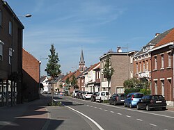
Merksplas 
Summary
Merksplas (Dutch pronunciation: [ˈmɛr(ə)ksplɑs]) is a municipality located in the Belgian province of Antwerp. The municipality comprises only the town of Merksplas proper. In 2021, Merksplas had a total population of 8,616.[2] The total area is 44.56 km2.
Merksplas | |
|---|---|
 | |
 Flag  Coat of arms | |
Location of Merksplas .mw-parser-output .locmap .od{position:absolute}.mw-parser-output .locmap .id{position:absolute;line-height:0}.mw-parser-output .locmap .l0{font-size:0;position:absolute}.mw-parser-output .locmap .pv{line-height:110%;position:absolute;text-align:center}.mw-parser-output .locmap .pl{line-height:110%;position:absolute;top:-0.75em;text-align:right}.mw-parser-output .locmap .pr{line-height:110%;position:absolute;top:-0.75em;text-align:left}.mw-parser-output .locmap .pv>div{display:inline;padding:1px}.mw-parser-output .locmap .pl>div{display:inline;padding:1px;float:right}.mw-parser-output .locmap .pr>div{display:inline;padding:1px;float:left}html.skin-theme-clientpref-night .mw-parser-output .od,html.skin-theme-clientpref-night .mw-parser-output .od .pv>div,html.skin-theme-clientpref-night .mw-parser-output .od .pl>div,html.skin-theme-clientpref-night .mw-parser-output .od .pr>div{background:#000;color:#fff}html.skin-theme-clientpref-night .mw-parser-output .locmap{filter:grayscale(0.6)}@media(prefers-color-scheme:dark){html.skin-theme-clientpref-os .mw-parser-output .locmap{filter:grayscale(0.6)}html.skin-theme-clientpref-os .mw-parser-output .od,html.skin-theme-clientpref-os .mw-parser-output .od .pv>div,html.skin-theme-clientpref-os .mw-parser-output .od .pl>div,html.skin-theme-clientpref-os .mw-parser-output .od .pr>div{background:#000;color:#fff}}  Merksplas Location in Belgium
Location of Merksplas in the province of Antwerp 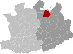 | |
| Coordinates: 51°22′N 04°52′E / 51.367°N 4.867°E | |
| Country | |
| Community | Flemish Community |
| Region | Flemish Region |
| Province | Antwerp |
| Arrondissement | Turnhout |
| Government | |
| • Mayor | Frank Wilrycx (LM) |
| • Governing party/ies | LM (Leefbaar Merksplas) |
| Area | |
| • Total | 44.61 km2 (17.22 sq mi) |
| Population (2020-01-01)[1] | |
| • Total | 8,588 |
| • Density | 190/km2 (500/sq mi) |
| Postal codes | 2330 |
| NIS code | 13023 |
| Area codes | 014, 03 |
| Website | www.merksplas.be |
References edit
External links edit
 Media related to Merksplas at Wikimedia Commons
- Official website - Available only in Dutch