


Summary
Miami is a coastal suburb in the City of Gold Coast, Queensland, Australia.[2] At the 2021 census, Miami had a population of 7,445 people.[1]
| Miami Gold Coast, Queensland | |||||||||||||||
|---|---|---|---|---|---|---|---|---|---|---|---|---|---|---|---|
 Nobby Beach at Miami, looking north towards Surfers Paradise | |||||||||||||||
 Miami | |||||||||||||||
 | |||||||||||||||
| Coordinates | 28°04′03″S 153°26′12″E / 28.0675°S 153.4366°E | ||||||||||||||
| Population | 7,445 (2021 census)[1] | ||||||||||||||
| • Density | 2,480/km2 (6,430/sq mi) | ||||||||||||||
| Established | 1920s | ||||||||||||||
| Postcode(s) | 4220 | ||||||||||||||
| Elevation | 7 m (23 ft) | ||||||||||||||
| Area | 3.0 km2 (1.2 sq mi) | ||||||||||||||
| Time zone | AEST (UTC+10:00) | ||||||||||||||
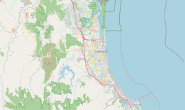
| Location |
| ||||||||||||||
| LGA(s) | City of Gold Coast (Division 12) | ||||||||||||||
| State electorate(s) | |||||||||||||||
| Federal division(s) | Moncrieff | ||||||||||||||
| |||||||||||||||
Geography edit
Miami is located along the Gold Coast Highway, 9 kilometres (5.6 mi) south of Surfers Paradise and 17 kilometres (11 mi) north of the Queensland / New South Wales border at Coolangatta/Tweed Heads.
The town of North Burleigh is located within the suburb (28°03′55″S 153°26′34″E / 28.0652°S 153.4427°E).[3]
Miami has the following mountains:
- North Nobby (28°03′43″S 153°26′26″E / 28.0619°S 153.4406°E) 46 metres (151 ft)[4][5]
- South Nobby (Little Burleigh) (28°04′20″S 153°26′47″E / 28.0721°S 153.4465°E) 7 metres (23 ft)[4][6]
Miami has the following beaches:
- Nobby Beach (28°03′42″S 153°26′35″E / 28.0618°S 153.4431°E) extending north to Mermaid Beach[7]
- Miami Beach (28°04′10″S 153°26′43″E / 28.0695°S 153.4453°E)[7]
- North Burleigh Beach (28°04′29″S 153°26′50″E / 28.0748°S 153.4472°E) extening south to Burleigh Heads[7]
Its commercial activity is mainly confined to the Gold Coast Highway and there is some light industry around Christine Avenue.
The Gold Coast Highway runs north to south through Miami, with Christine Avenue and Pacific Avenue connecting to the west.
History edit

The history of Miami can be dated back to the early 1920s when prospective investors were looking over plans for a new real estate development called Miami Shore at North Burleigh.[8] The name "Miami Shore" was chosen as a reference to Miami Shores, Florida.[9] The investors built their wooden or fibro bungalows on estates such as this, or rented their cottages to holiday makers.[10] They could also stay in the Hotel Miami which opened in 1925 by E. H. Berry.[11] In 1953, tennis courts were constructed.[12] Pizzey Park Sporting Complex was established on 60 hectares (150 acres) in 1969.[13]
Miami State High School opened on 1 January 1963.[14] Because there was a visible rock face remaining from an earlier quarry, the school principal William Callinan covered it up with a set of huge yellow letters saying "HI MIAMI HIGH". It now says just "MIAMI HIGH".[15][16]
On Sunday December 22, 1963, Calvary Memorial Catholic Church was officially opened and dedicated by Archbishop James Duhig. It commemorates those who served in the Korean War.[17]
Miami State School opened on 30 January 1979; it is now within the suburb boundaries of Mermaid Waters.[14]
In 1988, Australian musician John Farnham's music video for the top-10 song "Two Strong Hearts" was filmed outside the famous "Miami Ice" factory at 2015 Gold Coast Highway.[18]
| Age | Suburb of Miami | Queensland Average |
|---|---|---|
| Up to 14 years | 13.6% | 20.8% |
| 15 to 44 years | 45.6% | 43.4% |
| 45 to 64 years | 24.8% | 24.0% |
| 65 years plus | 16.0% | 11.9% |
In the 2016 census, Miami had a population of 6,843 people.[1]
Heritage listings edit

Miami has a number of heritage sites, including:
- 2171 Gold Coast Highway (28°03′48″S 153°26′26″E / 28.0633°S 153.4406°E): Miami State High School Sign [19]
Education edit

Miami State High School is a government secondary (7-12) school for boys and girls at 2137-2205 Gold Coast Highway (28°03′46″S 153°26′16″E / 28.0628°S 153.4378°E).[20][21] In 2018, the school had an enrolment of 1,255 students with 103 teachers (100 full-time equivalent) and 62 non-teaching staff (45 full-time equivalent).[22] It includes a special education program certified through the National Disability Insurance Scheme.[20]
Facilities edit
Miami Day Hospital is a private day hospital at 24 Hillcrest Parade (28°03′47″S 153°26′13″E / 28.0631°S 153.4369°E).[23][24]
Amenities edit

Pizzey Park is a major Gold Coast sporting and recreational located at 80 Pacific Avenue (28°03′50″S 153°25′35″E / 28.0638°S 153.4263°E).[25][26]
Calvary Catholic Church is at 50 Redondo Avenue (28°03′54″S 153°26′28″E / 28.0649°S 153.4411°E). It is part of the Burleigh Heads Catholic Parish within the Archdiocese of Brisbane.[27]
Burleigh Bears Rugby League Football Club is at 80 Pacific Avenue (28°03′48″S 153°25′50″E / 28.0633°S 153.4306°E).[28][29]
Gold Coast Burleigh Golf Club is an 18-hole golf course at 114 Albion Street (28°04′02″S 153°26′05″E / 28.0672°S 153.4348°E).[30][29]
There are two surf life saving clubs in Miami:
- Miami Beach Surf Life Saving Club, 2 Hythe Street (28°04′09″S 153°26′39″E / 28.0692°S 153.4443°E)[31][32]
- North Burleigh Surf Life Saving Club, 293 The Esplanade (28°04′27″S 153°26′47″E / 28.0741°S 153.4463°E)[33][32]
Other sporting teams include the Eastern Cobras.
Transport edit
Miami has two high frequency bus services that run at intervals of 8–15 minutes during peak times. Buses that travel through the suburb are: 700 Broadbeach South - Tweed Heads (the 700 gets extend to the Gold Coast University Hospital between 12am-5am weekdays), 777 Broadbeach South - Gold Coast Airport (777 is an express bus route) and the TX1 Tweed Heads - Dream World (TX1 is a theme park express service only). All bus services on the Gold Coast are provided by Kinetic Group under contract by Translink, a subsidiary of the Department of Transport and Main Roads.
References edit
- ^ a b c Australian Bureau of Statistics (27 June 2017). "Miami (SSC)". 2016 Census QuickStats. Retrieved 20 October 2018.
- ^ "Miami – suburb in City of Gold Coast (entry 46064)". Queensland Place Names. Queensland Government. Retrieved 20 July 2021.
- ^ "North Burleigh – town in City of Gold Coast (entry 47764)". Queensland Place Names. Queensland Government. Retrieved 29 November 2019.
- ^ a b "Mountain peaks and capes - Queensland". Queensland Open Data. Queensland Government. 12 November 2020. Archived from the original on 25 November 2020. Retrieved 25 November 2020.
- ^ "North Nobby – mountain in Gold Coast City (entry 24686)". Queensland Place Names. Queensland Government. Retrieved 25 November 2020.
- ^ "South Nobby – mountain in Gold Coast City (entry 31507)". Queensland Place Names. Queensland Government. Retrieved 25 November 2020.
- ^ a b c "Mountain ranges beaches and sea passages - Queensland". Queensland Open Data. Queensland Government. 12 November 2020. Archived from the original on 25 November 2020. Retrieved 25 November 2020.
- ^ "Advertising". The Brisbane Courier. No. 20, 534. Queensland, Australia. 14 November 1923. p. 11. Archived from the original on 27 January 2022. Retrieved 27 January 2022 – via National Library of Australia.
- ^ "Advertising". The Brisbane Courier. No. 20, 555. Queensland, Australia. 8 December 1923. p. 14. Archived from the original on 25 November 2023. Retrieved 31 January 2023 – via National Library of Australia.
- ^ "What's new on the Gold Coast". Tourism & Events Queensland. Queensland Government. Archived from the original on 1 April 2023. Retrieved 19 November 2023.
- ^ "History". The Miami Tavern, Miami, QLD. Archived from the original on 27 October 2023. Retrieved 19 November 2023.
- ^ "MIAMI TENNIS CLUB". South Coast Bulletin. No. 1591. Queensland, Australia. 19 August 1953. p. 3. Archived from the original on 19 November 2023. Retrieved 20 November 2023 – via National Library of Australia.
- ^ "Pizzey Park Master Plan: Draft Report" (PDF). Gold Coast City Council. p. 11. Archived (PDF) from the original on 20 October 2022. Retrieved 20 November 2023.
- ^ a b Queensland Family History Society (2010), Queensland schools past and present (Version 1.01 ed.), Queensland Family History Society, ISBN 978-1-921171-26-0
- ^ "History". Miami State High School. 26 September 2019. Archived from the original on 10 November 2021. Retrieved 27 January 2022.
- ^ Google (27 January 2022). "MIAMI HIGH sign" (Map). Google Maps. Google. Retrieved 27 January 2022.
- ^ Dunlea, Lea (August 2013). "Golden Jubilee — Calvary War Memorial Church, Miami" (PDF). Burleigh Heads Catholic Parish. Archived (PDF) from the original on 4 April 2021. Retrieved 27 January 2022.
- ^ John Farnham – Two Strong Hearts Archived 10 July 2016 at the Wayback Machine. YouTube music video. Retrieved on 17 January 2013.
- ^ Gold Coast Local Heritage Register - A to M, pp. 77-78
- ^ a b "State and non-state school details". Queensland Government. 9 July 2018. Archived from the original on 21 November 2018. Retrieved 21 November 2018.
- ^ "Miami State High School". Miami State High School. 26 September 2019. Archived from the original on 24 January 2022. Retrieved 27 January 2022.
- ^ "ACARA School Profile 2018". Australian Curriculum, Assessment and Reporting Authority. Archived from the original on 27 August 2020. Retrieved 28 January 2020.
- ^ "Miami Private Hospital | Microsurgical Procedures Gold Coast". Miami Private Hospital. Archived from the original on 20 January 2022. Retrieved 27 January 2022.
- ^ "Landmark Areas - Queensland". Queensland Open Data. Queensland Government. 18 November 2020. Archived from the original on 21 November 2020. Retrieved 21 October 2020.
- ^ "Pizzey Park". Gold Coast City Council. Archived from the original on 14 July 2014. Retrieved 13 July 2014.
- ^ "Pizzey Park – park in City of Gold Coast (entry 50164)". Queensland Place Names. Queensland Government. Retrieved 27 December 2020.
- ^ "Churches". Burleigh Heads Catholic Parish. Archived from the original on 11 December 2021. Retrieved 27 January 2022.
- ^ "Burleigh Bears". The Bears Leagues Club. Archived from the original on 22 December 2021. Retrieved 27 January 2022.
- ^ a b "Building areas - Queensland". Queensland Open Data. Queensland Government. 17 November 2020. Archived from the original on 23 October 2020. Retrieved 17 November 2020.
- ^ "Burleigh Golf Club". Burleigh Golf Club. Archived from the original on 6 May 2021. Retrieved 27 January 2022.
- ^ "Miami Beach SLSC | Gold Coast". Miami Beach SLSC. Archived from the original on 21 July 2021. Retrieved 27 January 2022.
- ^ a b "Building points - Queensland". Queensland Open Data. Queensland Government. 17 November 2020. Archived from the original on 25 November 2020. Retrieved 25 November 2020.
- ^ "North Burleigh Surf Life Saving Club - Gold Coast, Queensland". North Burleigh Surf Life Saving Club. Archived from the original on 17 December 2021. Retrieved 27 January 2022.
Sources edit
- "Gold Coast Local Heritage Register - A to M" (PDF). Gold Coast City Council. Archived from the original (PDF) on 26 August 2020. Retrieved 26 August 2020.
External links edit
- "Miami". Queensland Places. Centre for the Government of Queensland, University of Queensland.
- "Miami history". Gold Coast history and heritage. Gold Coast City Council. Archived from the original on 28 September 2020.
{{cite web}}: CS1 maint: unfit URL (link) - Map of Miami Archived 28 September 2011 at the Wayback Machine