
KNOWPIA
WELCOME TO KNOWPIA

Middleton Island 
Summary
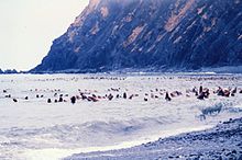
Middleton Island is a small, uninhabited island in the U.S. state of Alaska, located in the Pacific Ocean approximately 80 miles (130 km) southwest of Cordova.[1] The island was briefly home to Middleton Island Air Force Station, an early warning radar station, from 1958 until the station's closure in 1963.[2][3] During the 1964 Alaska earthquake the island was raised an additional 12 feet (3.7 m) above sea level.[4] The island now hosts the unattended Middleton Island Airport and a NEXRAD weather radar.[5][6][7]
Climate edit
Middleton Island has a subpolar oceanic climate (Köppen: Cfc).
| Climate data for Middleton Island, Alaska | |||||||||||||
|---|---|---|---|---|---|---|---|---|---|---|---|---|---|
| Month | Jan | Feb | Mar | Apr | May | Jun | Jul | Aug | Sep | Oct | Nov | Dec | Year |
| Record high °F (°C) | 46 (8) |
46 (8) |
47 (8) |
51 (11) |
63 (17) |
67 (19) |
70 (21) |
72 (22) |
62 (17) |
59 (15) |
53 (12) |
46 (8) |
72 (22) |
| Mean maximum °F (°C) | 43.0 (6.1) |
42.2 (5.7) |
43.7 (6.5) |
47.4 (8.6) |
53.7 (12.1) |
58.6 (14.8) |
63.0 (17.2) |
63.5 (17.5) |
59.1 (15.1) |
52.8 (11.6) |
47.3 (8.5) |
43.2 (6.2) |
65.4 (18.6) |
| Mean daily maximum °F (°C) | 36.2 (2.3) |
36.2 (2.3) |
37.9 (3.3) |
42.1 (5.6) |
46.2 (7.9) |
51.4 (10.8) |
56.4 (13.6) |
57.8 (14.3) |
54.5 (12.5) |
47.3 (8.5) |
42.1 (5.6) |
37.6 (3.1) |
45.5 (7.5) |
| Daily mean °F (°C) | 33.3 (0.7) |
33.3 (0.7) |
34.9 (1.6) |
38.5 (3.6) |
42.9 (6.1) |
47.9 (8.8) |
52.8 (11.6) |
54.4 (12.4) |
51.1 (10.6) |
44.1 (6.7) |
39.3 (4.1) |
34.6 (1.4) |
42.2 (5.7) |
| Mean daily minimum °F (°C) | 30.4 (−0.9) |
30.3 (−0.9) |
31.9 (−0.1) |
34.9 (1.6) |
39.5 (4.2) |
44.3 (6.8) |
49.2 (9.6) |
51.0 (10.6) |
47.7 (8.7) |
40.9 (4.9) |
36.5 (2.5) |
31.6 (−0.2) |
39.0 (3.9) |
| Mean minimum °F (°C) | 19.6 (−6.9) |
20.9 (−6.2) |
22.9 (−5.1) |
27.9 (−2.3) |
34.5 (1.4) |
40.3 (4.6) |
45.1 (7.3) |
46.3 (7.9) |
41.7 (5.4) |
34.1 (1.2) |
27.9 (−2.3) |
22.2 (−5.4) |
14.5 (−9.7) |
| Record low °F (°C) | 9 (−13) |
6 (−14) |
13 (−11) |
14 (−10) |
23 (−5) |
36 (2) |
42 (6) |
42 (6) |
36 (2) |
29 (−2) |
13 (−11) |
12 (−11) |
6 (−14) |
| Average precipitation inches (mm) | 4.14 (105) |
3.40 (86) |
3.01 (76) |
3.39 (86) |
3.34 (85) |
2.22 (56) |
3.13 (80) |
5.18 (132) |
6.83 (173) |
7.35 (187) |
5.96 (151) |
5.17 (131) |
53.12 (1,349) |
| Average snowfall inches (cm) | 6.8 (17) |
6.5 (17) |
6.0 (15) |
2.7 (6.9) |
0.1 (0.25) |
0.0 (0.0) |
0.0 (0.0) |
0.0 (0.0) |
0.0 (0.0) |
0.8 (2.0) |
2.0 (5.1) |
7.5 (19) |
32.4 (82) |
| Source: WRCC[8] | |||||||||||||
See also edit
- List of islands of Alaska
- Official Middleton Island Website
References edit
- ^ U.S. Geological Survey Geographic Names Information System: Middleton Island
- ^ Fussell, E.B. (September 1, 1955). "Army Racing Winter in North". Seattle Post-Intelligencer. Retrieved February 25, 2014.
- ^ "Information for Middleton Island AFS, AK". Radomes, Inc. Retrieved February 25, 2014.
- ^ "U.S.S. Coldbrook-Middleton Island". National Geographic. March 7, 2010. Archived from the original on August 17, 2016. Retrieved July 24, 2016.
- ^ U.S. Geological Survey Geographic Names Information System: Middleton Island (airport).
- ^ FAA Airport Form 5010 for MDO PDF. Federal Aviation Administration. Effective August 25, 2011.
- ^ "WSR-88D Radar List (156 sites)" (PDF). National Weather Service. June 27, 2011. Retrieved February 25, 2014.
- ^ "MIDDLETON ISLAND, ALASKA (505868)". Western Regional Climate Center. Archived from the original on 2023-05-18. Retrieved July 8, 2022.
External links edit
- Important Bird Areas : Middleton Island, Alaska
59°26′N 146°20′W / 59.44°N 146.33°W