


Summary
Mihama (美浜町, Mihama-chō) is a town located in Hidaka District, Wakayama Prefecture, Japan. As of 30 November 2021[update], the town had an estimated population of 6,761 in 3083 households and a population density of 530 persons per km².[1] The total area of the town is 12.77 square kilometres (4.93 sq mi).
Mihama
美浜町 | |
|---|---|
 Mihama town hall | |
 Flag  Emblem | |
 Location of Mihama in Wakayama Prefecture | |
 Mihama Location in Japan | |
| Coordinates: 33°49′N 136°3′E / 33.817°N 136.050°E | |
| Country | Japan |
| Region | Kansai |
| Prefecture | Wakayama |
| District | Hidaka |
| Area | |
| • Total | 12.77 km2 (4.93 sq mi) |
| Population (December 1, 2021) | |
| • Total | 6,761 |
| • Density | 530/km2 (1,400/sq mi) |
| Time zone | UTC+09:00 (JST) |
| City hall address | 1138-278 Wada, Mihama-cho, Hidaka-gun, Wakayama-ken 644-0044 |
| Website | Official website |
| Symbols | |
| Flower | Sunflower |
| Tree | Pine |

Geography edit
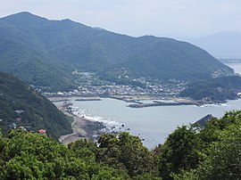
Mihama is located on the coast in central Wakayama Prefecture, facing the Kii Channel to the southwest. The eastern part of the town is part of the Hidaka Plain and is the center of the city. The western part is designated as Enjukaigan Prefectural Natural Park. The highest point is Mount Nishiyama, with an elevation of 329 meters.
Neighboring municipalities edit
Wakayama Prefecture
Climate edit
Mihama has a Humid subtropical climate (Köppen Cfa) characterized by warm summers and cool winters with light to no snowfall. The average annual temperature in Mihama is 16.8 °C. The average annual rainfall is 1878 mm with September as the wettest month. The temperatures are highest on average in August, at around 26.7 °C, and lowest in January, at around 7.3 °C.[2] The area is subject to typhoons in summer.
Demographics edit
Per Japanese census data,[3] the population of Mihama has remained fairly steady over the past 70 years.
| Year | Pop. | ±% |
|---|---|---|
| 1920 | 5,799 | — |
| 1930 | 6,863 | +18.3% |
| 1940 | 6,960 | +1.4% |
| 1950 | 8,667 | +24.5% |
| 1960 | 8,550 | −1.3% |
| 1970 | 8,741 | +2.2% |
| 1980 | 8,832 | +1.0% |
| 1990 | 8,920 | +1.0% |
| 2000 | 8,802 | −1.3% |
| 2010 | 8,077 | −8.2% |
| 2020 | 6,867 | −15.0% |
History edit
The area of the modern town of Inami was within ancient Kii Province. The villages of Matsubara, Mio and Wada were established with the creation of the modern municipalities system on April 1, 1889. These three villages merged on October 1, 1954 to form the town of Mihama.
Government edit
Mihama has a mayor-council form of government with a directly elected mayor and a unicameral city council of 10 members. Inami collectively with the other municipalities of Hidaka District, contributes three members to the Wakayama Prefectural Assembly. In terms of national politics, the town is part of Wakayama 3rd district of the lower house of the Diet of Japan.
Economy edit
The economy of Mihama is centered on commercial fishing and agriculture. The main catch is (Shirasu, spiny lobster, and abalone). The main crops are rice and cucumbers.
Education edit
Mihama has two public elementary schools and one public middle schools operated by the town government. The town does not have a high school.
Transportation edit
Railway edit
Mihama has no passenger rail service. The nearest train station is Gobō Station on the JR West Kisei Main Line in the neighboring city of Gobō
Highways edit
Mihama is not on any national highway or expressway.
Local attractions edit
- Hinomisaki Lighthouse
References edit
External links edit
 Media related to Mihama, Wakayama at Wikimedia Commons
- Mihama official website (in Japanese)