


Summary
Milbrulong is a locality in the central east part of the Riverina region of New South Wales, Australia.
| Milbrulong New South Wales | |
|---|---|
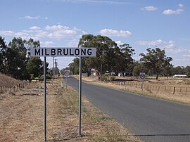 Entering Milbrulong | |
 Milbrulong | |
| Coordinates | 35°15′0″S 146°52′0″E / 35.25000°S 146.86667°E |
| Population | 366 (2006 census)[1] |
| Postcode(s) | 2656 |
| Elevation | 123 m (404 ft) |
| Location |
|
| LGA(s) | Lockhart Shire |
| County | Urana |
| State electorate(s) | Wagga Wagga |
| Federal division(s) | Riverina |
The locality is 515 kilometres (320 mi) south west of the state capital, Sydney and 59 kilometres (37 mi) south west of the regional centre Wagga Wagga in the Lockhart Shire local government area. The standard gauge Oaklands railway line passes through the locality. The Milbrulong State Forest is located nearby.[2]
At the 2006 census, Milbrulong had a population of 366.[1]
History edit
The place name Milbrulong is derived from the local Wiradjuri word mulbirrang meaning "Rosella parrot".[3][4]
Milbrulong Post Office opened on 7 August 1899 and closed in 1976.[5]
In May, 1900 Mr .J. H. Menz opened his new hotel at Milbrulong and opposite the proposed site of Milbrulong railway station.[6]
The Milbrulong Railway Station was opened in late 1900.[7]
In November 1916, Mrs Menz sold the Boundary Inn Hotel, Milbrulong to Mr R McLean of Adelong.[8]
Milbrulong Football Club edit

The first published match of the Milbrulong FC was against Lockhart in 1901[9] and they played in the McLauren Football Competition.[10] The club's colours in 1925 were royal blue.[11] In 1954 the club was known as the Maroons.[12] The club played in the following competitions –
- 1901 – McLaurin Football Competition. Gordon McLaurin was the NSW Member for Hume from 1901 to 1904.
- 1902 – 1903: Club active, playing friendly matches against local clubs, but no evidence of playing in an official competition.
- 1904 – Wagga United Football Association.[13]
- 1906 – Greengunyah Football Association.[14] Premiers: Boree Creek FC[15]
- 1907 – Club active, playing friendly matches against local clubs, but no evidence of playing in an official competition.
- 1908 – Lockhart Football Association.[16]
- 1909 – Lockhart & Boree Creek Football Association.
- 1910 – 1911: The Rock Football Association. Premiers: 1910 Finished on top of the ladder.,[17] 1911[18]
- 1912 – Lockhart Football Association. Premiers: Boree Creek FC
- 1913 – Lockhart Football Association. Merged with Tootool FC under the name of Milbrulong FC.[19] Premiers: Oaklands FC.
- 1914 – 1915: Milbrulong Football Association:[20][21] Premiers 1914[22]
- 1916 & 1917: Club in recess due to WW1.
- 1918: Lockhart Football Association: Club reformed.[23] In 1918, club captain, William T. McCarthy died in a truck accident.[24] Runners Up: 1918[25]
- 1919 – 1920: Milbrulong Football Association:[26] In 1919 won by Tootool FC.[27] In 1920 won by Brookdale FC.[28]
- 1921 – Lockhart & District Football Association:[29]
- 1922 – Borree Creek Football Association: Runners Up – 1922[30]
- 1923 – 1924: Lockhart Oaklands Line Football Association:[31] Oaklands FC were undefeated premiers in 1923[32][33] and won in 1924.[34]
- 1925 – Urangeline Football Association: Milbrulong FC played off in the "final", then Lockhart and Milbrulong were both expelled for not playing the grand final on a neutral ground.[35]
- 1926 – 1927: The Rock Football Association: Premiers: Mangoplah FC in 1926 & 1927.
- 1928 – Possibly in recess.
- 1929 – Lockhart & District Lines Football Association:[36]
- 1930 – 1931: The Rock & District Football Association: Milbrulong FC and Tootool FC merged to become Tootool United FC[37] and won the 1930 premiership.[38][39]
- 1932 – Tootool United FC disbanded prior to the 1932 football season.[40]
- 1933 – 1939: The Rock & District Football Association. Milbrulong FC reforms in 1933.[41] Premiers: 1939[42] Runners Up: 1935,[43] 1938 – 1st Grand final drawn,[44] then lost the replay.[45]
- 1940 – Lockhart & District Football League. Won by Osborne FC.
- 1941 – 1944: Club in recess due to WW2.
- 1945 – 1948: Milbrulong & District Football League. Premiers: 1945 – The Rock FC,[46] 1946 – Milbrulong FC,[47] 1947 – The Rock FC,[48] 1948 – Lockhart FC[49]
- 1949 – 1958: Central Riverina Football League – The Milbrulong & DFL changed its name at their 1949 AGM.[50] Premiers: 1949 – Lockhart FC,[51] 1950 – Osborne FC,[52] 1951 – Collingullie,[53] 1952 – Collingullie,[54] 1953 – Boree Creek FC,[55] 1954 – Yerong Creek FC d Milbrulong[56][57]
Gallery edit
-
 The former Boundary Inn Hotel
 -
 Milbrulong water tank
 -
 Milbrulong Public School
 -
 Silos at Milbrulong


| Preceding station | Former Services | Following station | ||
|---|---|---|---|---|
| Napier towards Oaklands
|
Oaklands Line | French Park towards The Rock
| ||
Notes and references edit
- ^ a b Australian Bureau of Statistics (25 October 2007). "Milbrulong (State Suburb)". 2006 Census QuickStats. Retrieved 30 October 2009.
- ^ "Milbrulong". Lockhart Shire. 2022. Retrieved 24 March 2023.
- ^ "Milbrulong". Geographical Names Board of New South Wales. Retrieved 24 March 2023.
- ^ "Rosella". Wiradjuri Condobolin Corporation Language Program. Wiradjuri Condobolin Corporation. Retrieved 24 March 2023.
- ^ Phoenix Auctions History, Post Office List, retrieved 19 January 2021
- ^ "1900 – Items of News". Wagga Wagga Advertiser (NSW). 3 May 1900. p. 2. Retrieved 8 February 2022.
- ^ "1901 – Wagga Police Court". Wagga Wagga Advertiser (NSW). 15 January 1901. p. 3. Retrieved 8 February 2022.
- ^ "1916 – New Hotel Keeper". The Lockhart Review and Oaklands Advertiser (NSW). 22 November 1916. p. 2. Retrieved 8 February 2022.
- ^ "1901 – Lockhart". The Albury Banner and Wodonga Express (NSW). 10 May 1901. p. 16. Retrieved 8 February 2022.
- ^ "1901 – Football". Wagga Wagga Express (NSW). 6 August 1901. p. 4. Retrieved 8 February 2022.
- ^ "1925 – Lockhart". The Albury Banner and Wodonga Express (NSW). 30 October 1925. p. 46. Retrieved 8 February 2022.
- ^ "1954 – Stockton to Coach Milbrulong". The Lockhart Review and Oaklands Advertiser (NSW). 23 March 1954. p. 8. Retrieved 9 February 2022.
- ^ "1904 – Football Fixtures". Wagga Wagga Advertiser (NSW). 25 July 1904. p. 6. Retrieved 25 February 2022.
- ^ "1906 – Lockhart". The Albury Banner and Wodonga Express (NSW). 13 July 1906. p. 2. Retrieved 8 February 2022.
- ^ "1906 – Lockhart". The Albury Banner and Wodonga Express (NSW). 17 August 1906. p. 3. Retrieved 9 February 2022.
- ^ "1908 – Lockhart". The Albury Banner and Wodonga Express (NSW). 10 July 1908. p. 3. Retrieved 8 February 2022.
- ^ "1912 – Lockhart". The Border Morning Mail and Riverina Times (Albury, NSW). 12 August 1912. p. 4. Retrieved 8 February 2022.
- ^ "1911 – Football". The Lockhart Review & Oaklands Advertiser (NSW). 1 August 1911. p. 4. Retrieved 8 February 2022.
- ^ "1913 – Local & General". The Lockhart Review and Oaklands Advertiser (NSW). 16 April 1913. p. 2. Retrieved 8 February 2022.
- ^ "1914 – An association formed at Milbrulong". The Lockhart Review and Oaklands Advertiser (NSW). 13 May 1914. p. 2. Retrieved 8 February 2022.
- ^ "1915 – football". The Lockhart Review and Oaklands Advertiser (NSW). 5 May 1915. Retrieved 8 February 2022.
- ^ "1914 – Milbrulong win Premiership". The Lockhart Review & Oaklands Advertiser (NSW). 12 August 1914. p. 3. Retrieved 8 February 2022.
- ^ "1918 – Milbrulong". The Lockhart Review and Oaklands Advertiser (NSW). 17 April 1918. p. 2. Retrieved 8 February 2022.
- ^ "1918 – Sad Death at Milbrulong". The Lockhart Review and Oaklands Advertiser (NSW). 26 June 1918. p. 2. Retrieved 8 February 2022.
- ^ "1918 – Football Final". The Lockhart Review and Oaklands Advertiser (NSW). 28 August 1918. p. 2. Retrieved 8 February 2022.
- ^ "1919 – Australian Football". Arrow (Sydney, NSW). 8 August 1919. p. 2. Retrieved 8 February 2022.
- ^ "1920 – football: Milbrulong DFA". Daily Advertiser (Wagga Wagga, NSW). 21 April 1920. p. 1. Retrieved 8 February 2022.
- ^ "1920 – Brookdale beats Tootool". The Daily Express (Wagga Wagga, NSW). 11 August 1920. p. 4. Retrieved 8 February 2022.
- ^ "1921 – Football: Meeting at Lockhart". The Daily Express (Wagga Wagga, NSW). 9 April 1921. p. 4. Retrieved 8 February 2022.
- ^ "1922 – Borree Creek FA Grand Final". Narandera Argus and Riverina Advertiser (NSW). 8 September 1922. p. 2. Retrieved 8 February 2022.
- ^ "1923 – Urana". The Albury Banner and Wodonga Express (NSW). 18 May 1923. p. 7. Retrieved 8 February 2022.
- ^ "1923 – Oaklands wins final". The Corowa Free Press (NSW). 21 August 1923. p. 4. Retrieved 8 February 2022.
- ^ "1924 – district News: Lockhart". The Albury Banner and Wodonga Express (NSW). 23 May 1924. p. 21. Retrieved 8 February 2022.
- ^ "Oaklands". The Corowa Free Press (NSW). 5 September 1924. p. 4. Retrieved 8 February 2022.
- ^ "1925 – Lockhart". The Albury Banner & Wodonga Express (NSW). 11 September 1925. p. 47. Retrieved 8 February 2022.
- ^ "1929 – Football: Lines Association". The Lockhart Review and Oaklands Advertiser (NSW). 14 May 1929. p. 7. Retrieved 8 February 2022.
- ^ "1930 – For the Ambulance". The Daily Express (Wagga Wagga, NSW). 4 July 1930. p. 2. Retrieved 8 February 2022.
- ^ "1930 – The Rock & District Final". Daily Advertiser (Wagga Wagga, NSW). 12 September 1930. p. 6. Retrieved 8 February 2022.
- ^ "1930 – Final won by Tootool". The Lockhart Review and Oaklands Advertiser (NSW). 16 September 1930. p. 4. Retrieved 8 February 2022.
- ^ "1932 – The Rock & DFL". Daily Advertiser (Wagga Wagga, NSW). 21 April 1932. p. 6. Retrieved 8 February 2022.
- ^ "1933 – The Rock Association Re-forms". The Lockhart Review and Oaklands Advertiser (NSW). 21 March 1933. p. 3. Retrieved 8 February 2022.
- ^ "1939 – Grand Final victory to Milbrulong". The Lockhart Review and Oaklands Advertiser (NSW). 29 August 1939. p. 4. Retrieved 8 February 2022.
- ^ "1935 – Lockhart Premiers". The Lockhart Review and Oaklands Advertiser (NSW). 10 September 1935. p. 6. Retrieved 8 February 2022.
- ^ "1938 – Osborne & Milbrulong to re-play". The Lockhart Review and Oaklands Advertiser (NSW). 23 August 1938. p. 2. Retrieved 8 February 2022.
- ^ "1938 – Osborne Wins Premiership Again". The Lockhart Review and Oaklands Advertiser (NSW). 30 August 1938. p. 2. Retrieved 8 February 2022.
- ^ "1945 – Premiership Banquet". Daily Advertiser (Wagga Wagga, NSW). 16 October 1945. p. 8. Retrieved 6 February 2022.
- ^ "1946 – Milbrulong wins grand final". The Lockhart Review and Oaklands Advertiser (NSW). 3 September 1946. p. 1. Retrieved 8 February 2022.
- ^ "1947 – THE ROCK UNDEFEATED IN MILBRULONG LEAGUE". The Henty Observer and Culcairn Shire Register (NSW). 5 September 1947. p. 6. Retrieved 8 February 2022.
- ^ "1947 – Lockhart Win Milbrulong Premiership By One Point". The Henty Observer and Culcairn Shire Register (NSW). 10 September 1948. p. 8. Retrieved 8 February 2022.
- ^ "1949 – CHANGE OF NAME FOR MILBRULONG LEAGUE". The Henty Observer and Culcairn Shire Register (NSW). 8 April 1949. p. 8. Retrieved 8 February 2022.
- ^ "1949 – Central Riverina League Grand-Final: won by Lockhart". The Henty Observer and Culcairn Shire Register (NSW). 9 September 1949. p. 4. Retrieved 8 February 2022.
- ^ "1950 – Osborne Defeat Yerong Creek in Central Riverina League Premiership". The Observer (Henty, NSW). 8 September 1950. p. 12. Retrieved 8 February 2022.
- ^ "1951 – COLLINGULLIE WINS ITS FIRST PREMIERSHIP". The Lockhart Review and Oaklands Advertiser (NSW). 11 September 1950. p. 2. Retrieved 8 February 2022.
- ^ "1952 – Collingullie win grand final". The Observer (Henty, NSW). 12 September 1952. p. 8. Retrieved 8 February 2022.
- ^ "1953 – Central Riverina League Result". The Lockhart Review and Oaklands Advertiser (NSW). 1 September 1953. p. 8. Retrieved 9 February 2022.
- ^ "1954 – Yerong Creek Win Cent. Riverina League Premiership". The Observer (Henty, NSW). 3 September 1954. p. 8. Retrieved 9 February 2022.
- ^ "1954 – MILBRULONG'S WIND-UP BALL". Daily Advertiser (Wagga Wagga, NSW). 20 September 1954. p. 4. Retrieved 9 February 2022.
External links edit
![]() Media related to Milbrulong at Wikimedia Commons
Media related to Milbrulong at Wikimedia Commons