


Summary
Milecastle 59 (Old Wall) was a milecastle on Hadrian's Wall (grid reference NY48546174).
| Milecastle 59 | |
|---|---|
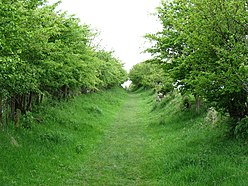 Hadrian's Wall Path in the vicinity of Milecastle 59 | |
 Location within Cumbria | |
| Type | Milecastle |
| Location | |
| Coordinates | 54°56′52″N 2°48′17″W / 54.94769°N 2.804851°W |
| County | Cumbria |
| Country | England |
| Reference | |
| UK-OSNG reference | NY48546174 |
Description edit
Milecastle 59 is on level ground 450 metres east of the hamlet of Oldwall in the civil parish of Irthington.[1] It is directly north of Carlisle Airport. The remains of Milecastle 59 are now under pasture, and it is not visible above ground.[2]
Milecastle 59 was excavated in 1894.[2] The excavations yielded stone foundations, and a pottery assemblage, described as being "Romano-British".[2] A geophysical survey conducted in 1981 indicated that the south wall of the milecastle still survives in situ, but that the side walls are ploughed away or robbed out.[2]
An inscription (RIB 2014) was found some 150 metres south of Milecastle 59 near the Vallum. It reads "C(OHORS) IIII LIN(GONUM) F(ECIT)" which translates as "The Fourth Cohort of Lingonians built this."[3] An altar (RIB 2015) found "near milecastle 59" was dedicated to Mars Cocidius, and erected by a centurion of the First Cohort of Batavians.[4]
Associated turrets edit
Each milecastle on Hadrian's Wall had two associated turret structures. These turrets were positioned approximately one-third and two-thirds of a Roman mile to the west of the Milecastle, and would probably have been manned by part of the milecastle's garrison. The turrets associated with Milecastle 59 are known as Turret 59A and Turret 59B. None of the turrets between Milecastles 59 and 72 were sought or identified prior to 1961.[5]
Turret 59A edit
Turret 59A (grid reference NY48086170) has never been located.[5] Its approximate position has been calculated in relation to other structures on Hadrian's Wall, and it is thought to be located immediately east of Oldwall.[1] Turret 59A was searched for by the 1981 geophysical survey but not located.[5]
Turret 59B edit
Turret 59B (grid reference NY476615) has never been located.[6] Its approximate position can only be estimated in relation to other structures on Hadrian's Wall.
References edit
- ^ a b Historic England, "Hadrian's Wall and vallum from A6071 to ... the road to Oldwall ... in wall miles 57, 58 and 59 (1010988)", National Heritage List for England, retrieved 10 December 2013
- ^ a b c d Historic England, "Milecastle 59 (11612)", Research records (formerly PastScape), retrieved 10 December 2013
- ^ Nic Fields (2003), Hadrian's Wall AD 122–410, page 31, Osprey Publishing. ISBN 1841764302
- ^ Guy De la Bédoyère (1999) Companion to Roman Britain, page 174. Tempus
- ^ a b c Historic England, "Turret 59A (1036384)", Research records (formerly PastScape), retrieved 10 December 2013
- ^ Historic England, "Hadrian's Wall between the road to Laversdale at Oldwall and Baron's Dike in wall miles 59 and 60 (1010989)", National Heritage List for England, retrieved 10 December 2013