


Summary
Minbya (Mongbra) (Burmese: မင်းပြားမြို့, pronounced [mɪ́ɰ̃bjá mjo̰]) is a town in Rakhine State, in the westernmost part of Myanmar (Burma). It is located along the Lay Myo River and foothill of Kyein Range. Kyein Taung Pagoda is one of the prominent Pagoda in Rakhine State. Ramaung Bridge is also well-known. Minbya is convenient in transportation as Sittwe-Yangon high-way road lies near Minbya. Ga Rim Gian is a nice place to visit with the pleasant sights.
Minbya
မင်းပြား | |
|---|---|
Town | |
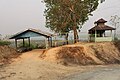
 Minbya
Kyein Taung Pagoda | |
 Minbya Location in Myanmar (Burma) | |
| Coordinates: 20°21′44″N 93°16′24″E / 20.36222°N 93.27333°E | |
| Country | |
| Division | |
| District | Mrauk-U District |
| Township | Minbya Township |
| Population | |
| • Total | 22,944[1] |
| • Ethnicities | Rakhine |
| • Religions | Buddhism |
| Time zone | UTC+6.30 (MMT) |
| • Summer (DST) | UTC20° 36' 77" North, 93° 27' 18" East |
| Area code(s) | 42, 43 |
History edit
During the civil war in Myanmar, Minbya was a center of heavy fighting between the Tatmadaw and the Arakan Army. The entirety of Minbya township was reportedly captured by the AA on 6 February 2024.[2]
Education edit
The education of Minbya (Mongbra) is fairly good. There are three high schools: BEHS 1,2,3 which are the main academic bodies of town. Many primary and middle schools persist. On the other hand, there were no place for English Language study and computer training before 2014. In 2014, Buddhist monks who are also scholars at various universities of India opened a center for young students called The Light Of Mizzima. The center offers computer and English courses for one year and provide scholarship for outstanding students. Having say that, there are still many things to be developed.
Natural disasters edit
On 15 June 2010, strong rains destroyed more than 25 buildings, including houses, school buildings, and a mosque. Close to 200 people were housed in mosques of several nearby villages.[3]
On 12 November 2011, all 567 permanent shops of the Minbya central market were destroyed in a fire accident.
[4] During the last weekend of July 2015, there was a heavy rain and cause the flooding and then this situation was worse as the Cyclone Komen hit the Arakan Coastal on 30 July. It caused great damages in urban and rural area. Many farms were destroyed. After flooding, many civil charity group were came to aid the rural residents. This flooding was also taking place in Mrauk-Oo, Kyauk Taw townships.


References edit
- ^ "Myanmar: Regions, States, Major Cities & Towns - Population Statistics, Maps, Charts, Weather and Web Information". www.citypopulation.de. Retrieved 2024-03-05.
- ^ "Myanmar's Military Driven Out of Township in Northern Rakhine, Reports Say". The Irrawaddy. Retrieved 7 February 2024.
- ^ Myanmar: Downpours, strong winds cause death, injury, damage to houses, roads, railroad sections, floods, landslides State, departments, Tatmadawmen, NGOs and wellwishers render assistance for relief and rehabilitation
- ^ "Archived copy" (PDF). Archived from the original (PDF) on 2010-11-22. Retrieved 2013-11-20.
{{cite web}}: CS1 maint: archived copy as title (link) Page 6 Col 1
External links edit
- Satellite map at Maplandia.com