


Summary
Minnetonka Beach is a community in Hennepin County, Minnesota, United States. The population was 539 at the 2010 census.[5]
Minnetonka Beach | |
|---|---|
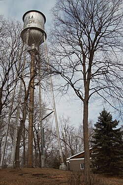 Minnetonka Beach Water Tower, a city landmark | |
 Location of Minnetonka Beach within Hennepin County, Minnesota | |
| Coordinates: 44°56′22″N 93°35′30″W / 44.93944°N 93.59167°W | |
| Country | United States |
| State | Minnesota |
| County | Hennepin |
| Incorporated | 1894 |
| Government | |
| • Mayor | Joe Pagano [1] |
| Area | |
| • Total | 1.54 sq mi (3.98 km2) |
| • Land | 0.47 sq mi (1.21 km2) |
| • Water | 1.07 sq mi (2.77 km2) |
| Elevation | 942 ft (287 m) |
| Population (2020) | |
| • Total | 546 |
| • Density | 1,169.16/sq mi (451.07/km2) |
| Time zone | UTC-6 (Central (CST)) |
| • Summer (DST) | UTC-5 (CDT) |
| ZIP code | 55361 |
| Area code | 952 |
| FIPS code | 27-43270[3] |
| GNIS feature ID | 0647950[4] |
History edit
Minnetonka Beach is located on the shores of Lake Minnetonka. Originally part of Excelsior Township, Minnetonka Beach was the site of the Hotel Lafayette, which was built by the Minneapolis, Saint Paul, & Manitoba Railway (later part of the Great Northern Railway) in 1882. In 1884, Minnetonka Beach was annexed by Medina Township. The community was incorporated as an independent village in 1894.[6]
After the Hotel Lafayette burned in 1897, a portion of the property became home to the Lafayette Club. The original clubhouse of the Lafayette Club was built in 1900 and burned in 1922. The current clubhouse was constructed in 1924.[7]
Geography edit
According to the United States Census Bureau, the city has a total area of 0.48 square miles (1.24 km2), of which 0.47 square miles (1.22 km2) is land and 0.01 square miles (0.03 km2) is water.[8] County 15 serves as a main route.
Demographics edit
| Census | Pop. | Note | %± |
|---|---|---|---|
| 1900 | 101 | — | |
| 1910 | 166 | 64.4% | |
| 1920 | 94 | −43.4% | |
| 1930 | 112 | 19.1% | |
| 1940 | 229 | 104.5% | |
| 1950 | 376 | 64.2% | |
| 1960 | 544 | 44.7% | |
| 1970 | 586 | 7.7% | |
| 1980 | 575 | −1.9% | |
| 1990 | 573 | −0.3% | |
| 2000 | 614 | 7.2% | |
| 2010 | 539 | −12.2% | |
| 2020 | 546 | 1.3% | |
| U.S. Decennial Census | |||
2010 census edit
As of the census[9] of 2010, there were 539 people, 201 households, and 159 families living in the city. The population density was 1,146.8 inhabitants per square mile (442.8/km2). There were 231 housing units at an average density of 491.5 per square mile (189.8/km2). The racial makeup of the city was 99.3% White, 0.4% Asian, and 0.4% from two or more races. Hispanic or Latino of any race were 0.6% of the population.
There were 201 households, of which 38.3% had children under the age of 18 living with them, 73.1% were married couples living together, 3.5% had a female householder with no husband present, 2.5% had a male householder with no wife present, and 20.9% were non-families. 18.9% of all households were made up of individuals, and 7% had someone living alone who was 65 years of age or older. The average household size was 2.68 and the average family size was 3.09.
The median age in the city was 46.7 years. 28.2% of residents were under the age of 18; 4.9% were between the ages of 18 and 24; 13.6% were from 25 to 44; 42.3% were from 45 to 64; and 10.9% were 65 years of age or older. The gender makeup of the city was 49.2% male and 50.8% female.
2000 census edit
As of the census[3] of 2000, there were 614 people, 215 households, and 176 families living in the city. The population density was 1,186.5 inhabitants per square mile (458.1/km2). There were 224 housing units at an average density of 432.8 per square mile (167.1/km2). The racial makeup of the city was 97.88% White, 0.16% Native American, 1.30% Asian, and 0.65% from two or more races.
There were 215 households, out of which 42.3% had children under the age of 18 living with them, 75.3% were married couples living together, 3.7% had a female householder with no husband present, and 17.7% were non-families. 14.4% of all households were made up of individuals, and 5.6% had someone living alone who was 65 years of age or older. The average household size was 2.86 and the average family size was 3.16.
In the city, the population was spread out, with 29.2% under the age of 18, 5.4% from 18 to 24, 20.7% from 25 to 44, 35.3% from 45 to 64, and 9.4% who were 65 years of age or older. The median age was 42 years. For every 100 females, there were 91.9 males. For every 100 females age 18 and over, there were 87.5 males.
The median income for a household in the city was $150,912, and the median income for a family was $168,868. Males had a median income of $100,000 versus $41,875 for females. The per capita income for the city was $91,844. About 1.8% of families and 2.7% of the population were below the poverty line, including 2.5% of those under age 18 and 16.7% of those age 65 or over.
Politics edit
| Year | Republican | Democratic | Third parties |
|---|---|---|---|
| 2020 | 47.7% 200 | 48.9% 205 | 3.4% 14 |
| 2016 | 50.3% 181 | 41.1% 148 | 8.6% 31 |
| 2012 | 69.0% 276 | 30.5% 122 | 0.5% 2 |
| 2008 | 57.0% 221 | 42.3% 164 | 0.7% 3 |
| 2004 | 61.7% 245 | 37.5% 149 | 0.8% 3 |
| 2000 | 66.3% 256 | 30.3% 117 | 3.4% 13 |
| 1996 | 65.1% 222 | 27.9% 95 | 9.0% 24 |
| 1992 | 51.2% 194 | 23.5% 89 | 25.3% 96 |
| 1988 | 73.2% 281 | 26.8% 103 | 0.0% 0 |
| 1984 | 80.9% 284 | 19.1% 67 | 0.0% 0 |
| 1980 | 67.6% 248 | 18.0% 66 | 14.4% 53 |
| 1976 | 73.3% 255 | 25.3% 88 | 1.4% 5 |
| 1972 | 71.7% 246 | 27.1% 93 | 1.2% 4 |
| 1968 | 73.2% 232 | 25.9% 82 | 0.9% 3 |
| 1964 | 76.1% 232 | 23.9% 73 | 0.0% 0 |
| 1960 | 83.2% 248 | 16.8% 50 | 0.0% 0 |
References edit
- ^ http://www.ci.minnetonka-beach.mn.us/index.asp?Type=B_BASIC&SEC={299CDA02-43F4-40B0-8C07-72B030812703}&DE={175DEC60-03E2-43FC-9516-5FE9713D0719}
- ^ "2020 U.S. Gazetteer Files". United States Census Bureau. Retrieved July 24, 2022.
- ^ a b "U.S. Census website". United States Census Bureau. Retrieved January 31, 2008.
- ^ "US Board on Geographic Names". United States Geological Survey. October 25, 2007. Retrieved January 31, 2008.
- ^ "2010 Census Redistricting Data (Public Law 94-171) Summary File". American FactFinder. U.S. Census Bureau, 2010 Census. Retrieved April 23, 2011.[dead link]
- ^ Johnson, Fred. The Big Water. Deep Haven Books, 2012. Pg. 122
- ^ "Minnehaha's Connection to History (3/4) – Steamboat Minnehaha".
- ^ "US Gazetteer files 2010". United States Census Bureau. Archived from the original on January 25, 2012. Retrieved November 13, 2012.
- ^ "U.S. Census website". United States Census Bureau. Retrieved November 13, 2012.
- ^ "Office of the Minnesota Secretary of State - Election Results". Archived from the original on February 22, 2021. Retrieved February 22, 2021.
44°56′23″N 93°34′36″W / 44.93972°N 93.57667°W