


Summary
Mirzapur district is one of the 75 districts in the Indian state of Uttar Pradesh. The district is bounded on the north by Bhadohi and Varanasi districts, on the east by Chandauli district, on the south by Sonbhadra district and on the northwest by Prayagraj. The district occupies an area of 4521 km2. Mirzapur city is the district headquarters. Mirzapur district is a part of Mirzapur division. This district is known for the Vindhyavasini temple in Vindhyachal and several tourist attractions like water falls like Rajdari & Devdari[2] and dams. It consist of several Ghats where historical sculptures are still present. During the Ganges festival these Ghats are decorated with lights and diyas.
Mirzapur district | |
|---|---|
 Siddhanath ki Dari Falls | |
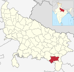 Location of Mirzapur district in Uttar Pradesh | |
| Country | |
| State | Uttar Pradesh |
| Division | Mirzapur |
| Established | 1509 |
| Headquarters | Mirzapur |
| Tehsils | 4 |
| Government | |
| • District Magistrate | Divya Mittal, IAS |
| • Mayor | Vinay Kumar Singh |
| • Lok Sabha constituencies | Mirzapur |
| • Member of Parliament, Lok Sabha | Anupriya Patel (Minister of State for Commerce and Industry of India) |
| Area | |
| • Total | 4,521 km2 (1,746 sq mi) |
| Population (2011)[1] | |
| • Total | 2,496,970 |
| • Density | 550/km2 (1,400/sq mi) |
| • Urban | 347,567 |
| Demographics | |
| • Literacy | 70.38% |
| • Sex ratio | 903 |
| • Language | Hindi • Urdu |
| Time zone | UTC+05:30 (IST) |
| Vehicle registration | UP-63 |
| Average annual precipitation | 1043 mm |
| Website | Official Website |
It was once the largest district in Uttar Pradesh until Sonbhadra district was separated from Mirzapur in 1989.
Demographics edit
| Year | Pop. | ±% p.a. |
|---|---|---|
| 1901 | 488,998 | — |
| 1911 | 483,880 | −0.11% |
| 1921 | 483,470 | −0.01% |
| 1931 | 526,344 | +0.85% |
| 1941 | 600,806 | +1.33% |
| 1951 | 679,171 | +1.23% |
| 1961 | 803,784 | +1.70% |
| 1971 | 960,495 | +1.80% |
| 1981 | 1,238,432 | +2.57% |
| 1991 | 1,627,970 | +2.77% |
| 2001 | 2,074,709 | +2.45% |
| 2011 | 2,496,970 | +1.87% |
| source:[3] | ||
According to the 2011 census Mirzapur district has a population of 2,496,970,[1] roughly equal to the nation of Kuwait[5] or the US state of Nevada.[6] This gives it a ranking of 174th in India (out of a total of 640).[1] The district has a population density of 561 inhabitants per square kilometre (1,450/sq mi).[1] Its population growth rate over the decade 2001-2011 was 17.89%.[1] Mirzapur has a sex ratio of 900 females for every 1000 males,[1] and a literacy rate of 70.38%. 13.92% of the population lives in urban areas. Scheduled Castes and Scheduled Tribes made up 26.48% and 0.81% of the population respectively.[1] Female literacy rate here is 54%.
Languages edit
At the time of the 2011 Census of India, 80.95% of the population in the district spoke Hindi and 18.40% Bhojpuri as their first language.[7]
Bhojpuri language is spoken in the district.[8] Agariya, an Austroasiatic tongue with approximately 70,000 speakers;[9] Awadhi, which has a lexical similarity of 72-91% with Hindi and is spoken by about 7,800,000 in Bagelkhand;[10] and Bagheli, a tongue in the Eastern Hindi group with almost 40,000,000 speakers, written in both the Devanagari and Kaithi scripts.[citation needed]
Administrative divisions edit
The district consists four Tehsils. These are Mirzapur (Sadar), Chunar, Marihan and Lalganj. These four tehsils are further divided into twelve blocks.
Economy edit
In 2006 the Ministry of Panchayati Raj named Mirzapur one of the country's 250 most backward districts (out of a total of 640).[11] It is one of the 34 districts in Uttar Pradesh have received funds from the Backward Regions Grant Fund Programme (BRGF).[11] Once tourism used to contribute in the economy but due to lack of care from government officials and local people the unmatched beauty of the places like Sirshe dam and waterfall, Dadri (Pipari) dam, Vindham waterfall, Lower Khajuri, Upper Khajuri, Lakhaniya waterfall, Siddhnath Waterfall, Kotwan-Patehara forest, Fort of Chunar and Dadri-Haliya forest has become 'the stories of past'. Once there was a time when every Sunday of rainy season used to be a fair like atmosphere for the neighbouring localities of Sirshe waterfall and Vindham waterfall due to their attraction of tourist not only from every part of the U.P. and but neighbourhood states too. The separation of the Sonebhadra largely affected the economical condition and after the closing of mills and depression in the carpet industry Mirzapur has become economically disadvantaged.
Education edit
Colleges edit
- B.L.J. Inter College
- M.P.M.B. Inter College
- Government Inter College
- Jubilee Inter College
- Arya Kanya Inter College
- K.B. Postgraduate College
- G.D. Binani P.G. College
- Rajiv Gandhi South Campus, BHU
- Maa Vindhyavasini Autonomous State Medical College
Notable people edit
- Sone Lal Patel, Indian politician.
- Anupriya Patel, Indian politician.
- Amar Goswami, senior journalist and one of the prominent fiction writers of Hindi literature
- Naheed Abidi, Indian scholar of Sanskrit
- Lakshmi Raj Sharma, Indian author, novelist, and academician
- Lalita Shastri, wife of former Prime Minister of India Lal Bahadur Shastri
- Prachi Mishra, Femina Miss India Earth 2012
References edit
- ^ a b c d e f g "District Census Handbook: Mirzapur" (PDF). censusindia.gov.in. Registrar General and Census Commissioner of India. 2011.
- ^ "Mirzapur".
- ^ Decadal Variation In Population Since 1901
- ^ "Table C-01 Population by Religion: Uttar Pradesh". censusindia.gov.in. Registrar General and Census Commissioner of India. 2011.
- ^ US Directorate of Intelligence. "Country Comparison:Population". Archived from the original on 13 June 2007. Retrieved 1 October 2011.
Kuwait 2,595,62
- ^ "2010 Resident Population Data". U. S. Census Bureau. Archived from the original on 25 December 2010. Retrieved 30 September 2011.
Nevada 2,700,551
- ^ a b "Table C-16 Population by Mother Tongue: Uttar Pradesh". www.censusindia.gov.in. Registrar General and Census Commissioner of India.
- ^ Bhojpuri at Ethnologue (25th ed., 2022)

- ^ Agariya at Ethnologue (25th ed., 2022)
- ^ Bagheli at Ethnologue (25th ed., 2022)
- ^ a b Ministry of Panchayati Raj (8 September 2009). "A Note on the Backward Regions Grant Fund Programme" (PDF). National Institute of Rural Development. Archived from the original (PDF) on 5 April 2012. Retrieved 27 September 2011.
External links edit
- Official website
25°09′02″N 82°33′53″E / 25.150677°N 82.564807°E