


Summary
Mogneville (French pronunciation: [mɔɲvil]) is a commune in the Oise department in northern France.[3]
Mogneville | |
|---|---|
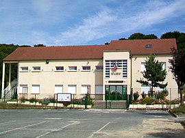 The town hall in Mogneville | |
 Coat of arms | |
Location of Mogneville .mw-parser-output .locmap .od{position:absolute}.mw-parser-output .locmap .id{position:absolute;line-height:0}.mw-parser-output .locmap .l0{font-size:0;position:absolute}.mw-parser-output .locmap .pv{line-height:110%;position:absolute;text-align:center}.mw-parser-output .locmap .pl{line-height:110%;position:absolute;top:-0.75em;text-align:right}.mw-parser-output .locmap .pr{line-height:110%;position:absolute;top:-0.75em;text-align:left}.mw-parser-output .locmap .pv>div{display:inline;padding:1px}.mw-parser-output .locmap .pl>div{display:inline;padding:1px;float:right}.mw-parser-output .locmap .pr>div{display:inline;padding:1px;float:left}html.skin-theme-clientpref-night .mw-parser-output .od,html.skin-theme-clientpref-night .mw-parser-output .od .pv>div,html.skin-theme-clientpref-night .mw-parser-output .od .pl>div,html.skin-theme-clientpref-night .mw-parser-output .od .pr>div{background:#000;color:#fff}html.skin-theme-clientpref-night .mw-parser-output .locmap{filter:grayscale(0.6)}@media(prefers-color-scheme:dark){html.skin-theme-clientpref-os .mw-parser-output .locmap{filter:grayscale(0.6)}html.skin-theme-clientpref-os .mw-parser-output .od,html.skin-theme-clientpref-os .mw-parser-output .od .pv>div,html.skin-theme-clientpref-os .mw-parser-output .od .pl>div,html.skin-theme-clientpref-os .mw-parser-output .od .pr>div{background:#000;color:#fff}}  Mogneville  Mogneville | |
| Coordinates: 49°18′54″N 2°28′20″E / 49.315°N 2.4722°E | |
| Country | France |
| Region | Hauts-de-France |
| Department | Oise |
| Arrondissement | Clermont |
| Canton | Nogent-sur-Oise |
| Intercommunality | Liancourtois |
| Government | |
| • Mayor (2020–2026) | Michel Delahoche[1] |
| Area 1 | 3.91 km2 (1.51 sq mi) |
| Population (2021)[2] | 1,490 |
| • Density | 380/km2 (990/sq mi) |
| Time zone | UTC+01:00 (CET) |
| • Summer (DST) | UTC+02:00 (CEST) |
| INSEE/Postal code | 60404 /60140 |
| Elevation | 36–113 m (118–371 ft) (avg. 51 m or 167 ft) |
| 1 French Land Register data, which excludes lakes, ponds, glaciers > 1 km2 (0.386 sq mi or 247 acres) and river estuaries. | |
History edit
Though inhabited from the Stone Age, the existence of the village first dates from the Romans. One of the merchants who followed Caesar and his camp to Catenoy, placed himself on the site of the modern village. The name of the village derives from the Latin Monnachivilla, "settlement of the monks", which is Moineville in French. Monks inhabited this territory in the 10th and 11th centuries. The Abbey of Chaalis, the Abbey of Lannoy and the Priory of Wariville possessed benefices here.
Population edit
| Year | Pop. | ±% p.a. |
|---|---|---|
| 1968 | 629 | — |
| 1975 | 721 | +1.97% |
| 1982 | 803 | +1.55% |
| 1990 | 1,203 | +5.18% |
| 1999 | 1,373 | +1.48% |
| 2009 | 1,495 | +0.85% |
| 2014 | 1,540 | +0.59% |
| 2020 | 1,467 | −0.81% |
| Source: INSEE[4] | ||
Sights edit
The Church of Saint-Denis is the oldest monument in the village of Mogneville. It was proclaimed a historic building by a decree of July 1937. The current building is a reconstruction of the XII structure. First it was reconstructed into a Roman church, later on – into Gothic.
See also edit
References edit
- ^ "Répertoire national des élus: les maires" (in French). data.gouv.fr, Plateforme ouverte des données publiques françaises. 13 September 2022.
- ^ "Populations légales 2021". The National Institute of Statistics and Economic Studies. 28 December 2023.
- ^ INSEE commune file
- ^ Population en historique depuis 1968, INSEE
External links edit
- Official website of Mogneville