
KNOWPIA
WELCOME TO KNOWPIA

Molochnyi Lyman 
Summary
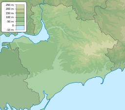
Molochnyi Estuary, or Molochnyi Lyman (Ukrainian: Молочний лиман), is an estuary of the Molochna River, located on the north-western coast of the Sea of Azov. About 10 km north is the town of Melitopol.
| Molochnyi Estuary | |
|---|---|
 | |
 Molochnyi Estuary  Molochnyi Estuary | |
| Location | Sea of Azov |
| Coordinates | 46°32′N 35°19′E / 46.533°N 35.317°E |
| River sources | Molochna, Tashchenak, Dzhekelna |
| Ocean/sea sources | Black Sea |
| Basin countries | Ukraine |
| Max. length | 32 km (20 mi) |
| Max. width | 8 km (5.0 mi) |
| Surface area | 168 km2 (65 sq mi) |
| Max. depth | 3 m (9.8 ft) |
| Salinity | 18-40 ‰ |
| Designated | 23 November 1995 |
| Reference no. | 770[1] |
 | |
Parameters of the water body:
- Length 32 km
- Width 8 km
- Depth 3 m
- Area 168 km2
It is connected to the Sea of Azov by an artificial canal.[2]
References edit
External links edit
Wikimedia Commons has media related to Molochny Lyman.
- Кисла доля Молочного лиману (Sour share of the Molochna (Milk) Estuary) [permanent dead link]
- (in Ukrainian) Екологія мовою серця громадськості — На Молочному лимані ситуація не є задовільною (Ecology in the heart of the public - The situation at the Milky Way (Molochna Estuary) is not satisfactory)